
Team: SAR Oceanography

The SAR Oceanography team at the "Maritime Safety and Security Lab" in Bremen is working on the development of algorithms that extract information about the state of the oceans from spaceborne radar images and provide it to users in near real time.
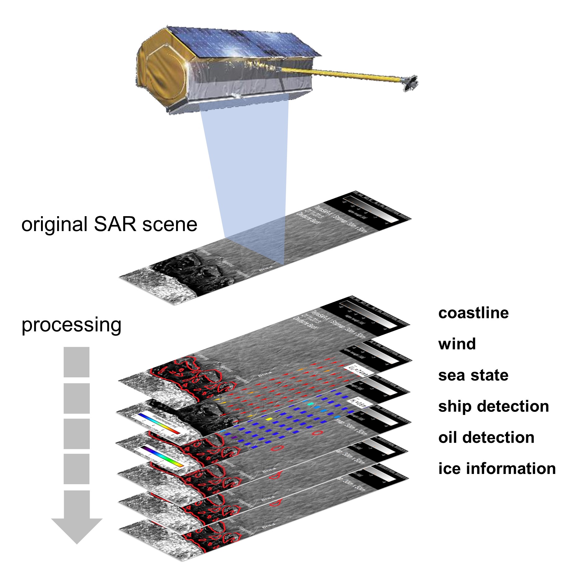
The developed algorithms make use of, amongst others, image processing and machine learning methods to automatically derive high-resolution maritime information from the satellite data. For operational processing at the satellite receiving stations, the software is constantly optimized in terms of speed and accuracy.
The information obtained is synthesized into a comprehensive overview of the maritime situation that benefits safety and security. The information extracted includes:
Meteorological and oceanographic parameters

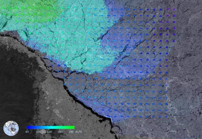
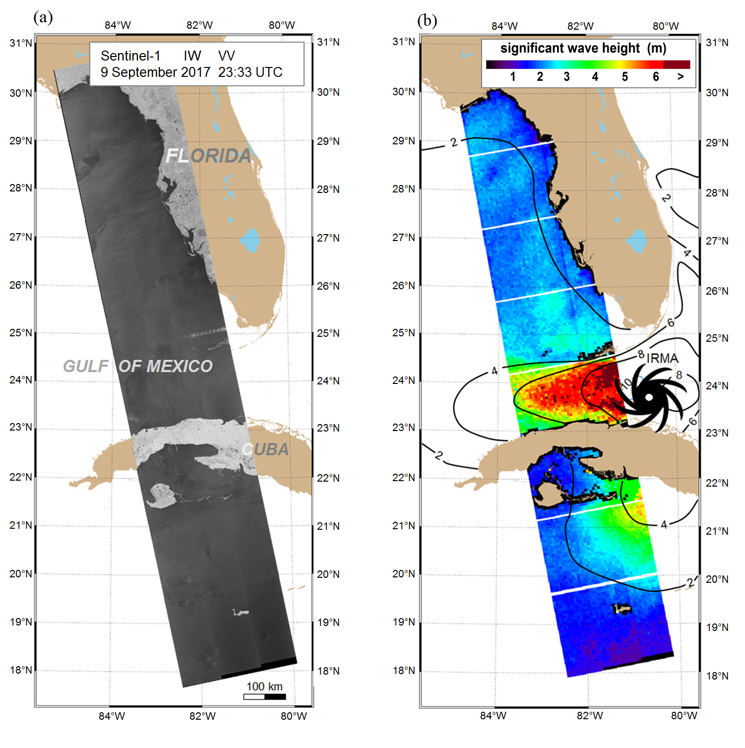
High-resolution wind and sea state parameters give a more detailed insight into extreme weather events. They help with the planning, construction and maintenance of offshore structures, for example wind parks in the North Sea. Moreover, they are used to improve weather models and forecasts and to study the effects of climate change on the oceans.
Properties and motions of sea ice and icebergs

Sea ice is subject to constant changes. Storms can push together large sheets of ice and close areas of open water in just a few hours. If pressure process continues, floes can be piled one over another. The resulting pack ice is difficult to traverse, even for icebreakers. Radar satellites provide large-scale images of the oceans and frozen waters regardless of cloud cover. Our algorithms extract detailed information about the ice and measure both short-term and long-term changes in the polar regions. Our team also supports research expeditions in navigating polar ice and provides data on the effects of climate change in high latitudes.
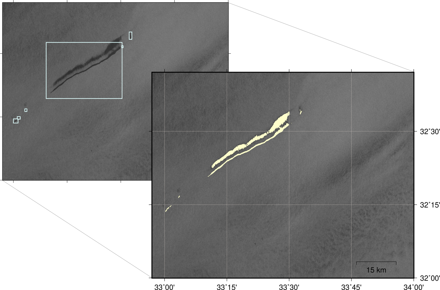
Position and extent of oil spills

Oil spills can be recognized in radar images as dark spots on the sea. However, there is a high risk of confusion with natural surface films such as algae or certain meteorological conditions such as heavy rainfall. Our team is developing AI-based systems for automated detection and measurement of oil slicks. They are combined with oil trajectory simulation in early warning systems, for example, to better coordinate containment measures and provide targeted protection for affected coastal areas.
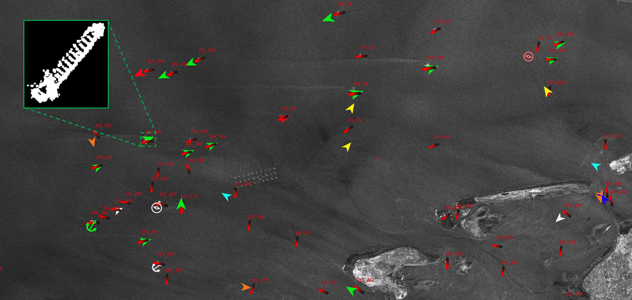
Characteristics and course of ships

The radar backscattering of most ships stand out clearly from the surrounding ocean surface. In addition, ship movements create characteristic anomalies on the ocean surface. Ships can therefore be recognized directly as well as indirectly. The ship detection algorithm developed by the team derives not only information concerning the trajectory such as position, direction of travel and speed, but also static ship characteristics such as size and class. This information, which is complementary to standard maritime surveillance, is helpful for tracking covert ship activities, e.g. illegal fishing.
Hardware-accelerated product generation on board of satellites and in ground stations

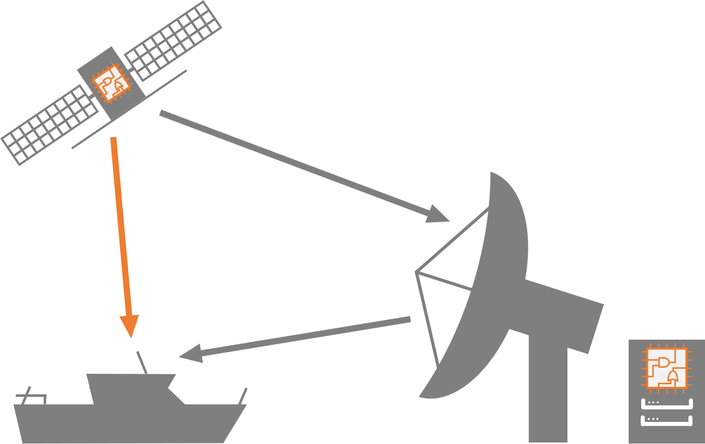
To generate information products from radar images in near real time, we are testing novel approaches with efficient hardware such as FPGAs. On the one hand, the aim is to make processing in ground stations more sustainable. On the other, data processing can already take place on board of satellites, so that the generated information can be received directly by users immediately after acquisition.
Links
- Shipwreck of the 'Endurance' found – safe navigation thanks to satellite data
- Pipeline leaks in the focus of DLR research
- DLR satellite data helps in the rescue of the Akademik Shokalskiy
- The art of forging robust services from algorithms
- Sentinel-1 sees through hurricanes
- BASE-platform project
- Project EO-Alert
- BigDataCube project
- CCI Sea State project
- EisKlass2 project
- DARTIS project
- CCI SARWAVE project
- MOSAiCmicrowaveRS project