The Multimodal Algorithms group focuses on the processing aspects of the end-to-end SAR processing chain, from image focusing to DEM generation, differential SAR interferometry or SAR tomography. The group is currently developing an experimental interferometric processing chain for TanDEM-X, including its bistatic processor. Further activities encompass the development of new processing algorithms for innovative spaceborne imaging modes (high-resolution SAR, TOPS, sliding-spotlight); performance analysis of future missions (TanDEM-L, UAV monitoring with a satellite constellation); as well as research activities related to airborne sensors (SAR tomography, differential SAR interferometry, motion compensation). A highlight of its main activities is shown below.
Spaceborne SAR Interferometry
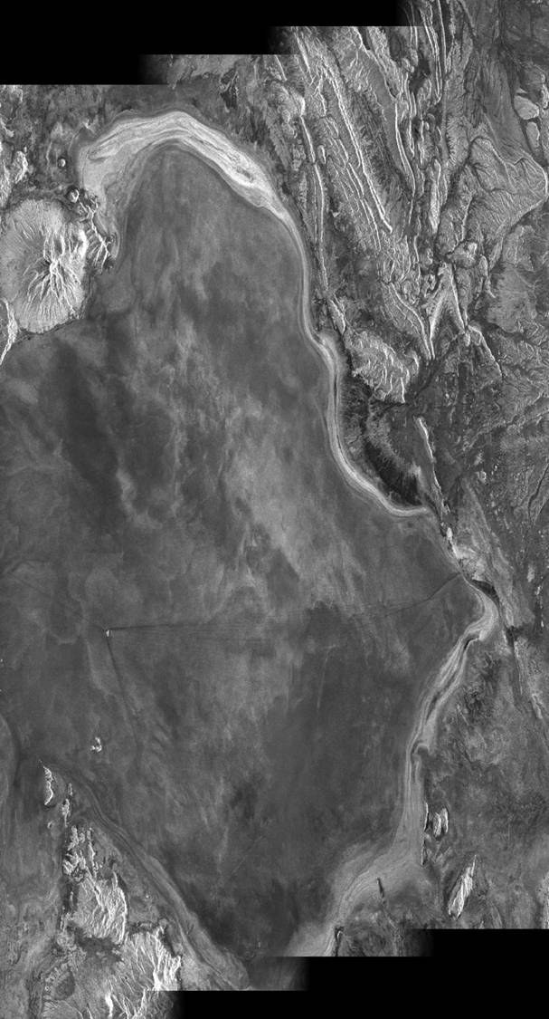
The group is currently involved in the development of an experimental SAR interferometric processing chain for TanDEM-X. The TanDEM-X mission, composed of two independent satellites flying in a close orbit formation, will deliver a global world map in accordance with HRTI-3 specifications, besides being a perfect system to test innovative radar imaging modes.
The figure below shows a TerraSAR-X repeat-pass interferogram processed in the group (SLC images processed by the operational TerraSAR-X processor).
The group is also involved in the development of SAR focusing algorithms for innovative imaging modes. The so-called baseband azimuth scaling (BAS) algorithm can process SAR data acquired in several modes, namely the high resolution sliding-spotlight mode, and the wide-swath ScanSAR and TOPS modes.
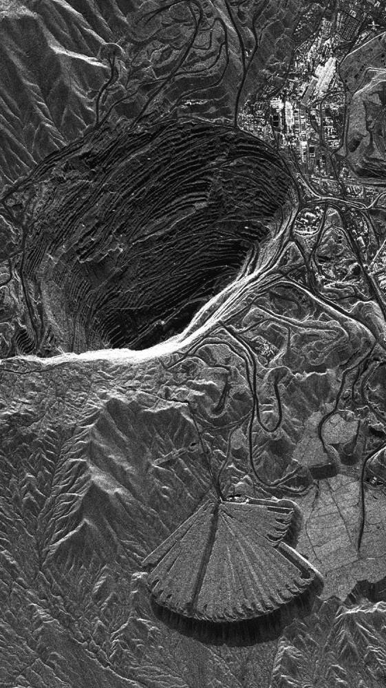
Sliding-spotlight
Sliding-spotlight image over the Chuquicamata copper mine, Chile.
The images above show an example for each of these. Note the scalloping effect in the ScanSAR image (middle) due to the burst mode, and the absence of it in the TOPS image (right).
Bistatic SAR
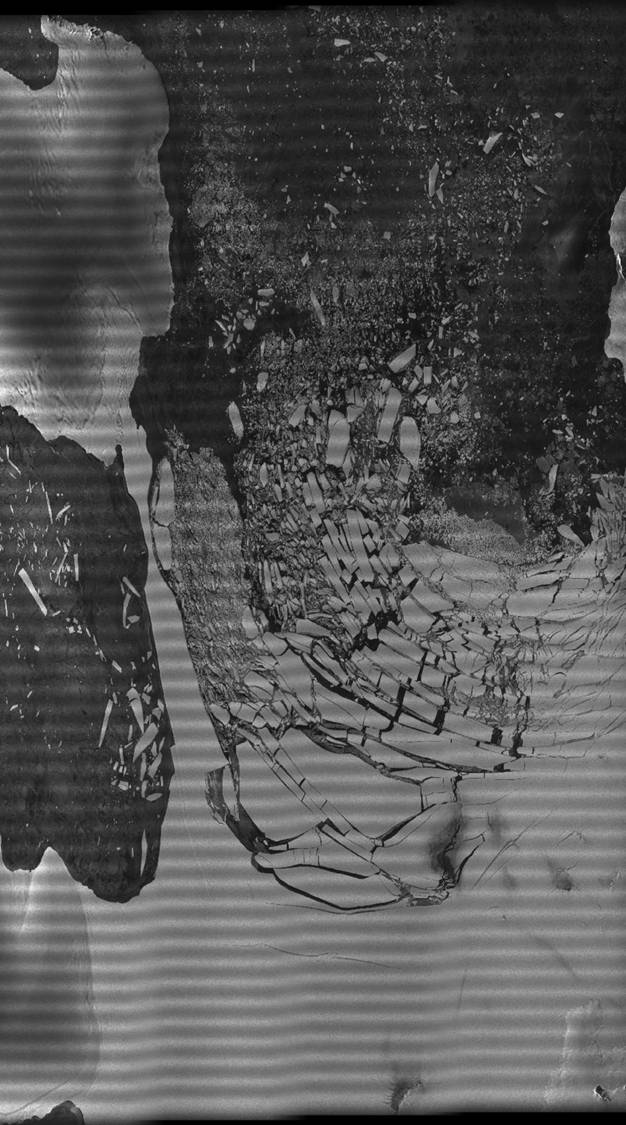
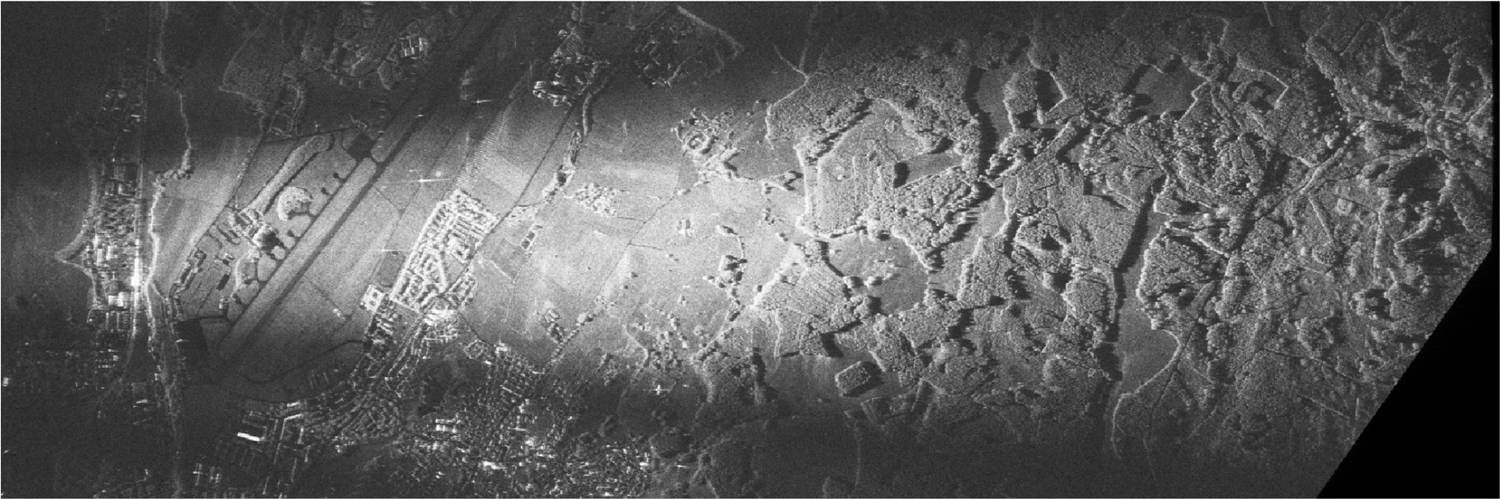
An application that has raised an increasing interest in the recent years is bistatic SAR. The group is developing an experimental bistatic processor for TanDEM-X, which needs to consider all synchronization and calibration issues in order to deliver accurate interferometric products. The image below shows a bistatic SAR image between TerraSAR-X and the DLR’s airborne F-SAR system. A new imaging algorithm has been developed to deal with the azimuth-variant properties of such extreme configurations.
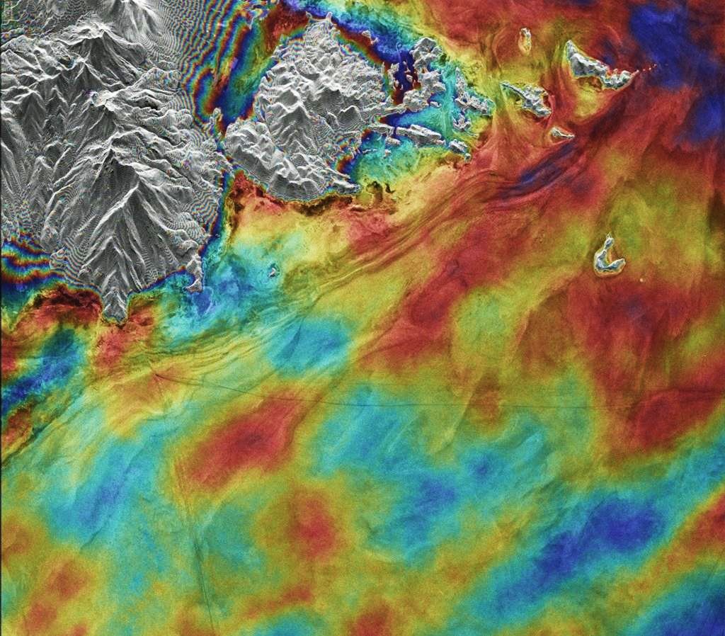
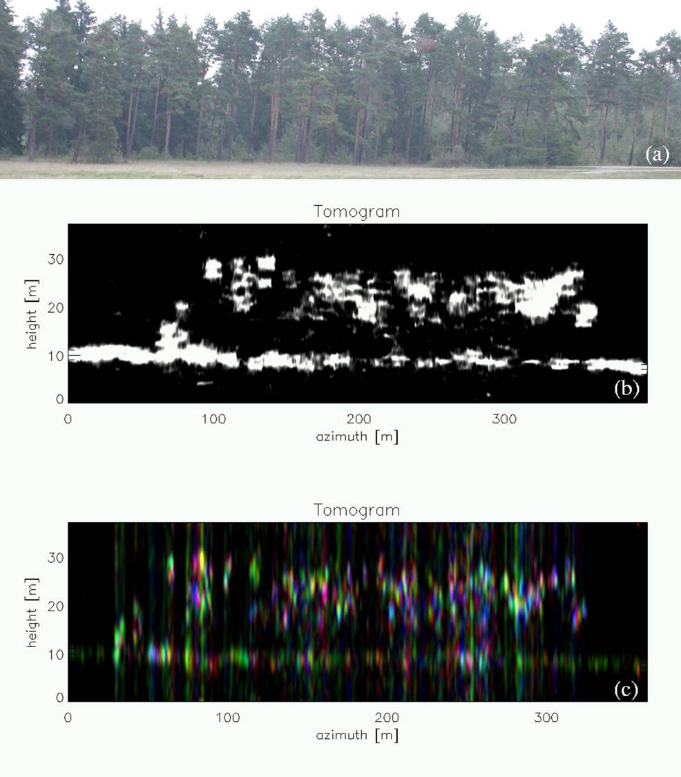
SAR Tomography is an imaging technique in the third dimension. The resolution in the vertical direction is obtained building an aperture (tomographic aperture) perpendicular to the flight path. This is done by means of additional observations. The image below shows an example of a SAR tomogram over a forested area.


