
Terrain modeling


Used Aerial Cameras
The multi-functional camera (MFC) has been developed by the DLR Institute of Robotics and Mechatronics, Department of Optical Information Systems (Berlin). It has been designed for use as panoramic and aerial camera. It is a pushbroom camera with 1 to 5 lines (i.e. depending on the application) and typically 8000 Pixel per line. Each line records full RGB.
The high resolution stereo camera (HRSC) has been developed by the DLR Institute of Planetary Research (Berlin) for mapping the Martian surface. It has reached Mars in 2003 on-board the ESA Mars Express probe and is still in use. HRSC is a pushbroom camera. The terrestial version that is used in planes has 5 panchromatic lines and 4 lines with color filters for red, green, blue and infrared. All lines are arranged in angles between -20.5 and 20.5 degrees and contain 12000 pixel. The ground resolutions are typically between 15-25 cm/Pixel.
Cameras from other vendors like the ADS 40 from Leica (pushbroom camera) or the UltraCam from Vexcel (full frame camera) are equally used, where applicable.
The camera position and orientation is in all cases measured during the flight using differential GPS and an inertial measurement unit (IMU). Typically, the position and orientation is corrected after the flight using bundle adjustment techniques.
Processing
Processing consists of stereo matching using Semi-Global Matching and terrain modeling. For processing the typically huge amounts of image data, all methods have been implemented on a cluster of currently 66 CPU's in a mixed configuration (i.e. 1.8 and 2.2 GHz single and dual core Opteron CPUs as well as 3 GHz Xeon CPU's).
Results
We have processed a total of almost 40000 km^2 in ground resolutions between 5 cm/Pixel and 20 cm/Pixel. Most flights have been within Bavaria (Germany), but some also far abroad. Some examples are shown below:
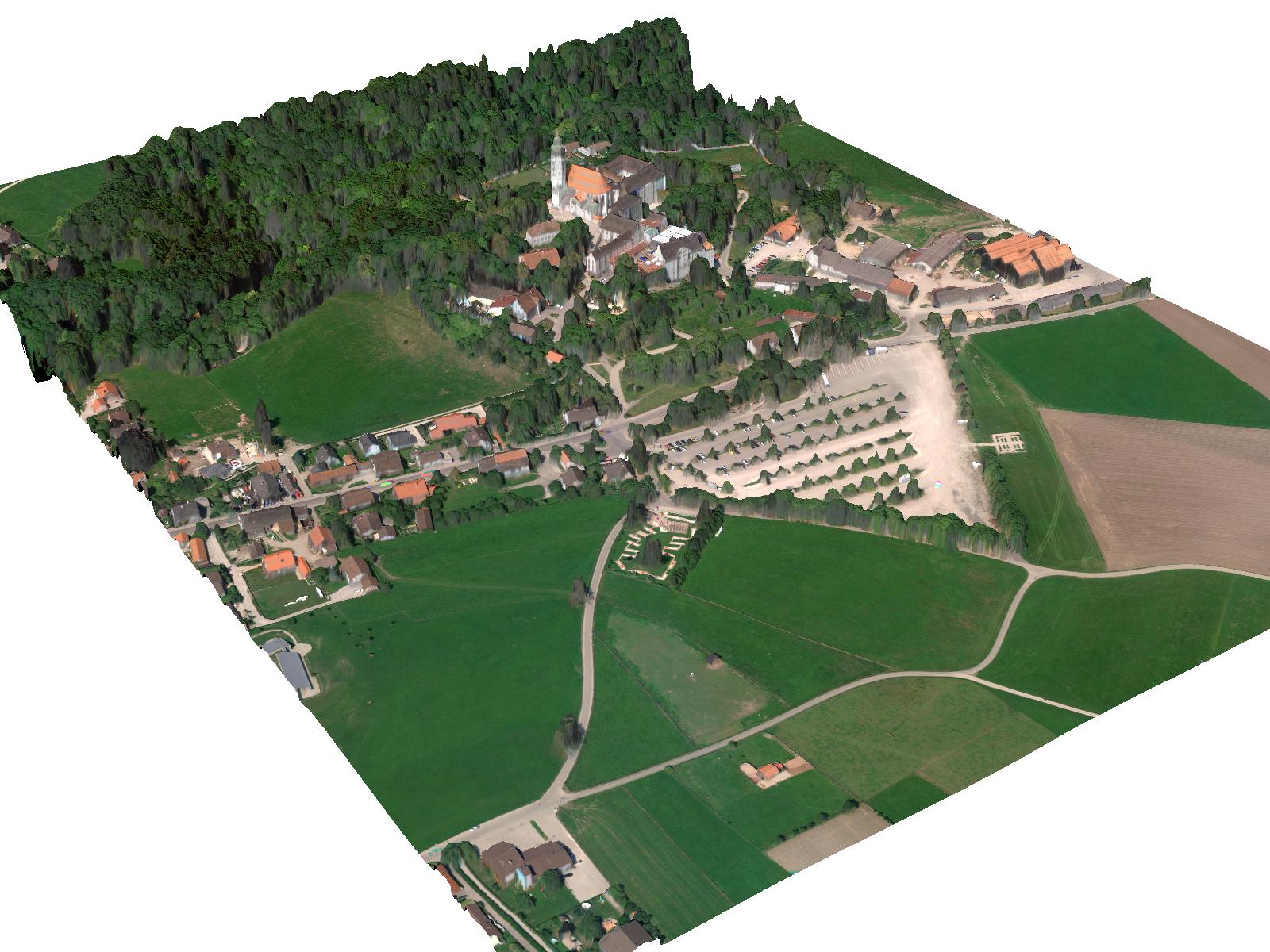
Andechs has been captured by HRSC in a ground resolution of 15 cm/pixel.
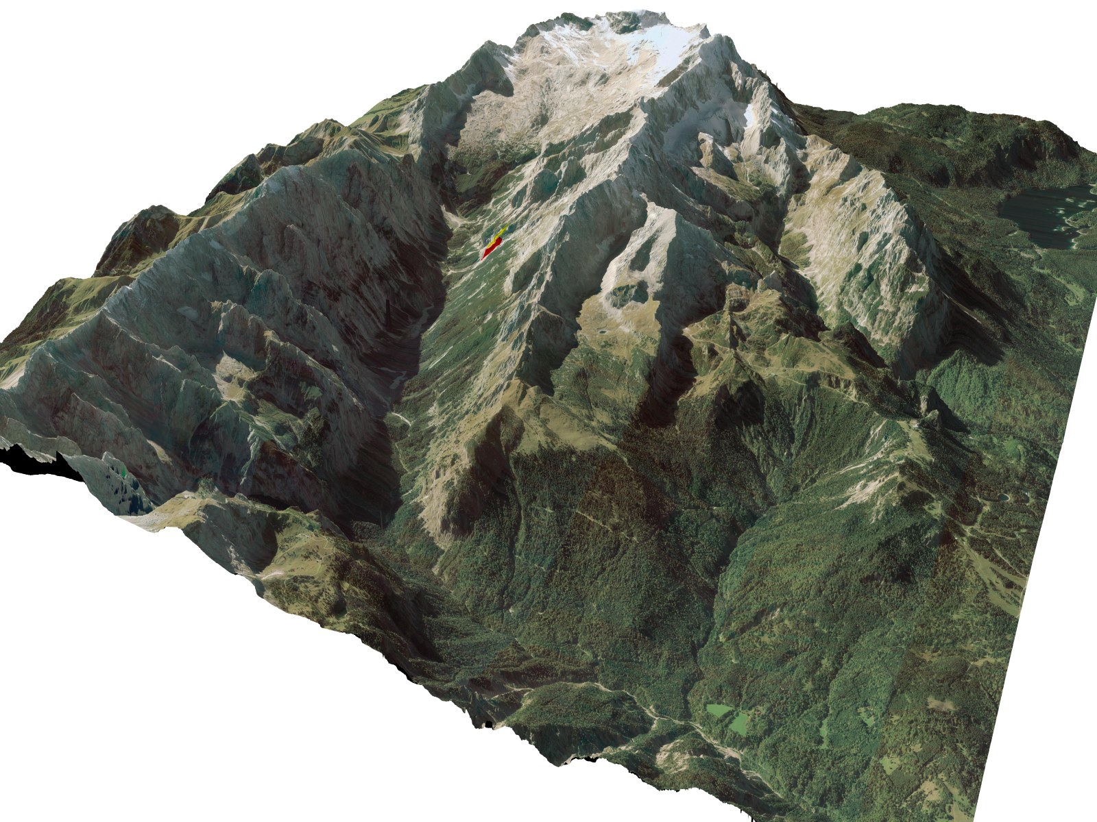
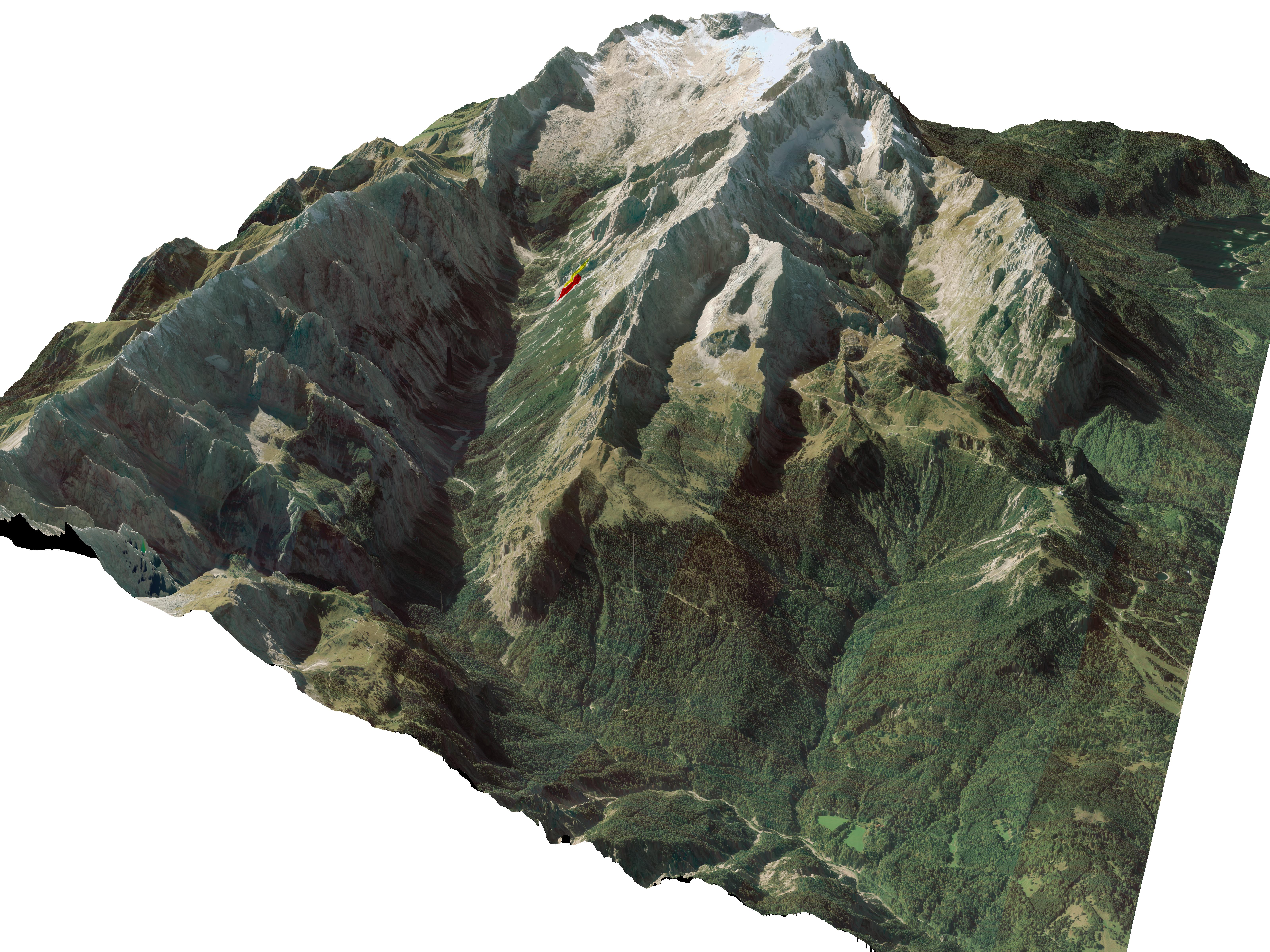
Many parts of Bavaria have been captured by HRSC, mostly in resolutions between 15-20 cm/Pixel. The Picture below shows the region around the highest mountain in Germany, i.e. Zugspitze.
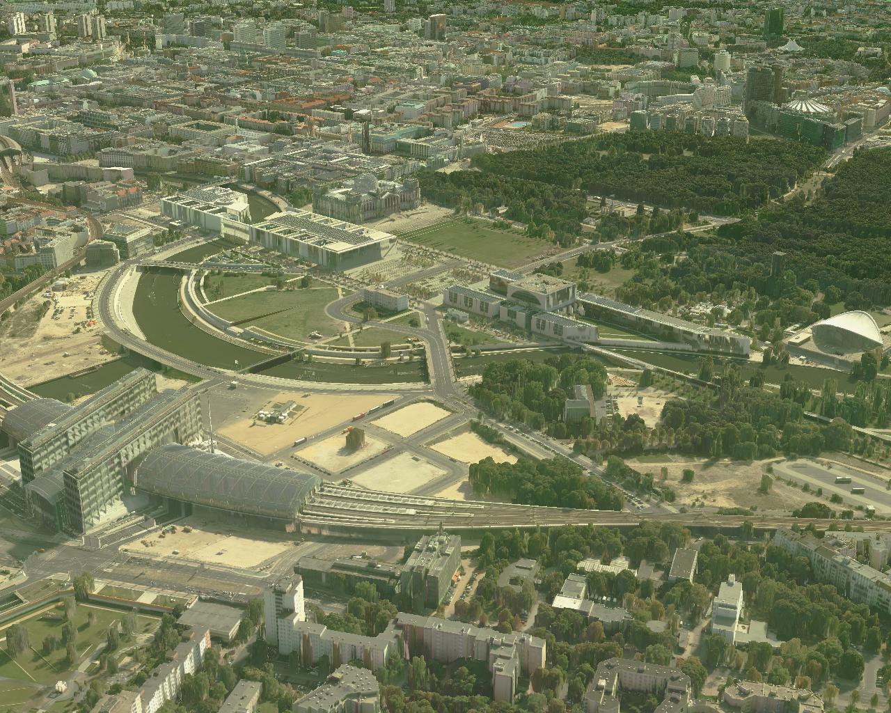
The city center of Berlin has been captured by 1850 full frame images (i.e. UltraCam) in 7 cm/Pixel ground resolution. Each image has a resolution of 86 MPixel, which results in 1.2 TB of image data (i.e. 16 Bit per pixel RGB and IR). Processing on the cluster took around 2 weeks and resulted in 153 GB of data (i.e. digital elevation model (DOM), ortho image and 4 tilted images for texturing the side of buildings).
The movie (60 MB) shows a virtual flight over Berlin. The reconstruction has not been manually cleaned! The only manual interaction consisted in defining the virtual flight path for generating the movie.