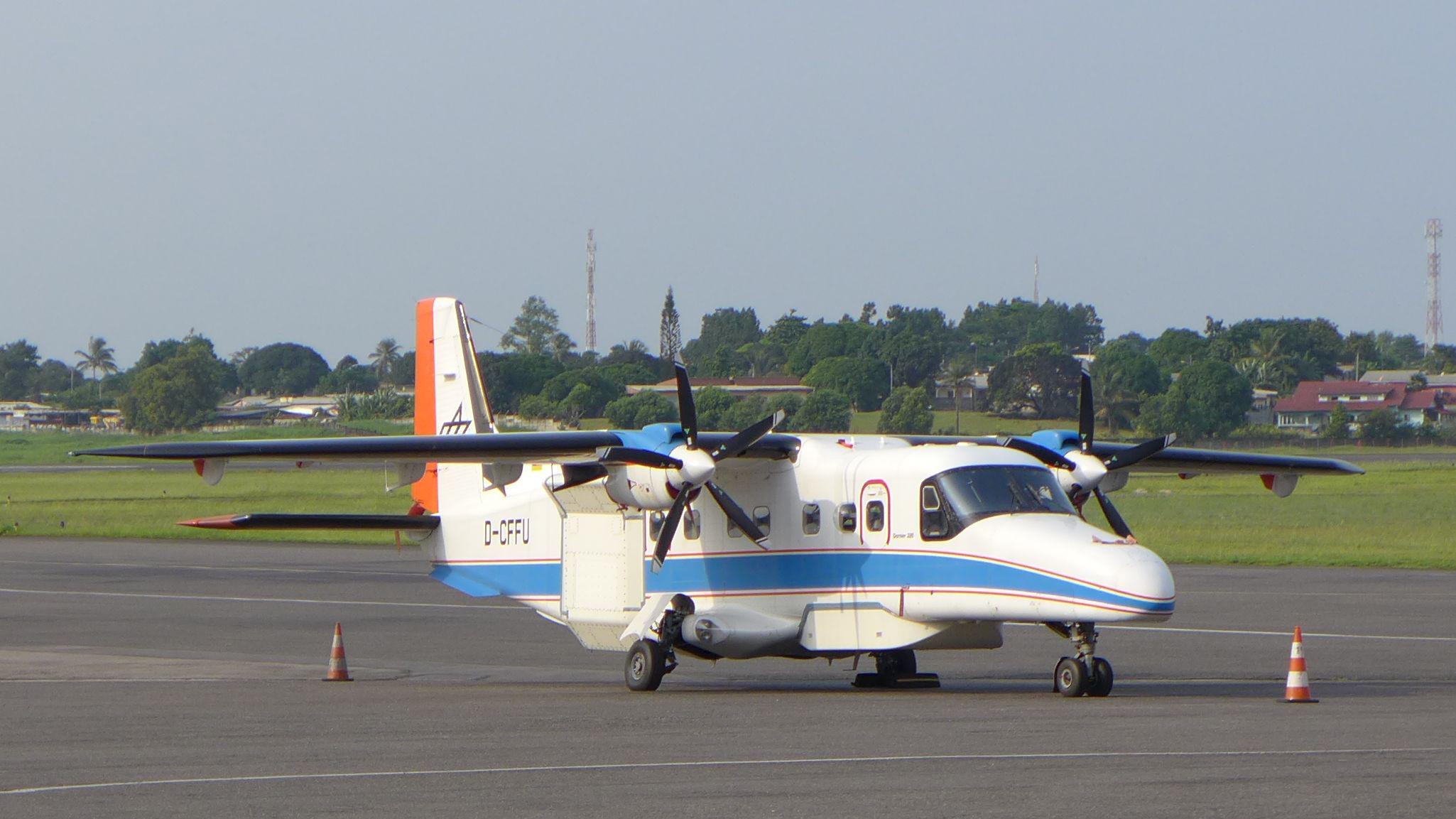
The twin engined turboprop DO 228-212 aircraft is well suited to the installation of special camera and radar systems because of its rectangular cabin and large openings in the floor.
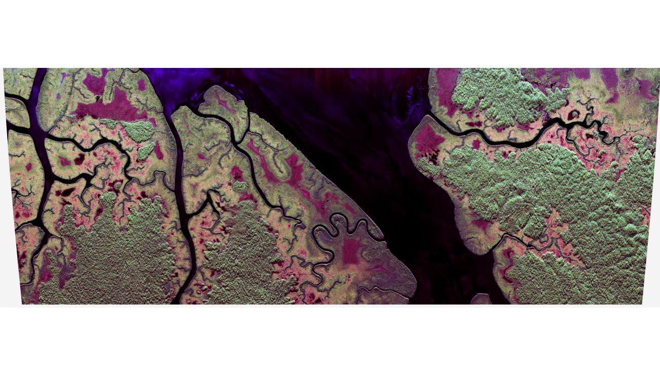
Radar image acquired by the F-SAR system over the Pongara National Park south of Libreville, Gabon
In Pongara National Park, there are still large areas of pristine mangrove forest, while the inland borders merge into dense rainforest. The colour scheme shows different types of reflection of the radar signals. For signals in the L band (23 centimetre wavelength) mainly vegetation-free surfaces (for example, water or open fields) appear blue in the image. A dominant double reflection (for example, from the vertical mangrove trees followed by the water surface) appears red. A predominantly omnidirectional reflection, especially from the volume of the rainforest treetops appears green.
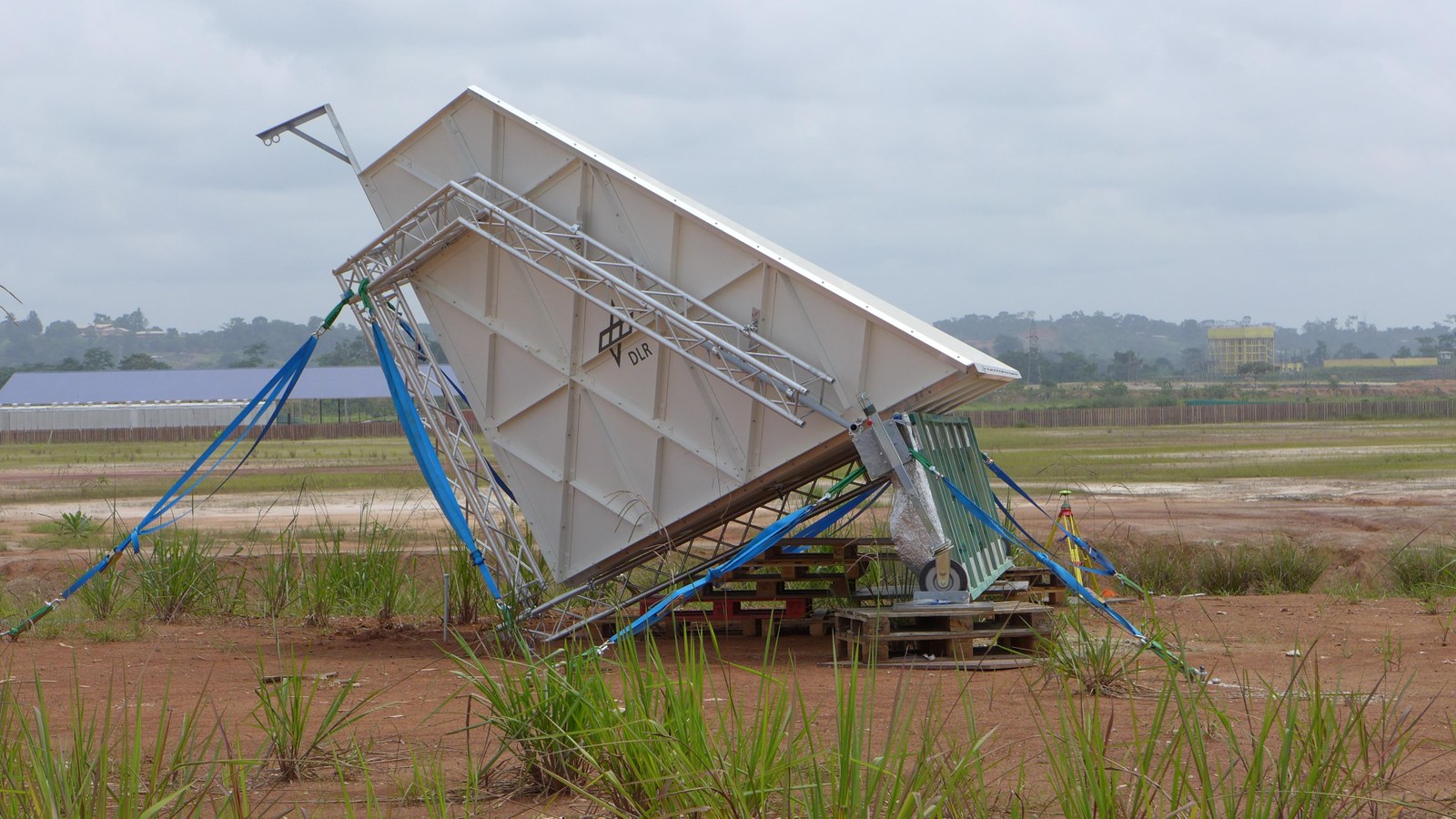
The reflector, with its three mutually perpendicular surfaces, collects all of the incident energy and sends it back directly in the direction from which it came – analogous to a cat’s eye road reflector in the visible wavelength range. The total energy appears to come directly from the inner corner of the reflector. The position of this rear corner was measured very precisely using GPS, so it can be determined whether the radar data is geometrically precise to within a few centimetres. Possible problems in the hardware can be detected, for example, by an apparent change in the position of the reflector. The strength and phase relationships of the incident horizontally or vertically polarised waves are evaluated with the aim of ensuring that the F-SAR hardware is functioning correctly in the aircraft.
Dense rainforest, a twin-engine turbo-prop aircraft and advanced radar technology – researchers from the German Aerospace Center (Deutsches Zentrum für Luft- und Raumfahrt; DLR) are performing numerous measurement flights from 1 to 29 February 2016 over the central African country of Gabon to determine the state of the rainforest. The data obtained will help to improve climate models and better understand global warming. The campaign is being carried out in cooperation with the European Space Agency (ESA), the French National Aerospace Research Center (Office National d'Etudes et Recherches Aérospatiales; Office National d'Etudes et de Recherches Aérospatiales (ONERA)), the Gabonese Agency for the Study of and Observation from Space (Agence d'Études et d'Observation Spatiales; AGEOS) and US Space Agency NASA. ONERA already performed measurement flights in July 2015, during the dry season, while DLR and NASA will research the rainforest with three aircraft during the rainy season. The results will serve as reference data for the ESA satellite mission 'Biomass', planned for launch in 2020, and the German Tandem-L mission proposal.
Approximately one third of Earth's land surface is covered by forest. Since half of the total carbon in forest ecosystems is found in biomass, any changes (for example, by windthrow or forest clearing) have a particularly strong impact. Therefore, a global inventory of forests and any changes they undergo is particularly critical to more accurately determining how much carbon is bound.
With their large mass of vegetation, rainforests play an important role. The problem is that the extent of the existing rainforests and their changes, due to deforestation or construction, has not been observed or quantified up to now. It is also not clear how much carbon is actually bound and released again within a given period. A better understanding of the carbon cycle would improve the determination of the carbon budget immensely. This will ultimately lead to more sustainable countermeasures against global warming.
At total of 88 percent of Gabon is rainforest, making it ideal for the measurement campaign. Researchers from the DLR Microwaves and Radar Institute will measure the above ground, terrestrially bound biomass of the lavish rainforest vegetation in the jungles of the central African west coast. To that end, the scientists have equipped the DLR Dornier DO 228 research aircraft with modern L- and P-band radar technology.
Conventional radar technology can only record the superficial structure of a rainforest area. The DLR twin satellite duo TanDEM-X, for example, measures the scattering of the radar signal at the treetops, but cannot penetrate through them. With the help of F-SAR (Synthetic Aperture Radar) airborne radar system developed by DLR, it is possible to measure in several frequency ranges simultaneously. The new radar technology is based on polarimetric SAR Interferometry (Pol-InSAR). This makes it possible to measure various parameters over wide ranges. "Thanks to the use of very long wave L- and P band frequencies, we are able to see through to the forest floor and can capture the entire area between the ground and the treetops," explains Irena Hajnsek, Manager of the AfriSAR project at DLR. The height of the forest is calculated and a vertical 3D profile is generated from the data collected. "With these parameters, we can deduce how much carbon is actually bound in the rainforest biomass," Hajnsek adds. The evaluated data will then be used to significantly improve existing climate models. Cleared and deforested areas can be made clearly visible as a by-product of the mapping process. This is very difficult to achieve with optical sensors due to constant cloud cover.
20,000 feet above the forest
The Do 228-212 aircraft is well suited to the installation of special camera and radar systems because of its rectangular cabin and large openings in the floor. Since it does not have a pressurised cabin and the measurements are taken at an altitude of 20,000 feet (approximately 6100 metres), the pilots fly with oxygen masks. "At these altitudes, within a short amount of time, the brain no longer receives enough oxygen. For this reason, wearing a mask is mandatory," emphasises Oliver Brieger, Head of DLR Flight Operations.
One of the major challenges when flying is the weather. Violent thunderstorms in the evening and dense clouds in the morning are not uncommon in the intertropical convergence zone where equatorial Gabon is located. During the 15 measurement flights the aircraft has to be flown very smoothly in order to make the radar measurements and the predetermined course must be followed very precisely – the pilots should not deviate more than two metres from the flight path. This accuracy is required to produce a tomographic data set using the radar data acquired in several parallel flight paths. From this, a 3D model of the forest can further be derived.
Contact
Falk Dambowsky
Head of Media Relations, Editor
German Aerospace Center (DLR)
Corporate Communications
Linder Höhe, 51147 Cologne
Tel: +49 2203 601-3959
Irena Hajnsek
Coordination science team TanDEM-X
German Aerospace Center (DLR)
Microwaves and Radar Institute
Münchener Straße 20, 82234 Oberpfaffenhofen-Weßling


