Forest fires in California: infrared images of the US Pacific coast
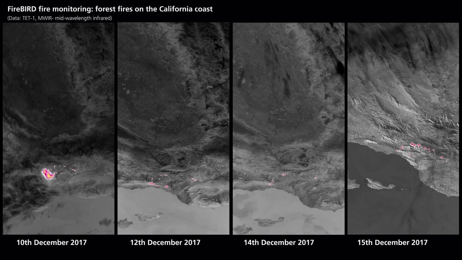
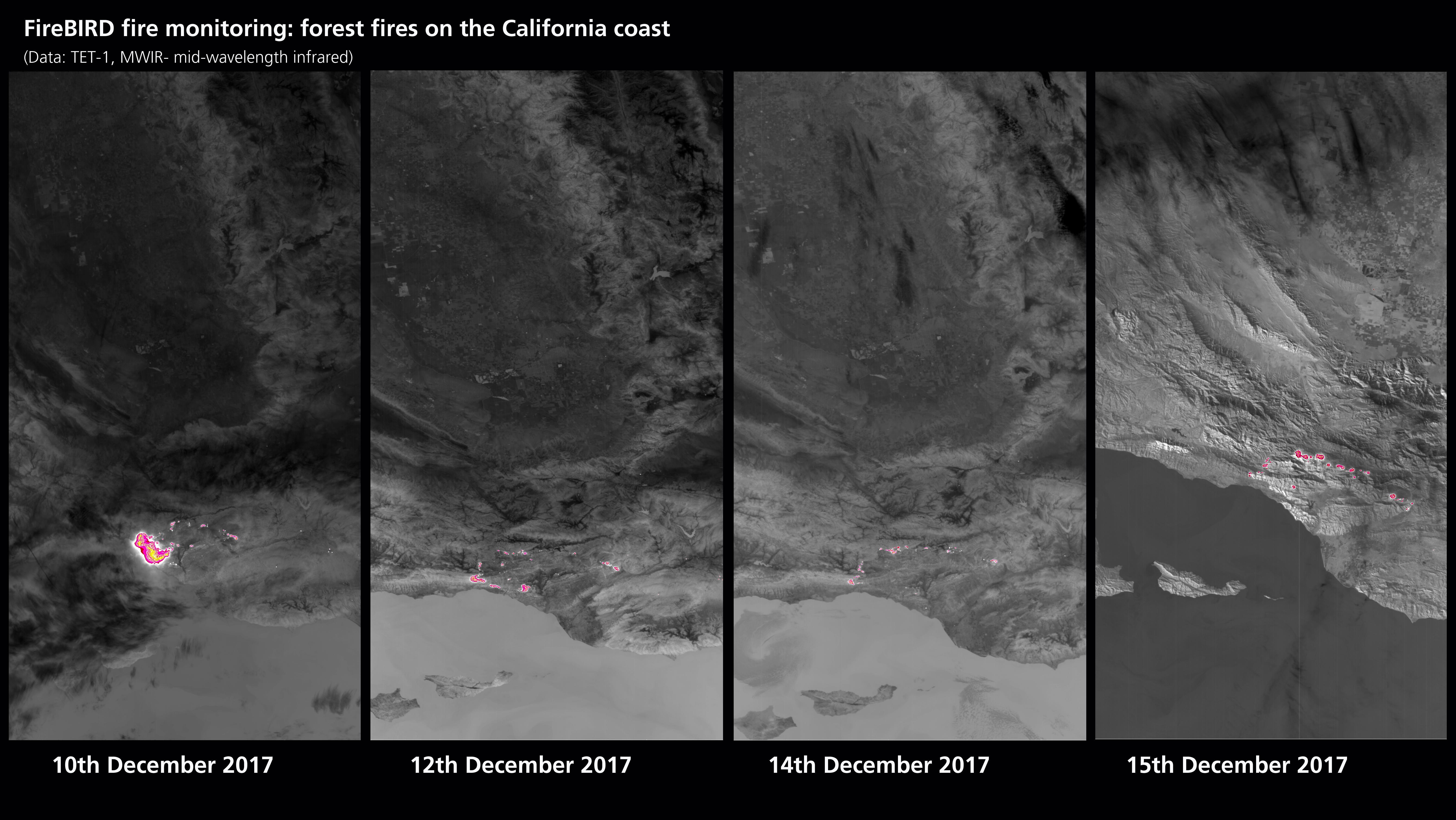
Over the course of several days, the TET-1 (Technology Experiment Carrier) satellite operated by DLR observed the development of a large seat of fire near the town of Ventura, north of Los Angeles. The largest contiguous area of fire that emitted a radiation energy of 18 megawatts was recorded on 10 December. From the image taken on 15 December scientists were able to calculate a radiation energy of 11 megawatts for individual areas. Together with the BIROS satellite, TET-1 is part of DLR’s FireBIRD mission, which detects high-temperature events, such as forest fires, from space.
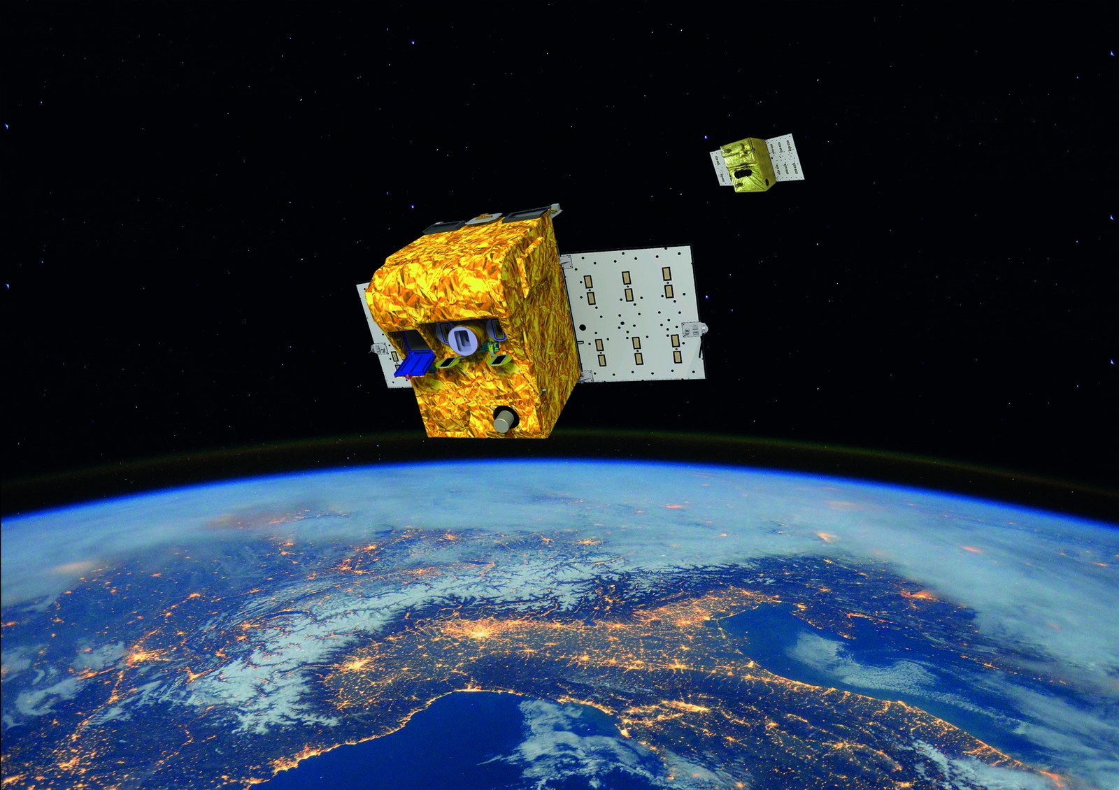
The small satellite BIROS (Bispectral InfraRed Optical System) and TET-1 (Technology Experiment Carrier) form a highly efficient pair for the early detection of forest fires in the FireBIRD (Fire Bispectral InfraRed Detector) mission. Their innovative infrared sensor system allows the satellites to precisely measure the spatial expansion and heat development of fires.
The TET-1 satellite has been recording the seat of a fire on the US Pacific coast for several days
The precise sensor systems of FireBIRD's satellite mission allow the spread and radiation energy of the fire to be measured with accuracy
Focus: earth observation, remote fire sensing, climate protection
Emergency services in the US state of California are still fighting fierce forest fires. Severe drought and strong winds have allowed the fires to spread. The FireBIRD (Fire Bispectral InfraRed Detector) mission run by the German Aerospace Center (Deutsches Zentrum für Luft- und Raumfahrt; DLR) consists of a pair of satellites – TET-1 (Technology Experiment Carrier) and BIROS (Bispectral Infrared Optical System). These detect high-temperature events from space. On Sunday 10 December TET-1 registered a major seat of fire near the town of Ventura, north of Los Angeles, on the US Pacific coast. Further data was recorded over the days that followed. "FireBIRD's precise systems allow us to detect incipient changes to fires with accuracy," says Winfried Halle, FireBIRD project manager at the DLR Institute of Optical Sensor Systems, adding, "This can help us predict the behaviour and development of major fires more effectively in future."
Energetic fires
After analysing initial imagery, DLR researchers realised that in central areas the fire burned more intensely and thus radiated more energy than was the case with the major forest fires that occurred in Chile, Portugal and British Columbia in 2016 and 2017. Scientists calculated a radiation energy of up to 18 megawatts for individual zones within the overall area affected by fires in California. The radiation energy of the aforementioned fires elsewhere in the world was only around half as high.
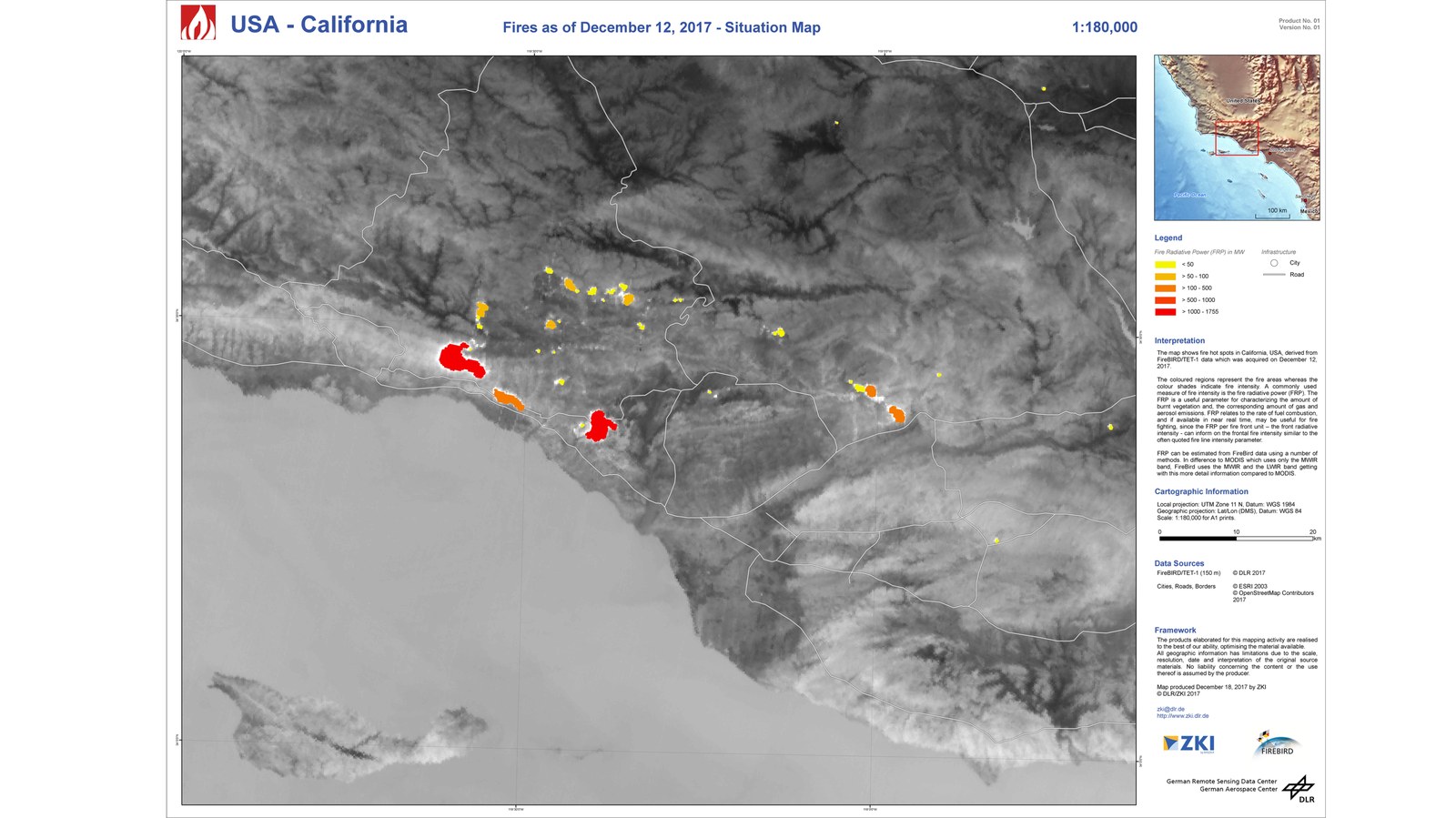
The data showed that over the course of the week the individual fire zones varied greatly in intensity and spatial extent. The largest contiguous area of fire was recorded on 10 December, while the largest number of individual, intensely burning fires was registered on 12 December. Over subsequent days the areas of intense fire declined. However, smaller fires increasingly flared up in other places. The recordings showed that, put together, the fires devastated a large area, hampering fire-fighting operations. "In Europe there is no other comparable satellite mission that is capable of measuring the radiation energy of fires with such precision," notes Halle.
For large fire events such as the forest fires that raged in Chile in January 2017, the DLR Center for Satellite-Based Crisis Information (Zentrum für Satellitengestützte Kriseninformation; ZKI) provides data from FireBIRD to local authorities. In crisis situations the ZKI puts the relevant satellite data together in such a way that it can be optimally used by situation centres, public authorities, relief organisations and policy makers. The ZKI created an overview map of forest fires in California using FireBIRD data.
About the FireBIRD mission
The DLR FireBIRD mission consists of two satellites, TET-1 and BIROS (Bispectral Infrared Optical System). They are both based on the small satellite BIRD (operational from 2001 to 2004), which was developed by the DLR Institute of Optical Sensor Systems. A similar system of infrared cameras is fitted to both of these satellites. TET-1 has been orbiting Earth since 2012, searching for fires and other high-temperature events. TET-1's 'brother', the small satellite BIROS, built in Berlin Adlershof, has also been in orbit since 2016, adopting an open constellation to support TET-1 on its important mission.
The satellite data is mainly received at the DLR ground station in Neustrelitz and then processed, archived and made available worldwide for scientific purposes by the The German Remote Sensing Data Center (DFD). The FireBIRD satellites are operated and controlled by the German Space Operations Center (GSOC) within DLR's Space Operations in Oberpfaffenhofen.
Unlike other current satellites, FireBIRD has the capability to detect smaller fires in particular. This enables more precise mapping, and therefore analysis of their impact on the climate. Moreover, exact registration of forest and bush fires is highly relevant due to the economic loss they entail.
Construction of the BIROS satellite was funded by the German Federal Ministry of Education and Research (Bundesministerium für Bildung und Forschung; BMBF).
