25th Anniversary of the Space Shuttle Missions SIR-C/X-SAR


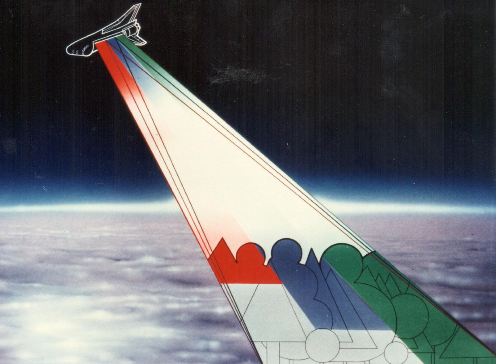
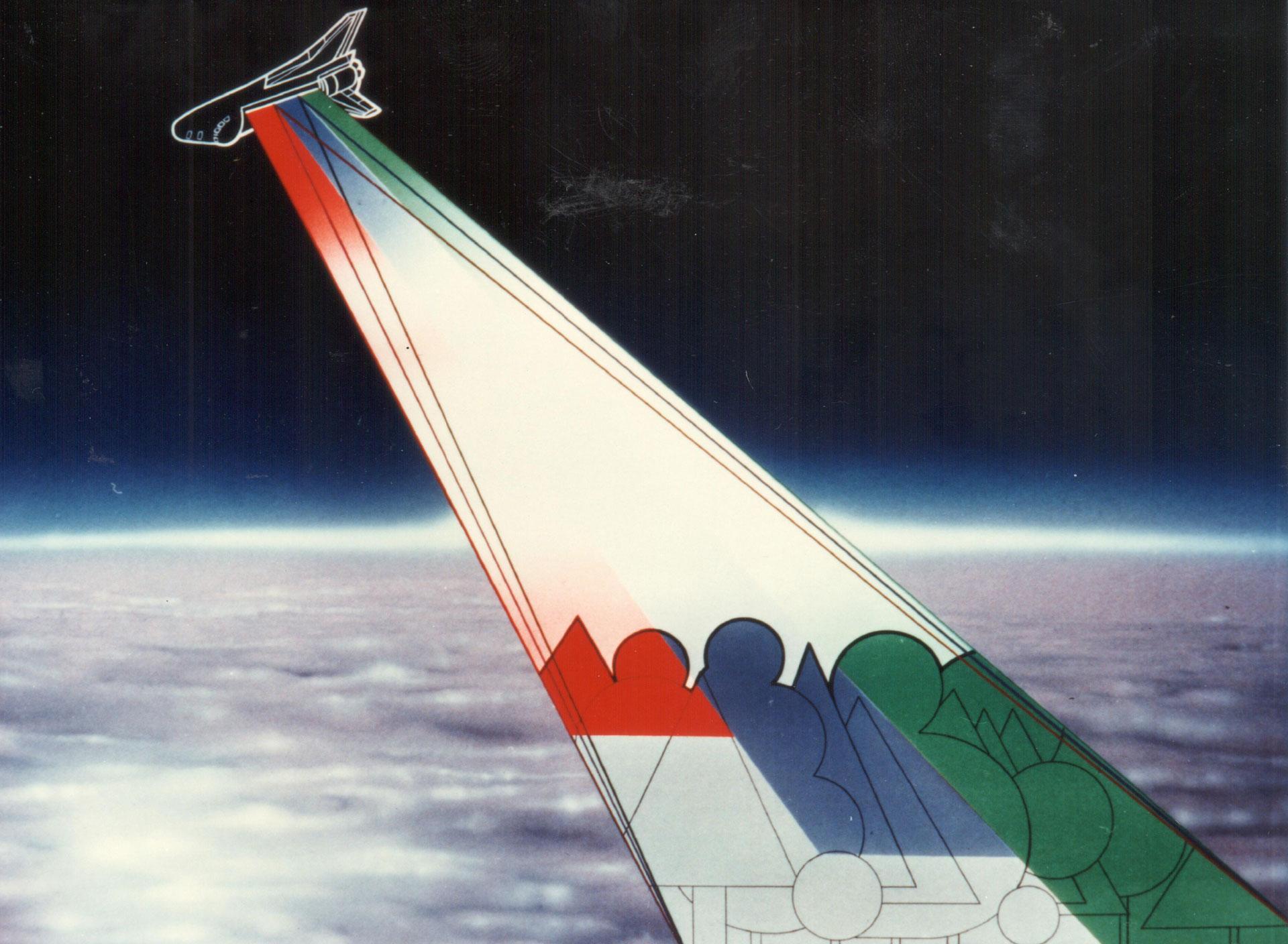
Earth observers like to 'look' at the Earth with radar sensor systems. They allow high-precision images of the surface and have a great advantage over optical cameras: images can be taken not only in excellent visibility, but also in cloudy conditions, rain or at night. Research into space-based radar technologies has a long history. A milestone was the multi-frequency radar system SIR-C/X-SAR. 25 years ago, the Space Shuttle Endeavour flew around the world twice, in April and October 1994. It was the most advanced civil radar in Earth orbit at that time – and for Earth observation it was as big a step as the transition from black-and-white to colour film in photography.
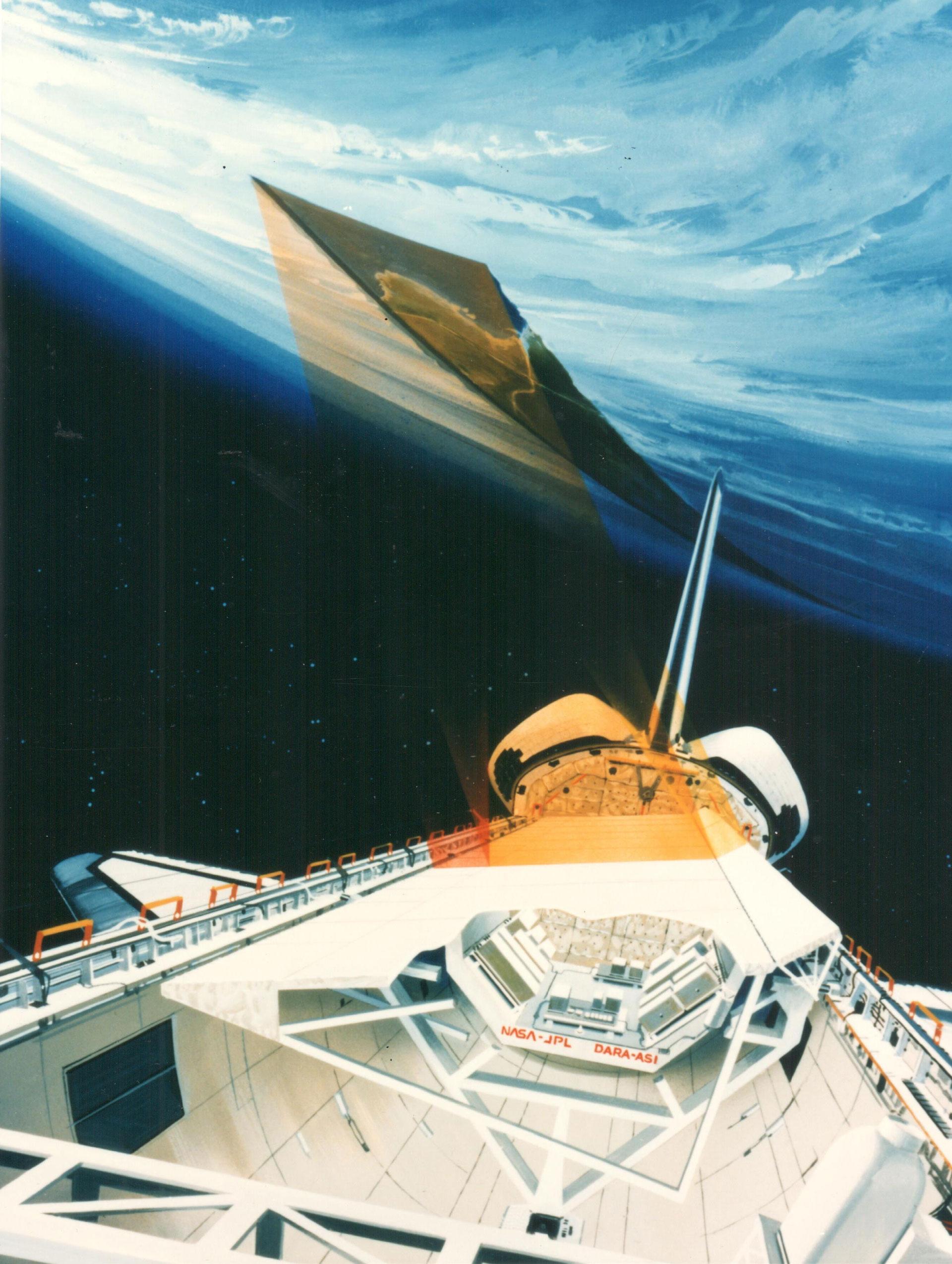
The mission, with the rather unwieldy name SIR-C/X-SAR, was a joint venture between the German Space Agency (Deutsche Agentur für Raumfahrtangelegenheiten; DARA) – today's DLR Space Administration – the US National Aeronautics and Space Administration (NASA) and the Italian space agency (Agenzia Spaziale Italiana; ASI). In addition to the C- and X-band radars, an L-band radar was operated in parallel. This 'multi-frequency' Synthetic Aperture Radar (SAR) proved its performance during two 10-day spaceflights. The radar data acquired during these missions became the basis for more than 5000 scientific publications in the years that followed.
Manfred Zink, from DLR's Microwaves and Radar Institute, and Rolf Werninghaus, from the DLR Space Administration, were both involved in the successful SIR-C/X-SAR mission in DLR's predecessor organisations. Zink has been head of department since 2006 and has been active in the field of satellite-based radar technologies in Oberpfaffenhofen since 1988. SIR-C/X-SAR was his first mission.
Rolf Werninghaus has been Head of Project Support at the DLR Space Administration (formerly DARA) since 2016 and has also been involved in several radar missions since 1988. During the first SIR-C/X-SAR flight, he worked as an interface engineer, and later – during the second SIR-C/X-SAR mission and the Shuttle Radar Topography Mission (SRTM), as well as TerraSAR-X and TanDEM-X – Werninghaus was project and programme manager.
Mr Zink, how were you involved in the SIR-C/X-SAR radar mission?
Manfred Zink: I was hired for the X-SAR project in 1988 and was responsible for calibration. That was largely uncharted territory at the time. For this purpose, we set up reflectors and ground receivers in the 'Supersite' in Oberpfaffenhofen along a north-south axis more than 100 kilometres long. With these measurements, the three radar instruments were precisely calibrated, a precondition for use in the various application fields.
Mr Werninghaus, what was your role during the mission?
Rolf Werninghaus: I was also hired for the X-SAR part of the mission in August 1988 and then worked as an interface engineer until the first flight in April 1994. This was a very exciting time for me, as I was responsible in particular for the technical interfaces of our X-SAR to the SIR-C instrument of our partner JPL and of course to NASA's Space Shuttle. For the second flight in September 1994 I worked as a project manager.
What applications are there for radar in remote sensing of the Earth's surface?
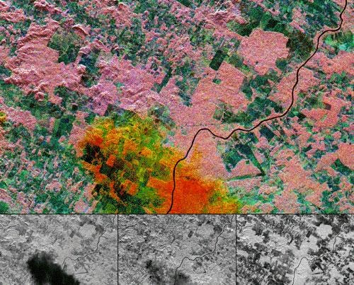
Manfred Zink: The fields of application range from geology, ecology and hydrology to oceanography and glacier research. They were investigated in the SIR-C/X-SAR mission by an international scientific team. In addition, there were first very successful demonstrations of radar interferometry, whereby a region is recorded by the radar sensors from two slightly different positions in order to derive 3-dimensional maps, the so-called digital elevation models.
What were the greatest technical challenges? What innovations were made?
Rolf Werninghaus: SIR-C/X-SAR is still the only multifrequency spaceborne SAR mission. X-SAR was the first civilian X-band SAR in orbit. SIR-C/X-SAR was a demonstrator for a variety of methods that today's missions use as a matter of course, such as operation in ScanSAR and Spotlight Mode or interferometry for 3D mapping, detection of deformations of the Earth's surface, glacier movements and ocean currents. In addition to the many technical innovations of the three radar instruments, the integration into a multifrequency system was certainly the greatest technical challenge.
What does 'multifrequency radar' mean and what are the advantages?
Manfred Zink: A multifrequency radar measures simultaneously in different frequency bands. The frequency of the radar pulses is one of the essential parameters that determines the backscattering of surfaces or the penetration into volume scatterers such as vegetation, ice, dry soil and sand. For example, long-wave L-band signals completely penetrate a forest and also detect the solid ground. Short wavelength X-band measurements only ‘see’ the top of the canopy. A major finding from the SIR-C/X-SAR mission was the need for SAR systems in the various frequency bands in order to optimally serve the various applications.
Today's TerraSAR-X and TanDEM-X satellites fly in a duo and together cast a 'stereo view' of the Earth. Their data are superimposed and converted into three-dimensional elevation models. How was topographic mapping possible in 1994 – with only one 'radar eye' on the Space Shuttle?
Manfred Zink: Basically, the two images for the 'stereo view' can also be captured with just one 'eye' at different times. However, any intermediate change of the objects on the ground reduces the accuracy of the mapping. The simultaneous acquisition of TerraSAR-X and TanDEM-X is the key to high-precision 3D surveying from space.
How much DLR was in SIR-C/X-SAR?
Rolf Werninghaus: The X-SAR project was managed by DARA in cooperation with ASI and brought into the two SIR-C/X-SAR missions on the Space Shuttle via a cooperation agreement with NASA. The Microwaves and Radio Institute designed the X-SAR together with industry, scientifically managed the mission on the German side and was responsible for calibration and, together with the German Space Operations Center (GSOC), for mission operations. The X-SAR processor and the user interface were developed and operated by today's Earth Observation Center (EOC).
And how much SIR-C/X-SAR is in the current radar satellite missions TerraSAR-X and TanDEM-X?
Manfred Zink: X-SAR is the technological forerunner of our TerraSAR-X and TanDEM-X satellites. Without the shuttle missions, they would have been difficult to implement. Of course, TanDEM-X also benefited greatly from the SRTM, the Shuttle Radar Topography Mission. The mission was virtually the ‘third’ SIR-C/X-SAR mission in the year 2000, in which a C- and X-band radar interferometer for 3D surveying was realised using additional antennas on a 60-metre-long deployable boom.
How has the research and development of radar technologies changed in the last 25 years?
Rolf Werninghaus: Today's radar systems go beyond their initial experimental status and are now used operationally for a wide range of applications and services. The best example is the Sentinel 1 satellites in the Copernicus programme. The imaging performance of future systems can be significantly improved by new technologies such as the digital beamforming and new system architectures with large deployable reflectors or additional companion satellites. HRWS, a next-generation X-band SAR with high-resolution imaging and wide ground coverage, and Tandem-L are the follow-up missions to TerraSAR-X/TanDEM-X proposed by DLR. They will capture the Earth with even higher resolution or map it interferometrically twice per week. SAR systems can also be distributed on several platforms flying in formation, thus enabling completely new approaches based on NewSpace technology.
What experiences do you remember from that time?
Rolf Werninghaus: I came directly from university to DLR in 1988 because of the X-SAR missions and then suddenly had to deal with the NASA centres in Florida and Houston, which are well-known from television, immediately and up close. These were very intense and exciting impressions for a fresh university graduate. After the launch of the first mission, there had been a malfunction in the X-SAR instrument. The radar simply could not be switched on at the beginning! After years of preparation, this was of course deeply frustrating for everyone involved. Fortunately, after a few hours we managed to understand the error and put X-SAR into operation. A huge relief.
Manfred Zink: We had to realign our calibration equipment to the shuttle orbit before each flyover. With typical overflight times between five and seven o'clock in the morning and at least three hours' lead time, that meant we had to get out in the middle of the night. One day in April 1994 it had snowed almost 20 centimetres late in the evening: really wet fresh snow, not unusual for Bavaria, but a great challenge for our campaign teams. Nevertheless, we managed to get all the measurements into the box.
About SIR-C/X-SAR
SIR-C/X-SAR was a cooperation of NASA, the German Space Agency (DARA) and the Italian ASI. The X-SAR radar instrument was developed and built under the direction of DARA by Dornier/Daimler-Benz Aerospace (today AIRBUS Defence and Space) and the Italian company Alenia Spazio (today TAS-I). DLR, which at that time was still called the German Aerospace Research Institute, was the scientific lead and carried out the calibration of the X-SAR data, the mission operation and the data processing for X-SAR.
NASA's Jet Propulsion Laboratory (JPL) built the SIR-C instrument and managed this part of the mission. October 2019 marks the 25th anniversary of the instrument's second flight on the Space Shuttle Endeavour. The radar data are still available today and are still used in science today. DLR's Earth Observation Center is currently planning to develop a new SIR-C/X-SAR data processor.