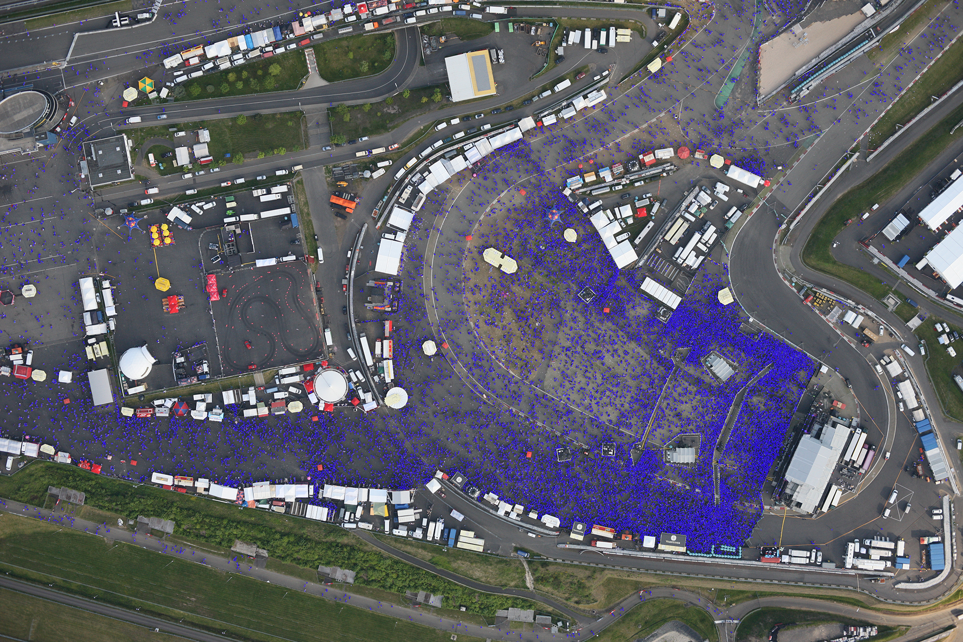
Overlay of an aerial image with an AI-based visualisation
The image shows an aerial image of the music festival ‘Rock am Ring’ in 2013, superimposed onto the result of an AI-based estimation (blue dots). A manual count estimated 24,368 people. The trained algorithm was applied to the image and estimated 25,332 people.
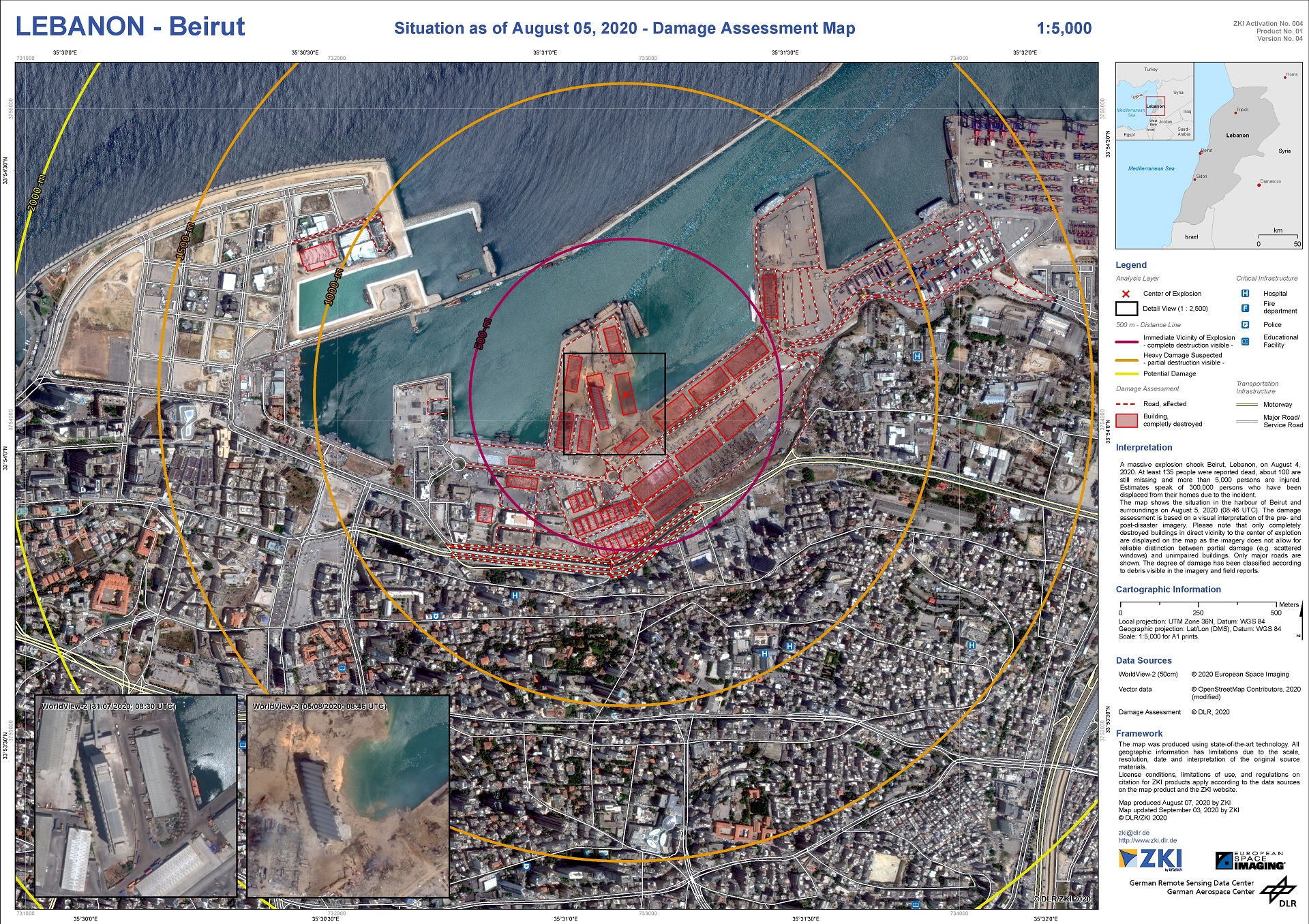
On 4 August 2020 a powerful explosion occurred in the Lebanese capital, Beirut. With the help of a map produced by DLR, the damage situation on 5 August 2020 is clearly visible. By comparing a pre-event scene with a post-event scene, it is possible to provide an initial overview of the affected area and an estimate of the major losses incurred.
The German Aerospace Center (Deutsches Zentrum für Luft- und Raumfahrt; DLR) Remote Sensing Data Center (Deutsche Fernerkundungsdatenzentrum; DFD) is now 40 years old. DFD has been receiving and analysing images from Earth observation satellites since 1980, with over 21 terabytes of data processed there every day. The German Satellite Data Archive (D-SDA) now offers access to 29 petabytes of remote sensing data, acquired over four decades. This volume of data is the equivalent of video material with a running time of over 800 years.
DFD is not the only one celebrating a big anniversary. The DLR Remote Sensing Technology Institute (Institut für Methodik der Fernerkundung; IMF) was founded twenty years ago. Since then, DFD and IMF have formed a unique alliance within DLR, today known as the Earth Observation Center (EOC), a leading international centre of excellence for satellite-based Earth observation. EOC spans the entire remote sensing system chain and combines the expertise of engineers, computer scientists, physicists and geoscientists.
Progress in remote sensing opens up new possibilities
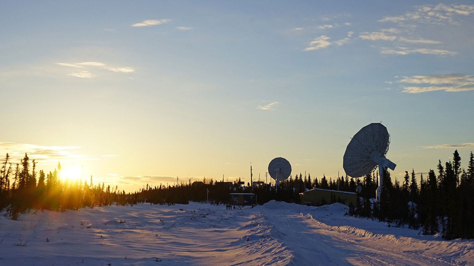
"The developments in remote sensing that we are seeing today would have been unimaginable 40 years ago. At that time, the technology for receiving data from space was largely developed and constructed in house. The data were only accessible to a handful of researchers, who mostly used them to examine small details of Earth's surface," says Stefan Dech, Director of DFD. Today, DFD boasts an international network of ground stations with receiving facilities located everywhere from the Canadian Arctic to Antarctica, receiving data 24 hours a day, all year round. DFD uses these to create global products, such as a highly accurate elevation map of Earth. By deploying big data analytics and artificial intelligence, DFD uses current data flows to obtain information about the global level of natural and artificial water reservoirs, estimate the production of aquacultures worldwide and create an accurate picture of the global distribution of human settlements. This information can also be useful in the event of environmental or natural disasters, provide warnings of health risks and contribute towards an understanding of global processes such as ecological degradation and climate change.
Remote sensing is proving useful during the ongoing pandemic. In order for organisers of events such as concerts, trade fairs or demonstrations to be able to avoid dangerous congestion in gatherings of people and ensure security and protection against infection, they need an up-to-date picture of visitor numbers. A 'learning algorithm' developed by IMF scientists is able to count people automatically using aerial images, photographs and videos, to determine the density of crowds. This counting is performed in real time and in accordance with data protection regulations; individuals cannot be identified – only outlines and contours typical of the human form can be distinguished. Elsewhere, artificial intelligence is able to recognise and classify lane markings from Earth observation data to provide up-to-date information for automated driving worldwide. "The AI processes that we have developed generate useful geoinformation of a previously unattainable quality on the basis of Earth observation data," explains Richard Bamler, Director of IMF.
The enormous amount of new Earth observation data, as well as the new capabilities for evaluating big data rapidly and globally in major processing environments in the cloud and in computing centres with the help of AI processes is such that huge steps will be taken over the next 40 years. This will make again for an interesting trip down memory lane at the next major anniversary.


