Topographic map of a part of Nereidum Montes (HRSC terrain data)

Topographic map of a part of Nereidum Montes (HRSC terrain data)
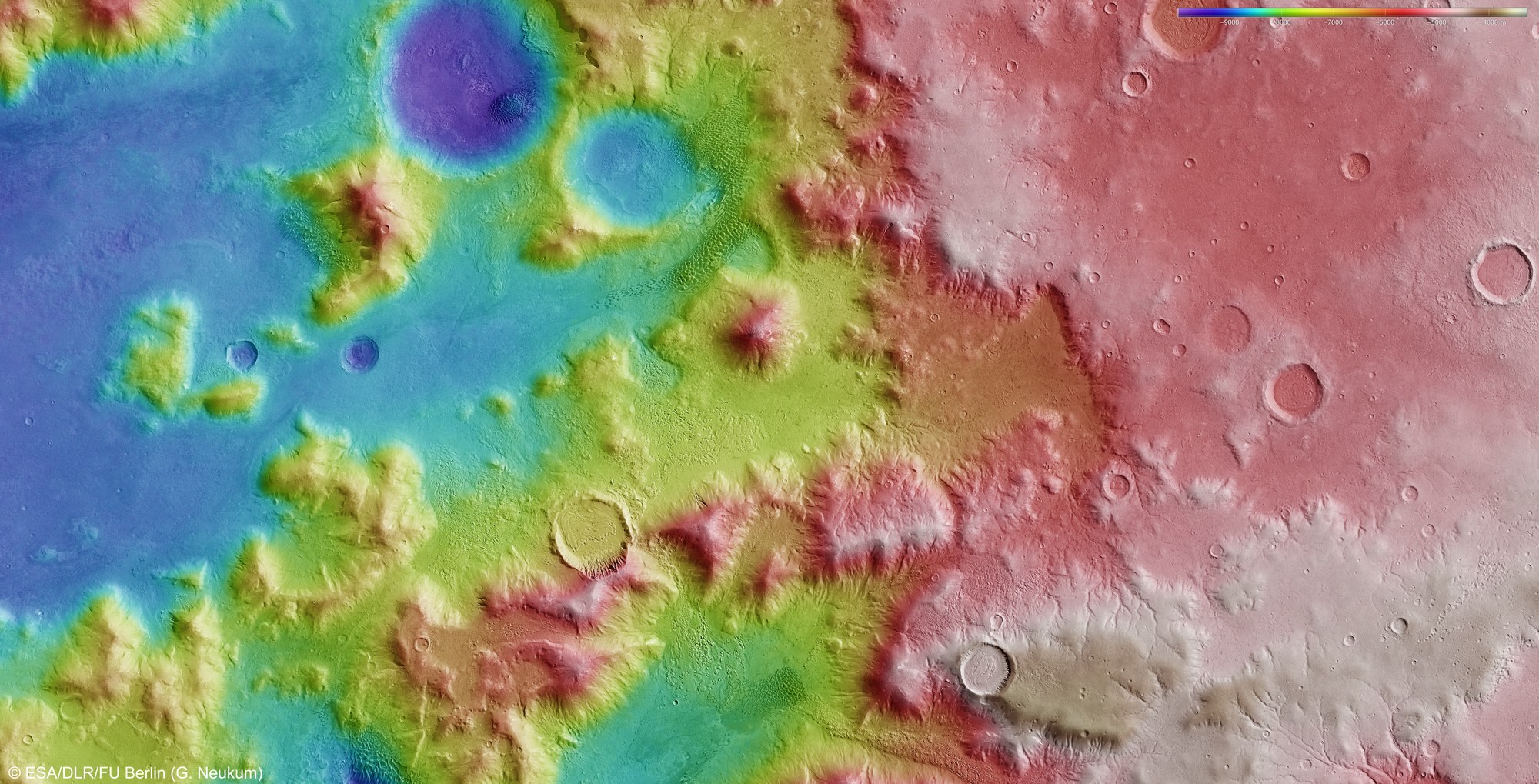
Using the High Resolution Stereo Camera (HRSC), digital terrain models can be derived that illustrate the topography of the region using false colours. The altitudes can be read from the coloured scale at the top right of the full image (blue: low-lying regions; red: regions at higher altitude). In the absence of 'sea level', the elevation data is referenced to an areoid – a modelled equipotential surface on which everything experiences the same gravitational attraction towards the centre of the planet. Nereidum Montes is located just inside the main ring of Argyre Planitia and forms part of the mountainous northern rim. Similar to the Alps, this range stretches in an arc over 1100 kilometres, parallel to the edge of the basin, with individual mountains of three to four thousand metres in height.
Copyright note:
As a joint undertaking by DLR, ESA and FU Berlin, the Mars Express HRSC images are published under a Creative Commons licence since December 2014: ESA/DLR/FU Berlin, CC BY-SA 3.0 IGO. This licence will also apply to all HRSC images released to date.