Colour plan view of Osuga Valles


Colour plan view of Osuga Valles
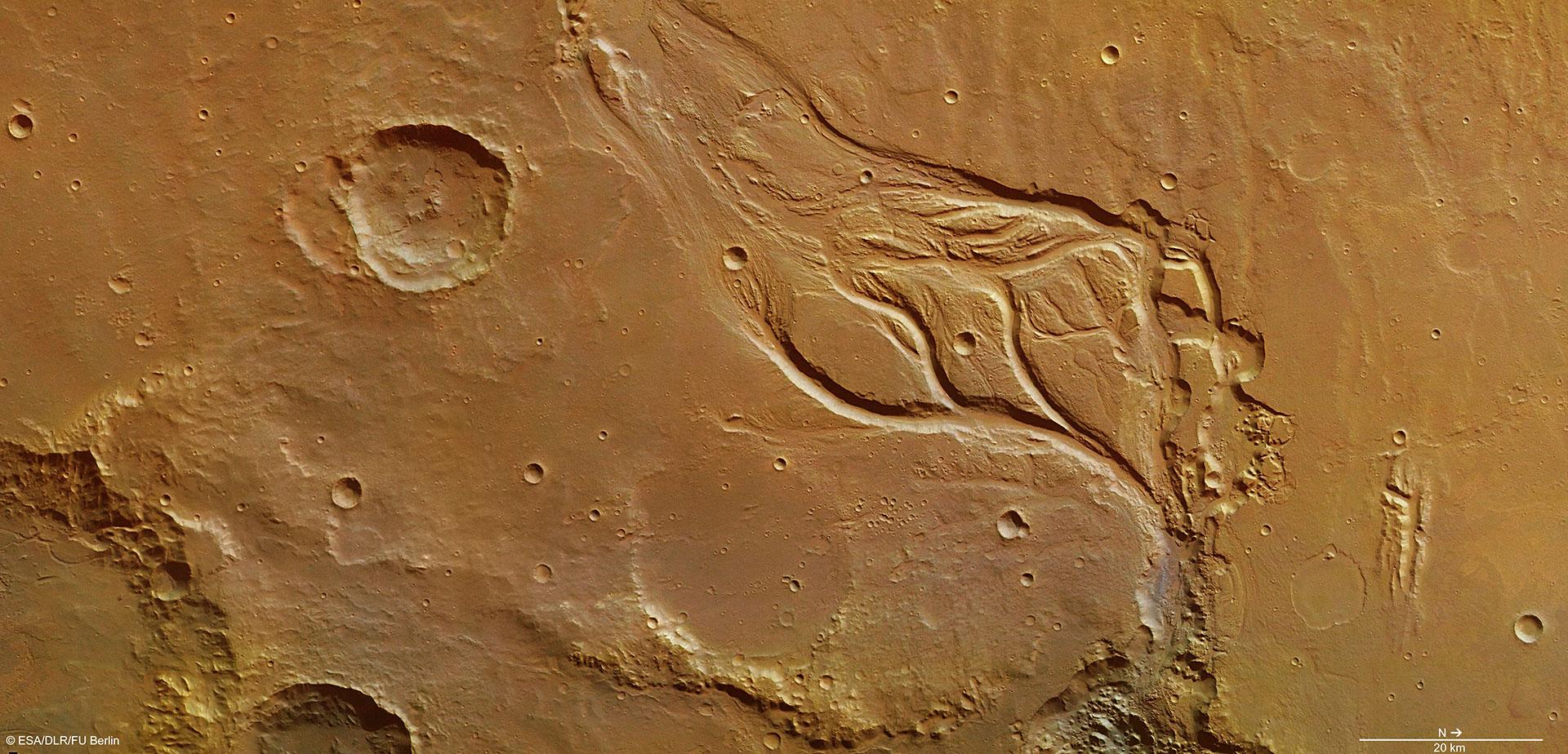
View of the central part of Osuga Valles on Mars. The valley is relatively short at 164 kilometres long, but its width (up to 20 kilometres) and depth (up to 900 metres) suggest that massive, catastrophic floods have occurred here. The strongly erosive force of the water flowing through has left behind typical landscape features: teardrop-shaped islands that the floodwaters streamed around, flow patterns on the valley floor in the form of rilles, and terraces along the valley walls and streamlined islands. The rilles on the valley floor give an indication of the high flow rate of the water; streamlines encircle the islands, proving that the water flowed towards the northeast (lower right). Elevation differences in the valley floor and intersecting/overlapping valleys indicate that a number of separate flooding events took place. The High Resolution Stereo Camera (HRSC) acquired this image on 7 December 2013, during Mars Express orbit 12,624. The resolution is about 17 metres per pixel.
Copyright note:
As a joint undertaking by DLR, ESA and FU Berlin, the Mars Express HRSC images are published under a Creative Commons licence since December 2014: ESA/DLR/FU Berlin, CC BY-SA 3.0 IGO. This licence will also apply to all HRSC images released to date.