Topographical image map of part of the Cydonia region

Topographical image map of part of the Cydonia region
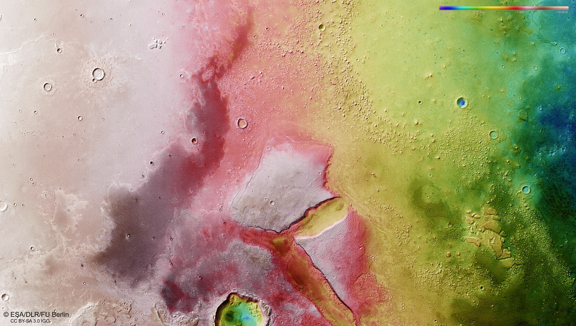
Digital terrain models can be derived from the HRSC imaging system’s stereo image data, which allocates an altitude value to each pixel on the surface of Mars. The reference level for the altitude values is an ‘areoid’ (named after Ares, the Greek name for Mars), a notional plane of equal gravitational attraction that corresponds to sea level on Earth. The distribution of altitude values can be seen using the colour scale in the upper right of the image. In the centre of the image there are two large mesas, around 500 metres high and some 20 kilometres in length, making them six times as large as the famous 1000-metre-high Table Mountain near Cape Town in South Africa. The two mountains once formed a contiguous massif but are now separated by an oval valley.