Time series images from TET and MODIS


Time series images from TET and MODIS
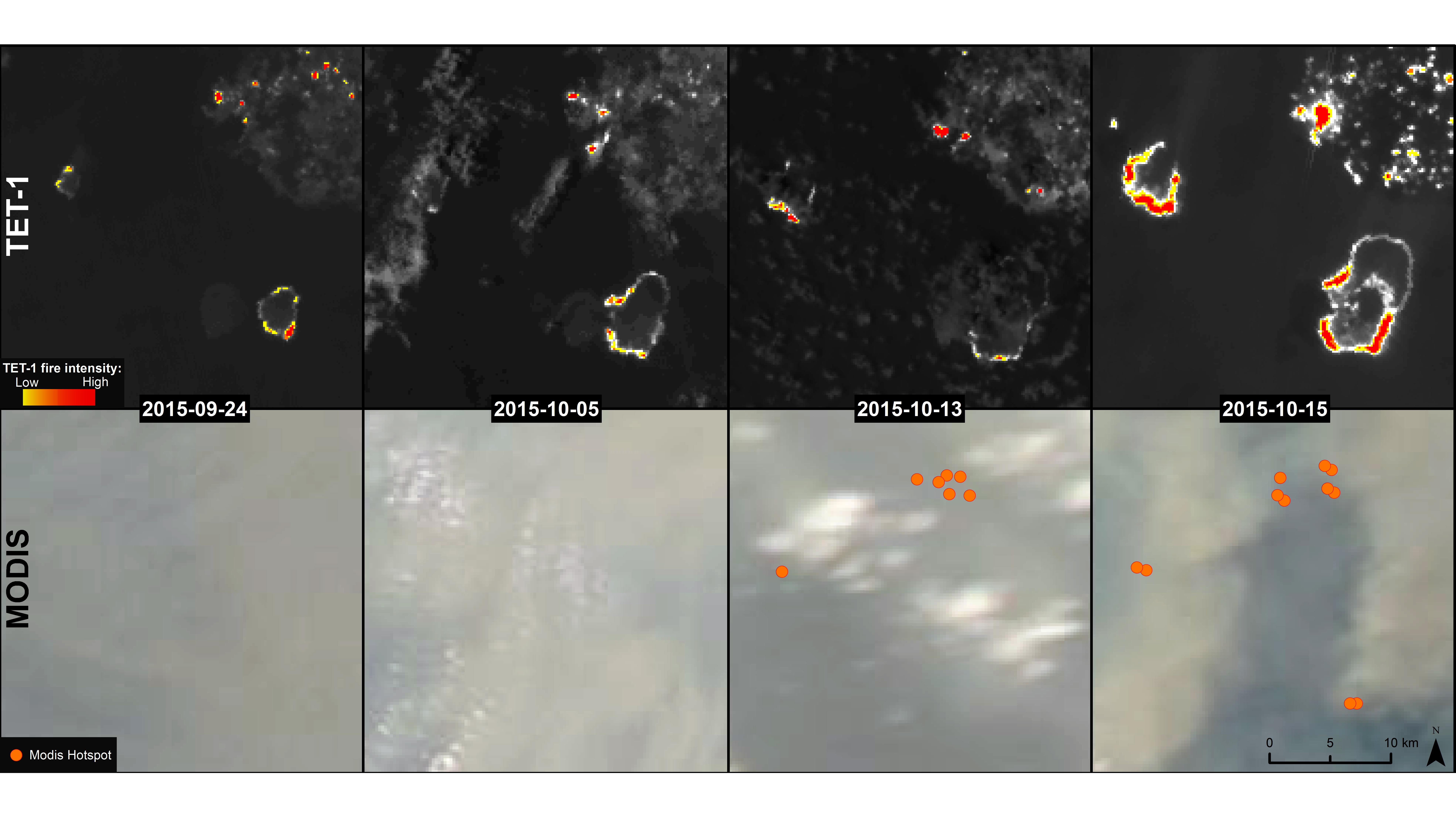
Time series images can help to identify the source of a fire and to estimate its potential spread. These images show the distribution of peat fires across the Sebangau National Park on Borneo over a period of three weeks. Images acquired by the DLR satellite TET are shown at the top and the images acquired using NASA’s MODIS instrument are shown below.