Difference image with map

Difference image with map
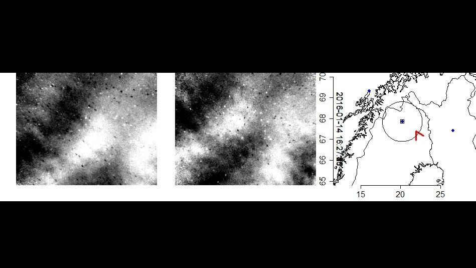
The first two images show changes in a gravity wave field within a few seconds. The black and white points are stars that have not been entirely eliminated and are, in fact, amplified by the differential imaging. The image on the far right shows a map of northern Scandinavia. The red arrow represents the position of the DLR Falcon research aircraft at the time of image acquisition. The blue dots are ground-based measuring stations.