Emergency mapping – relieving hunger in Somalia

Emergency mapping – relieving hunger in Somalia
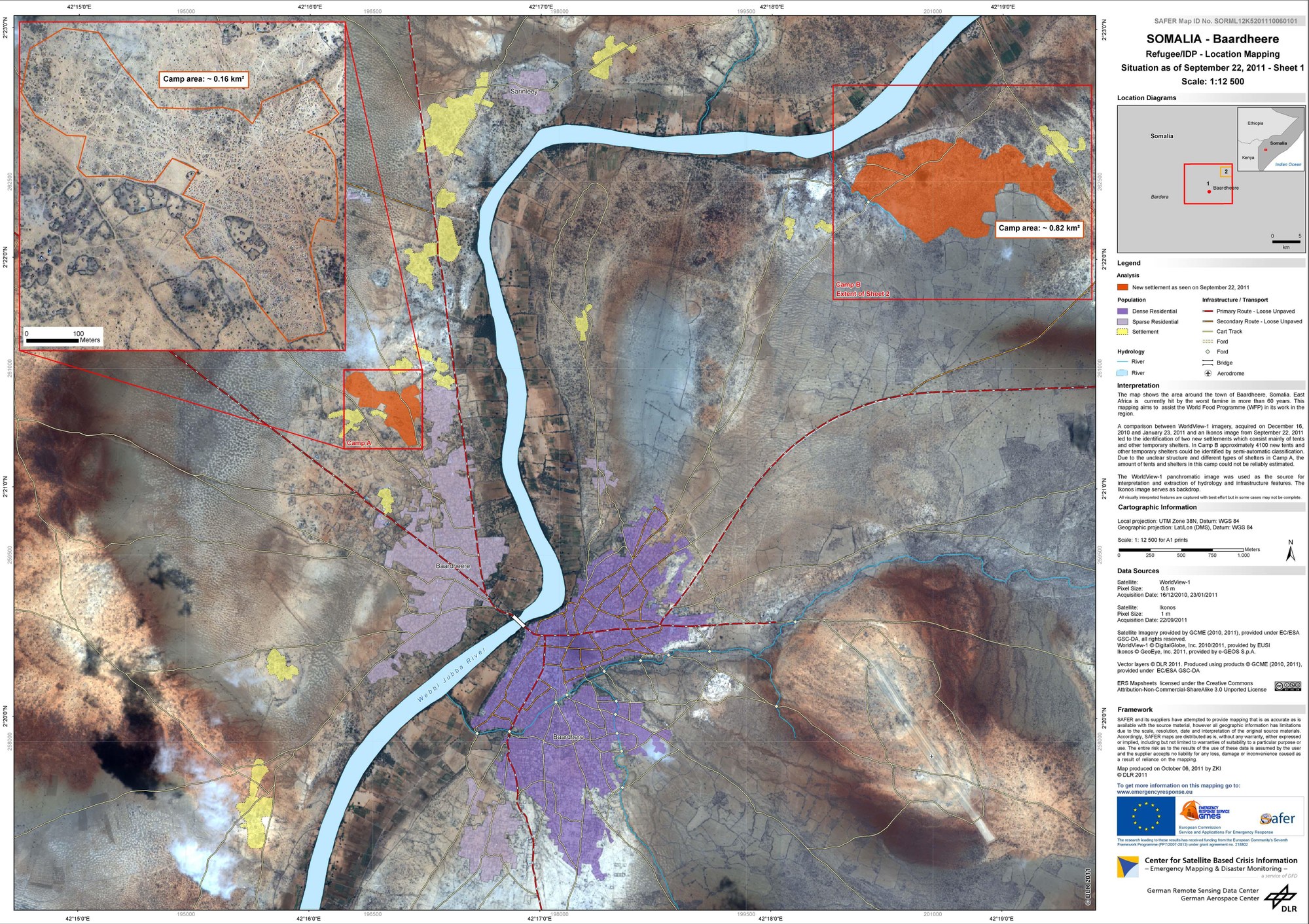
In 2011, East Africa was hit by its worst famine in decades. DLR created emergency maps on behalf of the UN World Food Programme. This satellite map of the city of Baardheere provides information on the infrastructure, hydrology systems and the size of the settlements located there.