Sulphur dioxide map: volcanic eruption on Bali


Sulphur dioxide map: volcanic eruption on Bali
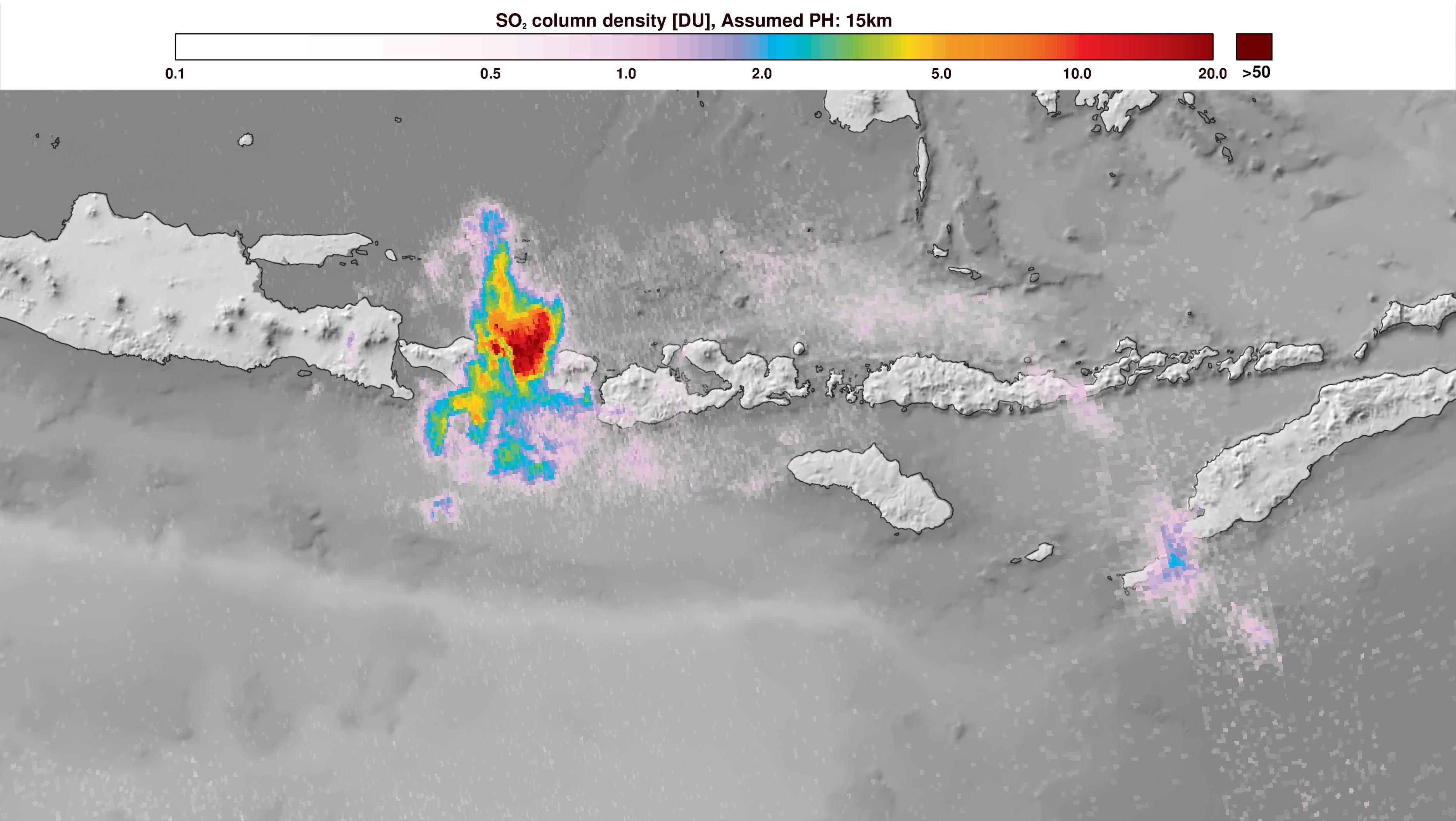
On 27 November 2017 the Copernicus Sentinel-5P satellite captured the ash and gas clouds spewed into the air during the eruption of the Gunung Agung volcano on Bali in Indonesia. The map shows that the Sentinel-5P mission also measures aerosols as well as trace gases in the atmosphere.
Copyright: contains modified Copernicus Sentinel data (2017) processed by DLR/ESA.