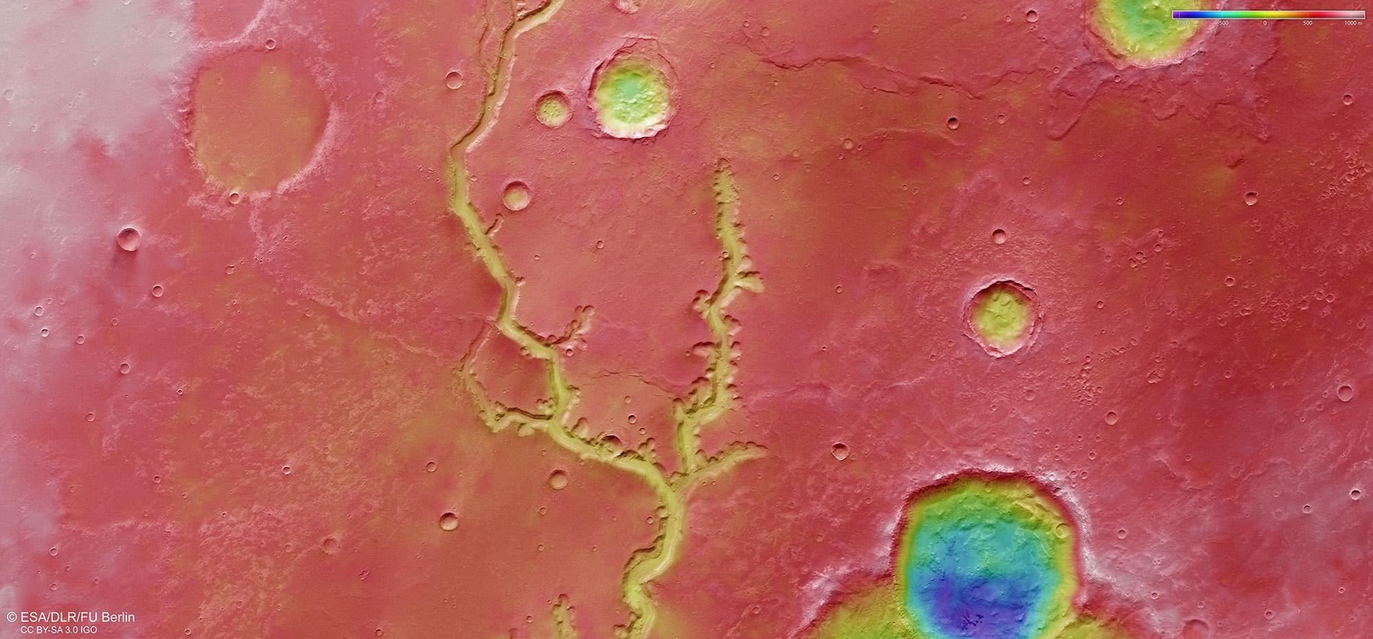
Topographic image map showing part of Nirgal Vallis

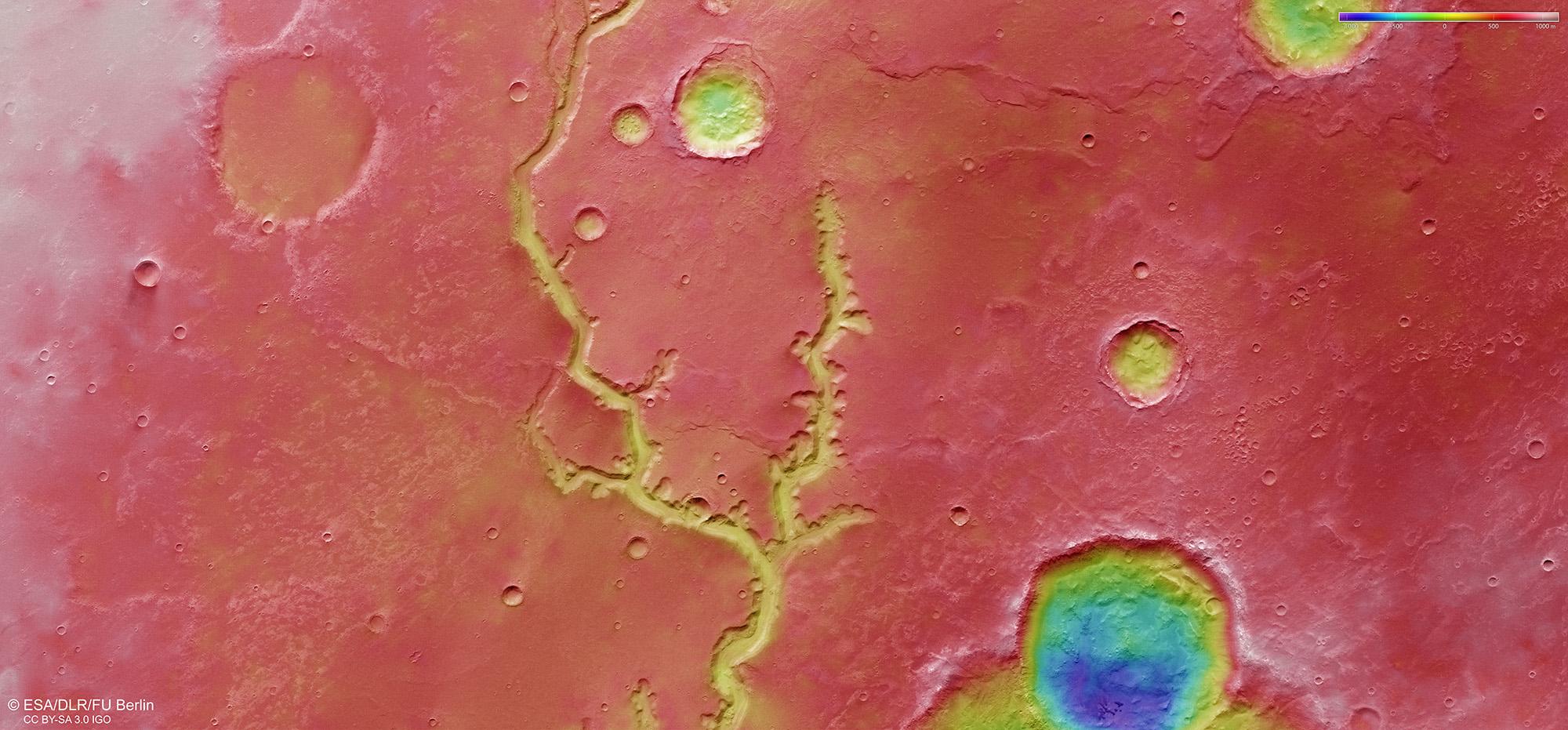
Topographic image map showing part of Nirgal Vallis
Image strips acquired from different angles by the High Resolution Stereo Camera (HRSC) on board Mars Express were used to generate digital terrain models of the Martian surface; these contain height information for each recorded pixel. The colour coding of the digital terrain model (legend, top right) indicates the elevation differences. In this area, the valley depth averages between 200 and 250 metres.