EUREC4A


EUREC4A
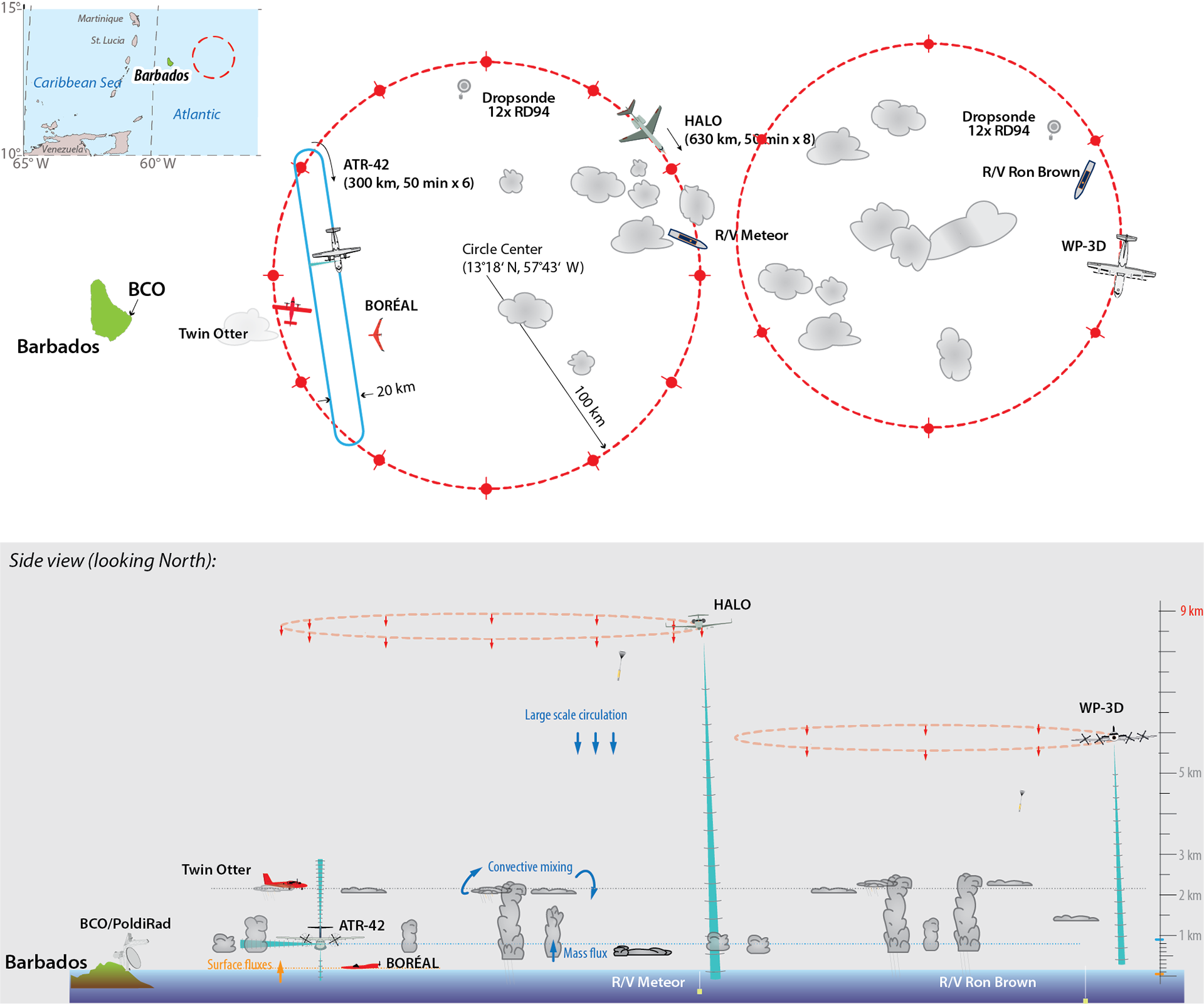
Diagram of the airborne and ship-based measurements planned for EUREC4A. The low-altitude flight segments will map the cloud conditions and determine the mass balance of the layer of air beneath the clouds. The circular flights will document the large-scale conditions using dropsondes and record the underlying cloud field using remote sensing. Ship-based remote sensing will complement the aircraft measurements, while also conducting in-situ measurements using sensors attached to tethered balloons. EUREC4A will be the largest study yet to examine low-level clouds and their interactions with the atmosphere and ocean.