
Icebreaker voyage to the wreck of the Endurance
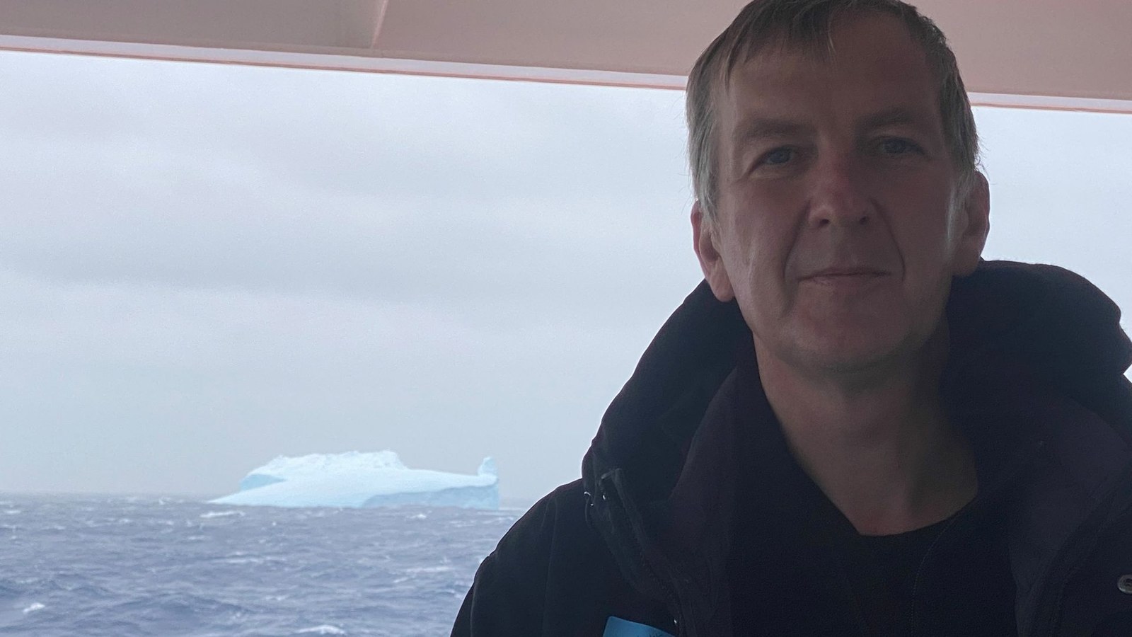
Thomas Busche can still picture that climactic moment in perfect detail. Over the last few days, the research ship S.A.Agulhas II had pushed its way through the mighty pack ice of the Antarctic Weddell Sea. The constant, omnipresent rumble could be heard on all of the decks as the ice floes scraped along the ship’s sides. The search for Endurance, the expedition ship of polar explorer Ernest Shackleton that sank in 1915, had been going on around the clock for days. Working alongside Dmitrii Murashkin of the German Aerospace Center (Deutsches Zentrum für Luft- und Raumfahrt; DLR), Busche had retrieved and processed daily images from the TerraSAR-X radar satellite to plan a safe route for the ship through the ice during the Endurance22 expedition. Suddenly a colleague rushed up, holding his mobile phone aloft. On the screen was an image of the hull of Endurance, 3008 metres underwater, taken by a submersible robot. On 5 March 2022, the team of scientists and the ship’s crew made headlines around the world for their remarkable find.
A polar region like an alien planet


The Falklands Maritime Heritage Trust put together an interdisciplinary team of scientists, engineers and technicians for the expedition. “The Weddell Sea is a remote wilderness and only accessible to ships for a few weeks a year,” says Busche. “This is the most inaccessible region on Earth.” There are lots of penguins and seals, a few other birds, and no land in sight. During the research voyage, temperatures usually ranged from minus five to minus eight degrees Celsius. During cold spells, the thermometer dropped to minus 17 degrees. “You would think twice about taking off your gloves on deck,” recalls Busche, who assisted other science teams with their research work on the pack ice itself. “It truly is like being on another planet out there.”
Ernest Shackleton is supposed to have recruited his crew with the following newspaper advertisement: “Men wanted: for hazardous journey, small wages, bitter cold, long months of complete darkness, constant danger, safe return doubtful, honour and recognition in case of success.” In other words, honour and recognition were not awarded for successfully crossing Antarctica, but for sheer survival. The last time Frank Worsley, the captain of Endurance, wrote down his ship’s coordinates was on 21 November 1915. By this time, Shackleton’s plan to cross Antarctica had already failed, leaving Endurance abandoned and firmly in the grip of the destructive pack ice. A private expedition in 2019 to search for the historic wreck had to give up when the team lost contact with their diving robot and the dense pack ice threatened to trap their research ship. The success of the Endurance22 expedition was by no means guaranteed.
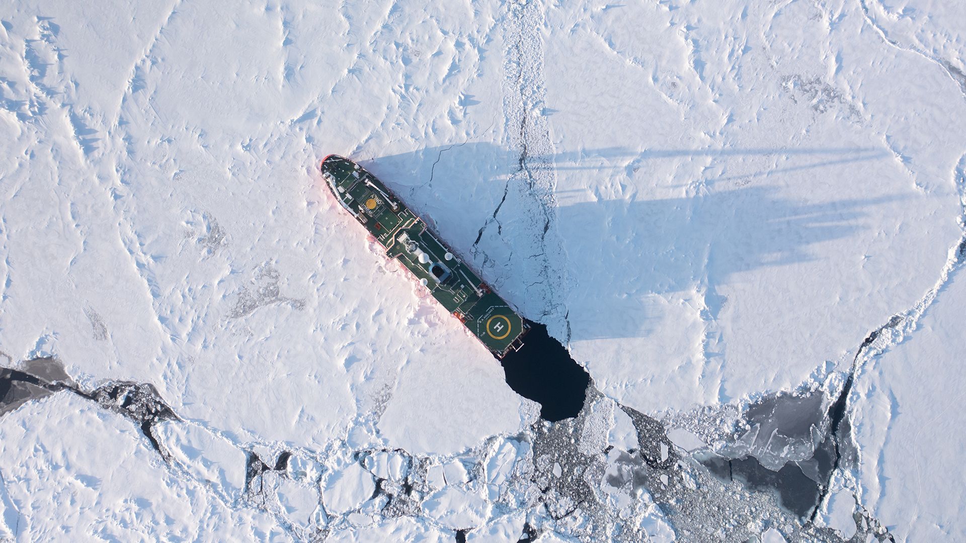
Remote sensing in shifts
“The ice in the Weddell Sea is very different to the ice you find elsewhere, as it ranges from newly formed ice to ice floes that are several years old,” says Busche, who coordinates the international scientific use of the TanDEM-X radar satellites at the DLR Microwaves and Radar Institute. “Those differences are difficult to interpret in the radar images.” But satellite images have a unique advantage – their radar signals can pass through clouds unhindered, so they can provide up-to-date images regardless of the weather and time of day. The Bremen-based company ‘Drift+Noise’ asked Thomas Busche to take part in the expedition. The remote sensing specialist began his career at DLR with an internship during his geography degree course; he also prepared his thesis at DLR. Together with his colleague Dmitrii Murashkin from the DLR Remote Sensing Technology Institute, his work on the expedition involved processing and evaluating the satellite data for the geo-information system on board and shift work on the ship’s bridge.

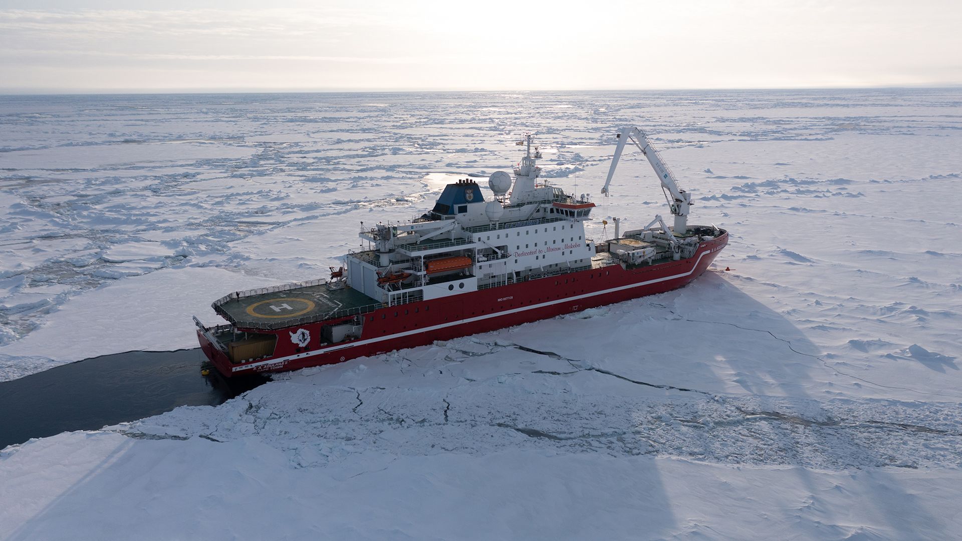
“Using our charts, the specialist ice team worked with the ship manager and the ice pilot to determine the safest route.” Even the very best icebreaker would not attempt to force its way through the solid pack ice ridges of the Weddell Sea. The DLR science team greatly appreciated being able to put their science expertise to practical use in this way. Busche and Murashkin were full of nervous excitement as they sat down in front of the screens in the office on deck four. Had the satellites acquired the images? Could the raw data be downloaded from space? The data team had special internet access on board. Everything went surprisingly well, according to Busche – there were only a couple of technical issues.
Satellite imagery on rough seas
Life on the ship took some getting used to for the crew, who were now working in an office surrounded by up to five-metre waves and living in a two-person cabin on deck six instead of comfortable apartments. Temperatures ranged from T-shirt weather at the port of departure in Cape Town to icy polar winds in the Weddell Sea. They slept and worked according to the rhythm of the expedition, with the ship’s position determined by the working area of the diving robot. Busche was lucky. “After a day or two I got used to the rough seas, although working on a screen was difficult.” More than 100 years ago, Shackleton kept his crew entertained with football matches and amateur theatre on the ice. For the scarce free time when the S. A. Agulhas II was surrounded by pack ice and drifting along calmly, those on board could make use of a fitness studio, two lounges, a small kitchen and table tennis in the helicopter hangar. Simply getting around the nine decks of the over 130-metre-long ship provided plenty of opportunities for exercise at other times; Busche covered four to five kilometres a day on the ship’s decks and stairways. Only jogging on the ship’s deck was prohibited for safety reasons.

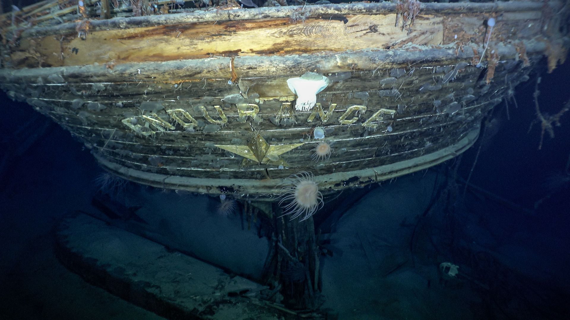
The successful discovery of the legendary wreck in a search area of over 400 square kilometres was due to the expedition’s well-prepared team, the necessary technology and the safe route-finding made possible by the satellite images evaluated by DLR. In the images that the diving robot transmitted to the ship, the Endurance lies incredibly well preserved on the seabed. The stern bearing the name of the discovery vessel emerges eerily from the darkness, illuminated by the cone of light from the diving robot. Small jellyfish and white crabs sit on her railing and wooden planks. The ship looks just as it did when it was photographed for the last time, locked in the pack ice, but now it is resting on the sea floor. This will not change, because as a historical site the wreck must not be touched.
At the end of the world
There was a second moment of the expedition that Thomas Busche will not forget. On the return voyage to Cape Town, the S. A. Agulhas II dropped anchor off the island of South Georgia. The captain, crew and researchers set out in small boats for the east coast of the island and the town of Grytviken, home to a disused whaling station by the picturesque fjord, a research station, a small museum with the Endurance captain’s nautical calendar and a cemetery. There lies the grave of polar explorer Ernest Shackleton, who was buried here in March 1922. “Standing before it was a very moving experience,” says Busche.

Tags: