
Gathering airborne data, even with a blocked nose


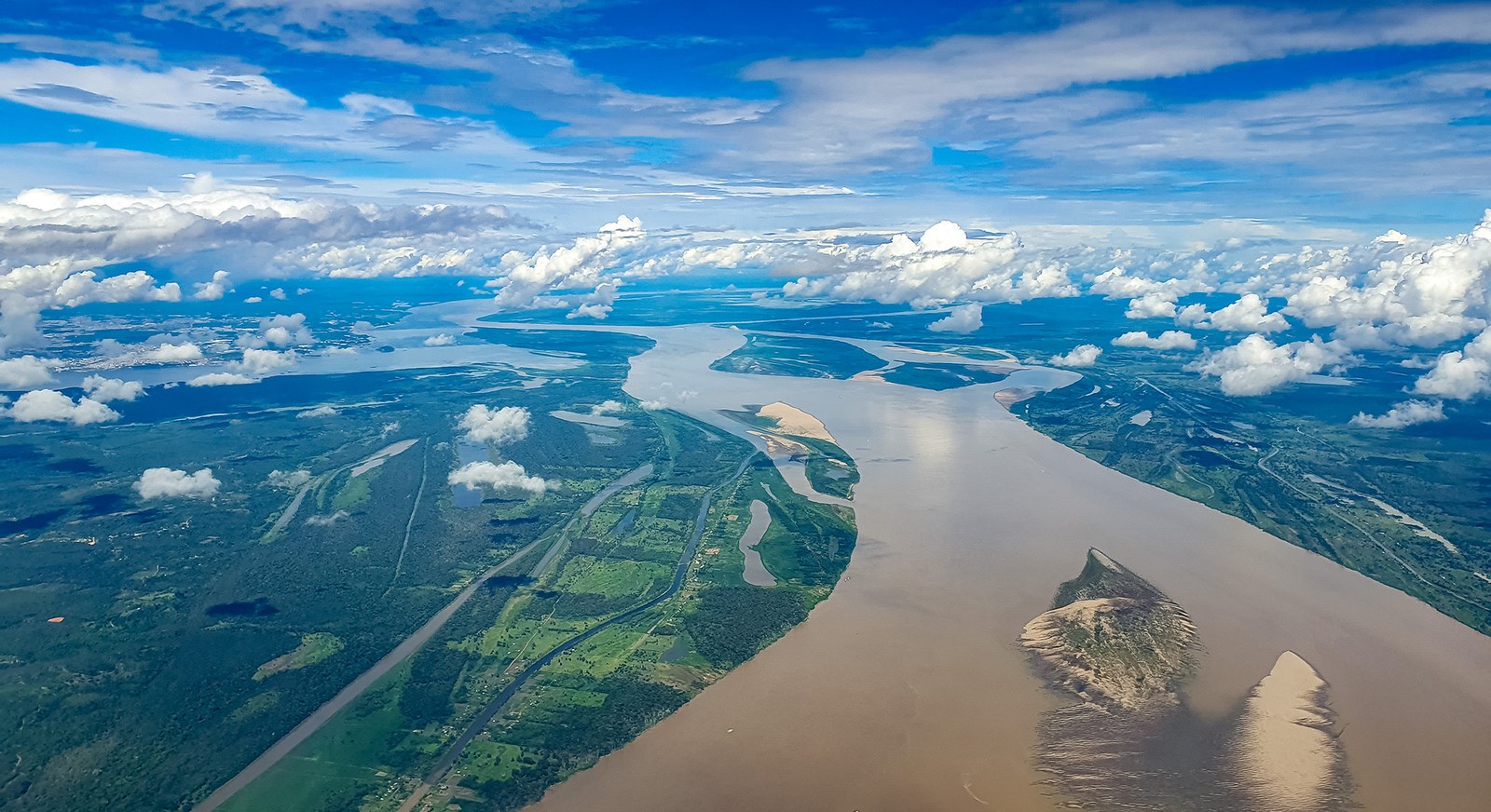
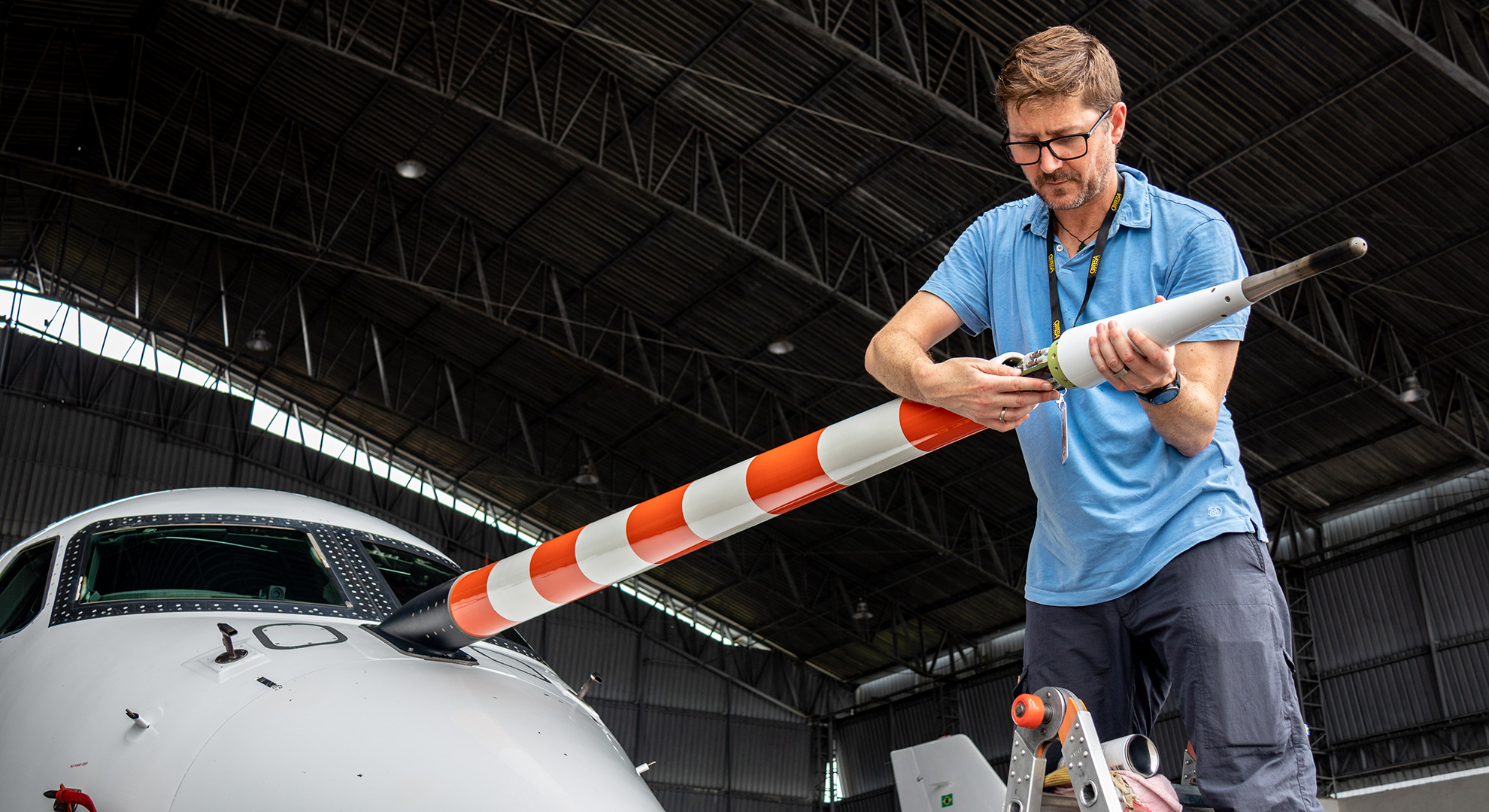
On Christian Mallaun's screen is a map of the Amazon rainforest, with Manaus right in the centre. A straight line runs north from the city, tracking the current flight path of DLR’s HALO research aircraft, which has set off to circle over this northern region while air flows through the instruments of the CAFE-Brazil climate campaign team of scientists. Christian, a meteorologist from DLR's Flight Experiments facility, also has measuring sensors on board. They are located primarily in the nose of the aircraft and continuously record data during flights. "Our measurement technology and products are needed by all scientists, whether they are travelling for climate research or to improve weather forecasts," says the 46-year-old. Christian works in the Measurement and Sensor Technology group and provides the scientific team with key environmental parameters such as pressure, temperature, humidity, aircraft position and wind strength while on site during the campaign. This data is indispensable for evaluating the measurements taken by the research instruments and ensuring that the subsequent research results take the conditions of the measurement flights into account.
Recordings on more than 1000 channels

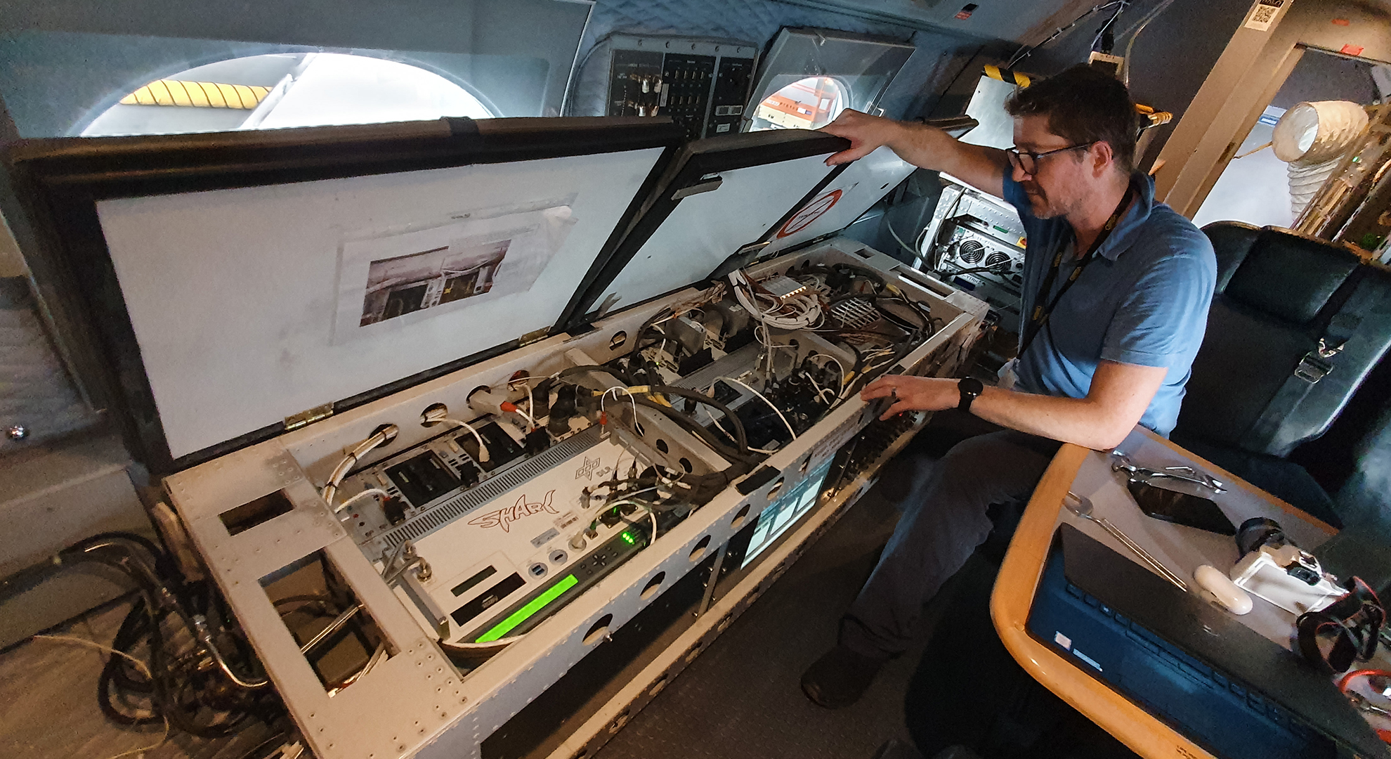
"In the measurement and sensor technology department, we turn a normal aircraft into a research aircraft," explains Christian. At HALO, this is done primarily through the BAHAMAS system (Basic Halo Measurement and Sensor System), which brings together all the group's measurement sensors and instruments. The start and end of the working day in Brazil is determined by the flight plan of the research aircraft. Christian drives through Manaus to the airport – even at 02:00 – to start all the measurement sensors and prepare the recording before HALO takes off without him. "The seats on the plane are few and far between and passengers are handpicked". He is nevertheless in contact with the team on board the aircraft via a chat application. Should problems arise with the measurement sensors, he can advise the airborne team on how to get everything working again. It is vital that the dozen or so devices, which together record on more than 1000 measuring channels, are carefully checked before the flight and that they function smoothly and autonomously. The science team can even check the flap position of the aircraft or the cabin interior temperature thanks to the measurement and sensor technology group.
Data sets for the science team
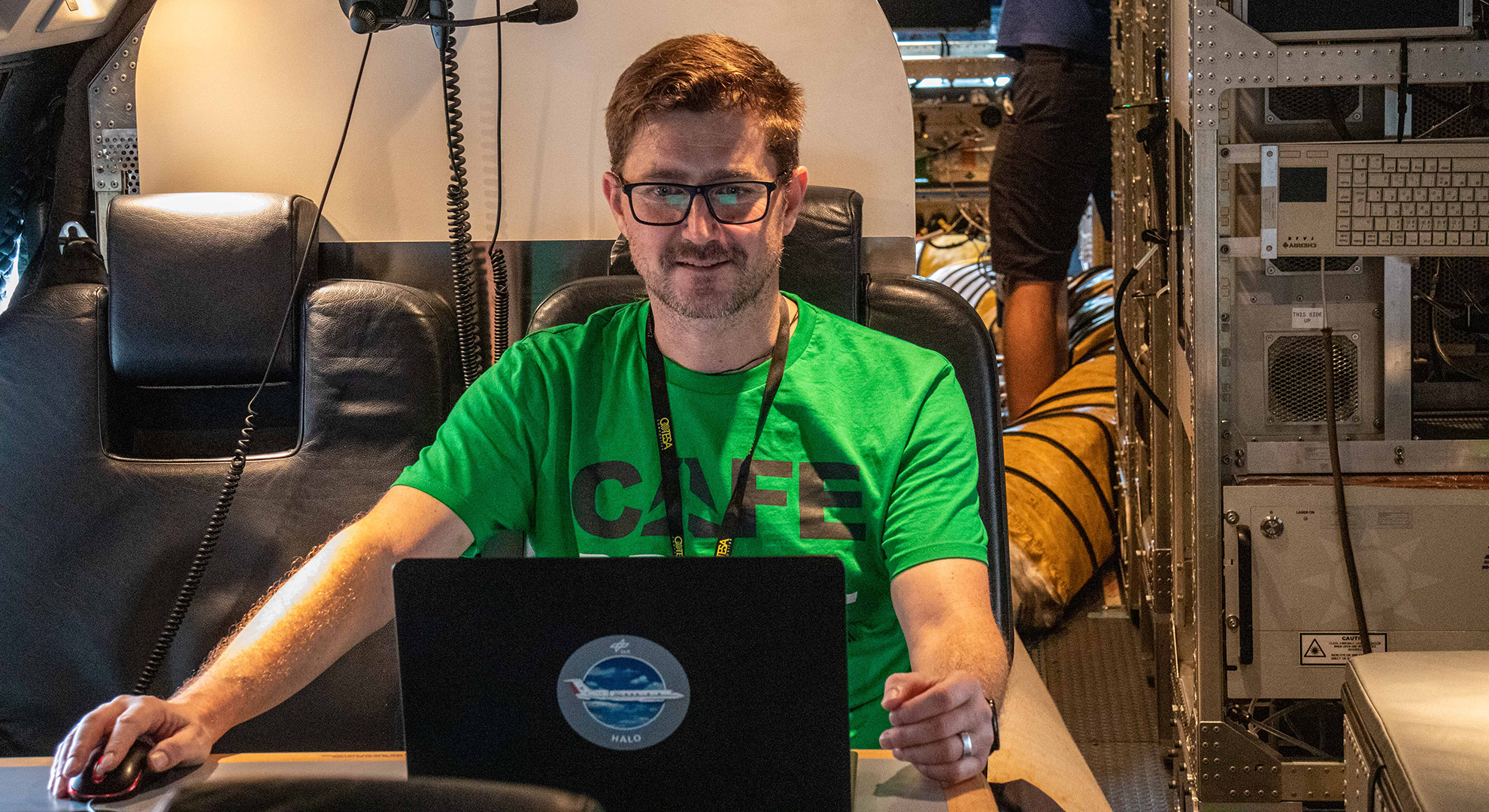
When HALO returns from an eight or ten-hour measurement flight, Christian is waiting at the hangar ready to download the data and check its quality. He carries out the first evaluations on the very same day and passes them on to the science team. "Our meteorological measurements perform very well in international comparisons. We are enormously proud of that." Precise measurements and analysis are "our contribution to the different measurement campaigns." The fact that Christian is a meteorologist helps him not only in interpreting and correcting the data, but also in understanding the research topics for which the aircraft take to the air.

In addition to this knowledge, other skills are important when working in DLR's measurement and sensor technology team: "We've developed software that allows us to quickly convert the data on site and check its quality." So there’s definitely an element of programming. However, the human eye and the human mind with its experience have not become obsolete in quality control and evaluation. Sometimes, for example, when the environmental conditions allow water to get into the nose mast and freeze during the flight, Christian has to compensate for the missing data sets in his evaluations: "Then, unfortunately, the plane had a blocked nose." The fact that all this happens under time pressure – the science team also uses the data from the measurement flight to make decisions about the sequence of future measurement flights – does not faze Christian: "I find it rather exciting!"
From weather service to measurement technology
This is also thanks to the experience the meteorologist has gained at DLR since 2007. He came from the weather service in Bolzano, Italy, to take over data evaluation for the Falcon research aircraft at DLR. In 2010, he began his doctoral thesis, during which he expanded and converted measurement technology for the ‘flying auditorium’, DLR's Cessna. The measurement system then had to pass its meteorological baptism of fire during a flight through fair-weather clouds. Since then, Christian has accompanied an average of two to three measurement campaigns per year: "I love to travel and see our locations from a scientist's perspective. At the same time, of course, travelling has to be compatible with family life so the team for measurement and sensor technology take turns, and during long campaigns abroad, staff also rotate. Christian estimates that in any given year, around 30 to 40 percent of his time is dedicated to campaigns.
Expanding horizons
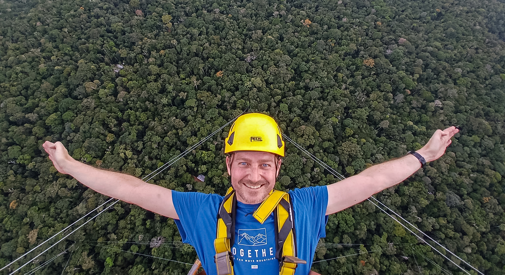
By the time he has finished the detailed data evaluation for CAFE-Brazil on the computer in Germany, the next project is waiting for him: the ‘flying auditorium’ is to receive new sensors and new hardware again to keep the measuring system up to date. "I have very different tasks during the year, so I don't get bored quickly." What remains of the CAFE-Brazil campaign are not only the many data sets, but also personal impressions: the city in the middle of the jungle, home to two million people; the sometimes very poor living standards of the inhabitants; the sweltering climate and heavy downpours. Also, the view from the Amazonian Tall Tower Observatory (ATTO). A small group of campaign staff visited the tower, which is located in the middle of the rainforest, around 100 kilometres from Manaus as the crow flies. From there, Christian looked down on the treetops from a height of 325 metres. "When you take measurements, you also have to understand the Amazon region. A view like this undeniably broadens your horizons.”

Tags: