Regional overview map

Regional overview map
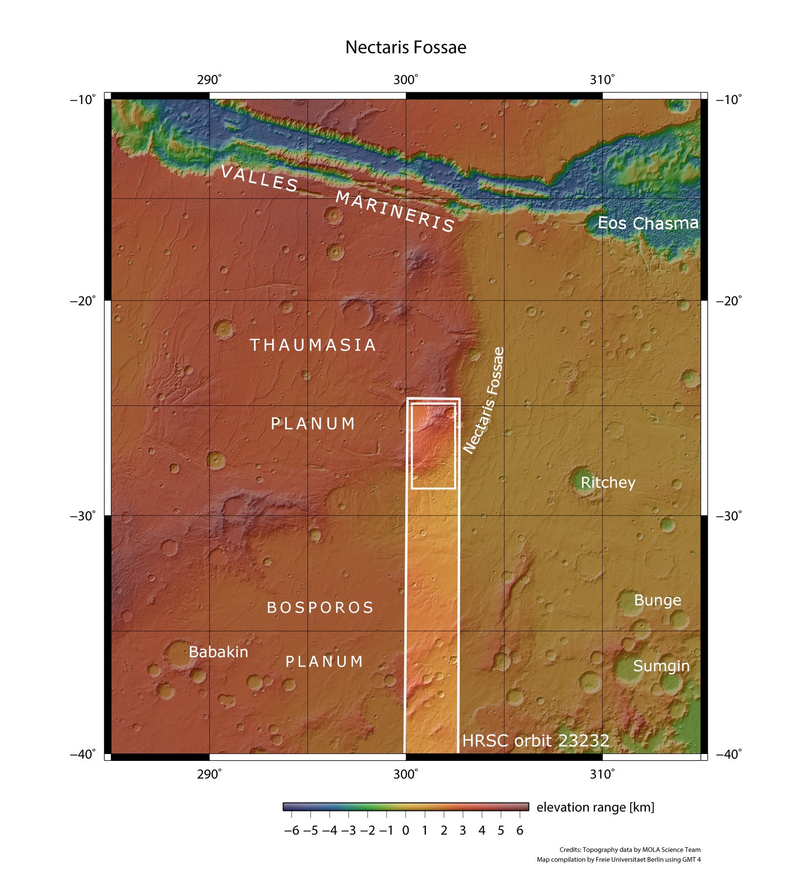
ESA's Mars Express spacecraft imaged a part of the Martian highlands south of the Valles Marineris valley system using DLR’s High Resolution Stereo Camera (HRSC) during orbit 23,232 on 23 May 2022. The images and landscape descriptions presented here are located within the small rectangle at the northern end of the image strip. The colouring of this topographical representation shows how the Coprates ridge separates the volcanic Thaumasia plateau in the west from the Noachis Terra plain almost four thousand metres below, over a distance of several hundred kilometres. Presumably, large magma bubbles from the interior of Mars caused the region to arch up and resulted in tectonic stresses and extensional fractures. This is how the fracture structures of the Nectaris Fossae trenches were formed.