CoMet 1.0, the first mission in the CoMet series, took place in Europe in early summer 2018. One of the main objectives of this mission was to develop new methods for measuring greenhouse gases and to validate current satellite measurements. In addition, instrument developments required for future Earth observation satellites were to be driven forward. The overarching scientific goal was to test new technologies that would later be used in space applications. The measurement flights used atmospheric data to estimate local, regional and subcontinental greenhouse gas fluxes in Europe. One focus was on the coal mining area of the Upper Silesian Coal Basin in Poland. The airborne measurements were supplemented by ground-based and satellite-based greenhouse gas sensors. For the first time, a combination of remote sensing and in-situ instruments was used to exploit their potential synergies. During this campaign, these instruments were still used on various aircraft. In later CoMet missions, the instrumentation was consolidated and optimized for the HALO research aircraft. The data obtained is used to derive geographically resolved CO₂ and CH₄ fluxes using regional and global atmospheric transport models and inverse modeling. For example, methane fluxes over the entire Upper Silesian coal basin were successfully estimated.
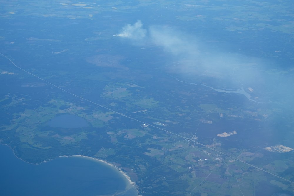
Smoke plume observed during a measurement flight for the CoMet 1.0 campaign. Such plumes contain methane as well as CO2, so quantifying them is important for a better understanding of environmental conditions.
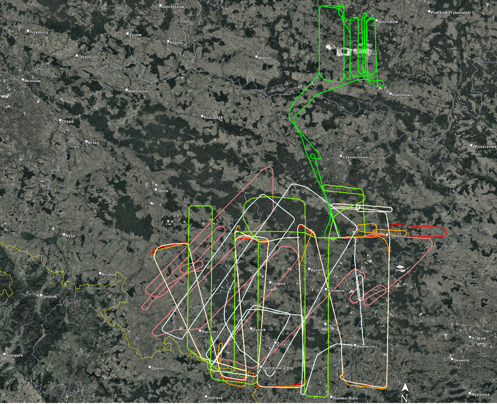
Flight tracks of the FUB Cessna during CoMet 1.0 over Poland.
The research group of FU Bremen used their passive remote sensing instrument MAMAP onboard of the Cessna from FU Berlin to measure methane outgassings over coal shafts in Poland.
CoMet 1.0 was an international, multi-platform measurement campaign for the high-resolution quantification of methane and carbon dioxide emissions from anthropogenic sources. The focus was on the Upper Silesian Coal Basin in Poland and the Czech Republic, which is characterised by complex emission structures from underground mining, ventilation shafts and industrial infrastructure.
The aim of the campaign was to consistently record and link emissions over a wide range of scales - from individual point sources to regional rivers. For this purpose, active and passive airborne remote sensing and in-situ measurements in the atmospheric boundary layer were combined. In addition, vertical profiles were integrated using balloon and UAV-based air samplers (AirCore) as well as ground-based and mobile observations. In addition, targeted satellite underflights were carried out to validate greenhouse gas emissions.
During the campaign period from May to June 2018, a total of five research aircraft and drones were deployed, accompanied by a dense network of ground-based sensors. The close coordination of measurement platforms made it possible to derive consistent emission estimates, evaluate atmospheric transport processes and compare different measurement methods. CoMet 1.0 thus represents a central reference data set for the further development of emission inventories, inversion methods and future satellite missions.
Airborne measuring platforms
Plattforms
Instruments
The German research aircraft HALOwas operated by DLR from its home base in Oberpfaffenhofen. During the campaign period, 9 scientific flights totalling 63 flight hours were carried out. The focus was on the measurement of large-scale gradients, vertical profiles and the validation of satellite products.
CHARM-F measures partial columns of the two most important greenhouse gases CO2 and CH4 with lasers Passive remote sensing Mini-DOAS
JIG - Jena Instrument for Green- house gas measurements for in-situ measurement of CO2, CH4, CO, and H2O
JAS - Jena Airborne Sampler, air sampler for monitoring CO2, CH4, CO, N2O, H2, SF6, and their isotopes 13C in CH4, 2H in CH4, 13C in CO2 and 18O in CO2
Meterological drop probes
BAHAMAS provides the basic meteorological system on board HALO
The Cessna T207A of the FU Berlin is a single-engine propeller aircraft and was initially based in Schöneiche, near Berlin, and later in Katowice, Poland, during the campaign. During 8 scientific flights (~25 flight hours) regional and local emission measurements as well as flights near the boundary layer were carried out.
MAMAP measures relative increases in CH4 or CO2 concentrations
In-situ sensors
DLR's Cessna 208 Grand Caravan was also stationed in Katowice, Poland, during the campaign and conducted 10 scientific flights from there, totalling 23 flight hours. The measurement flights mainly took place within the boundary layer to determine greenhouse gas fluxes.
In-situ greenhouse gas analysers
METPOD (for meteorological data)
During the campaign, theDLR DO228-212 carried out two measurement flights from Oberpfaffenhofen to individual mines.

