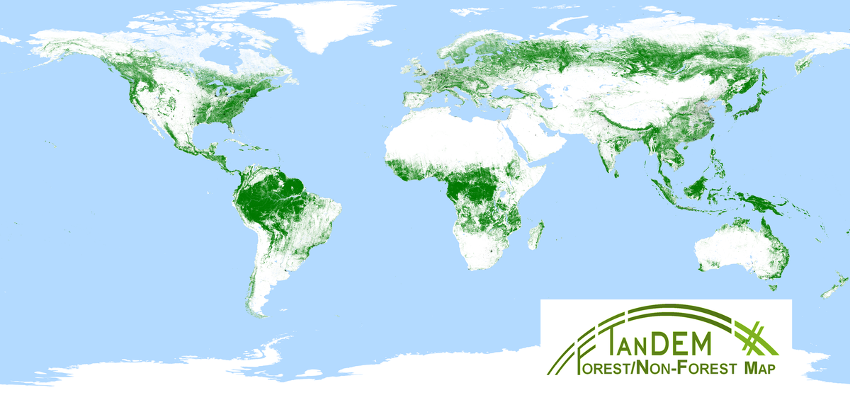
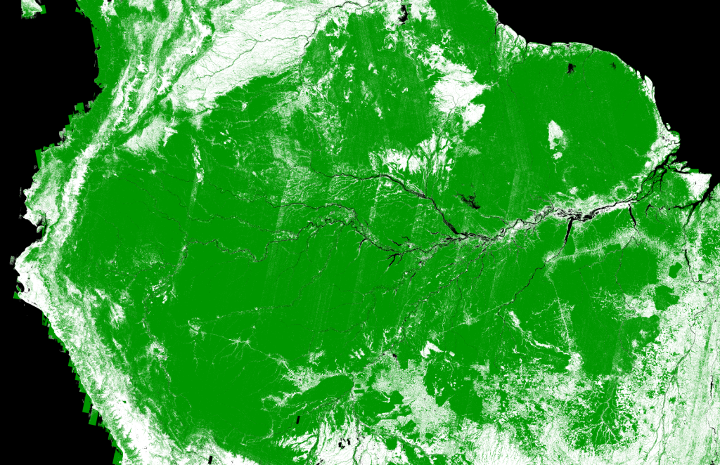
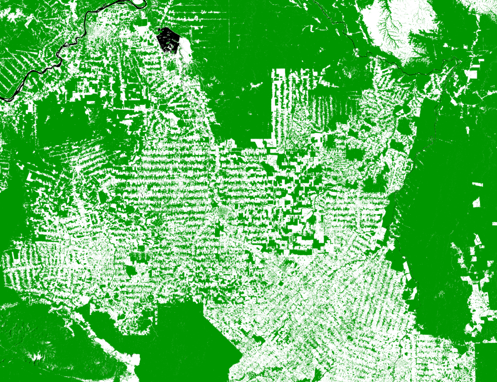
The TanDEM-X Forest/Non-Forest Map is a project developed by the Microwaves and Radar Institute at the German Aerospace Center, within the activities of the TanDEM-X mission. The goal is the derivation of a global forest/non-forest classification mosaic from TanDEM-X bistatic interferometric synthetic aperture radar (InSAR) data, acquired for the generation of the global digital elevation model (DEM) between 2011 and 2015 in stripmap single polarization (HH) mode.
In this work, the global data set of quicklook images, characterized by a ground resolution of 50 m x 50 m, was used, in order to limit the computational burden. For classification purposes several observables, systematically provided by the TanDEM-X system, can be exploited, such as the calibrated amplitude, the bistatic coherence, and the digital elevation model (DEM) height information. In particular, the volume correlation factor quantifies the amount of decorrelation due to multiple scattering within a volume, which typically occurs in presence of vegetation.
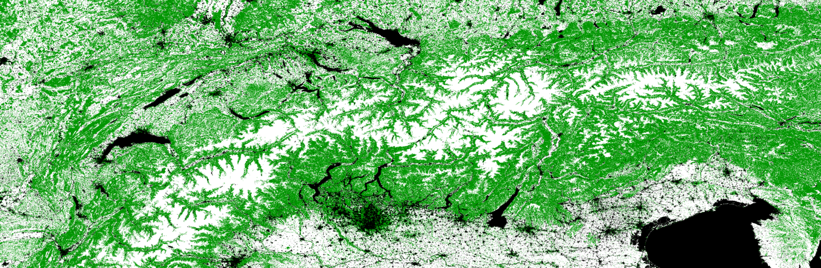
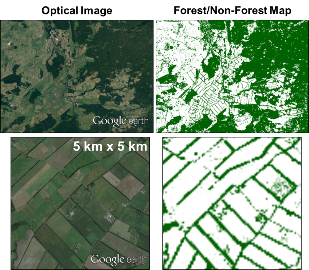
TanDEM-X Forest/Non-Forest Map over Germany
Example of TanDEM-X Forest/Non-Forest Map over Germany.
This quantity is directly derived from the interferometric coherence and used as main indicator for the identification of vegetated areas. For this purpose, a fuzzy multi-clustering classification approach, which takes into account the geometric acquisition configuration for the definition of the cluster centers, is individually applied to each acquired scene.
A certain variability of the interferometric coherence in X-band has been observed among different forest types, mainly due to changes in forest structure, density, and tree height. This leads to an adjustment of the algorithm settings, and in particular to the derivation of different cluster centers, depending on the considered type of forest. Additional layers are utilized for filtering out water bodies, cities, deserts, and geographic regions above the tree line.
The global Forest/Non-Forest map is now available free of charge for scientific purposes and can be downloaded from the EOC geoweb interface.
At the moment, more details can be found in the following references:
[1] M. Martone, P. Rizzoli, G. Krieger, Volume Decorrelation Effects in TanDEM-X Interferometric SAR Data, IEEE GRSL, Vol. 13, No. 12, December 2016.
[2] M. Martone, P. Rizzoli, C. Wecklich, C. Gonzalez, J.-L. Bueso-Bello, P. Valdo, D. Schulze, M. Zink, G. Krieger, and A. Moreira, “The Global Forest/Non-Forest Map from TanDEM-X Interferometric SAR Data,” Remote Sensing of Environment, vol. 205, pp. 352–373, Feb. 2018.


