
Mission Goals

The earth system comprises a multitude of components and processes which are intimately meshed through complex interactions. For example, variations in the
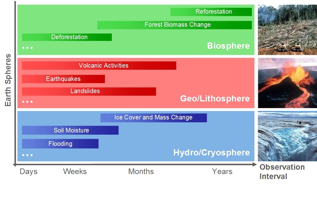
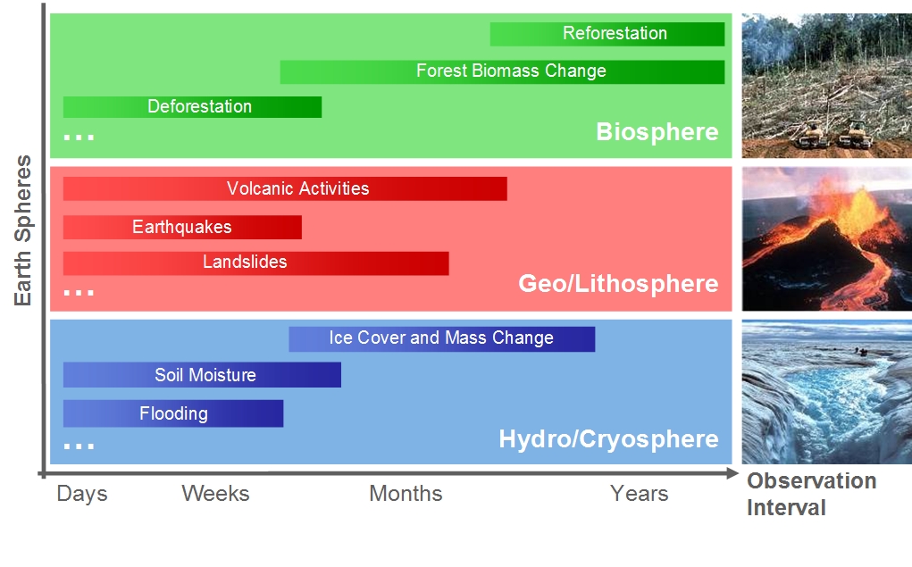
- Biosphere (logging in rain forests, forest planting, ...),
- Geosphere/lithosphere (volcanic eruptions, …),
- Hydrosphere (changes in ocean currents, soil moisture, …),
- Cryosphere (polar ice and snow cover, ...)
not only can permanently change the mutual dynamic equilibrium but also the physics and chemistry of the atmosphere. Changes in the atmosphere subsequently affect the weather and climate, which themselves influence a multitude of processes in the biosphere, geosphere, hydrosphere and cryosphere. Many of these complex interactions currently are either uninvestigated, or are inadequately researched and understood. An important reason for this is that processes from several earth spheres and different spatial and temporal scales are usually interlinked, while suitable observation data for analysing the many interactions are often unavailable or only available for a limited range of locations and times.
The measurement of dynamic processes requires a continuous, extended and systematically planned observation strategy, in order to promptly detect changes and quantify them with sufficient accuracy. Depending on the phenomena to be observed, changes have to be measured on the variable spatial and temporal scales, and then related to one another. With the advent of satellite-based earth observation, our understanding of changes in the earth system has increased markedly. However, the imaging performance, measurement accuracy and recording capacity of existing sensor systems are, in many cases, inadequate to draw reliable conclusions about the dynamics of large-scale processes.
An essential requirement of the Tandem-L mission is the ability to image large areas regularly, in the shortest possible time intervals and with high spatial resolution. Together with a systematically planned recording strategy, this facilitates the generation of consistent time series for the whole earth. Only thus can the dynamics of the different changes on the earth’s surface be measured with sufficient accuracy and without errors caused by an inadequate sampling rate. The combination of short revisit times and data recording periods extending over several years allows rapidly developing, highly dynamic processes, such as the relaxation following an earthquake, as well as more slowly developing processes, such as forest ecosystem change, to be monitored with the necessary precision and resolution.