
Forest height and biomass map

Forest height and biomass map
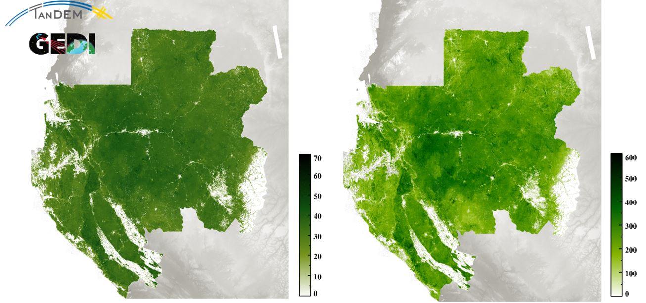
On the left is the forest height map, a product of TanDEM-X and GEDI data. On the right is the biomass map, which was created from the forest height map and the forest structure map. The forest height map was created in a cooperation between the University of Maryland and DLR.
Credit: DLR (CC BY-NC-ND 3.0)