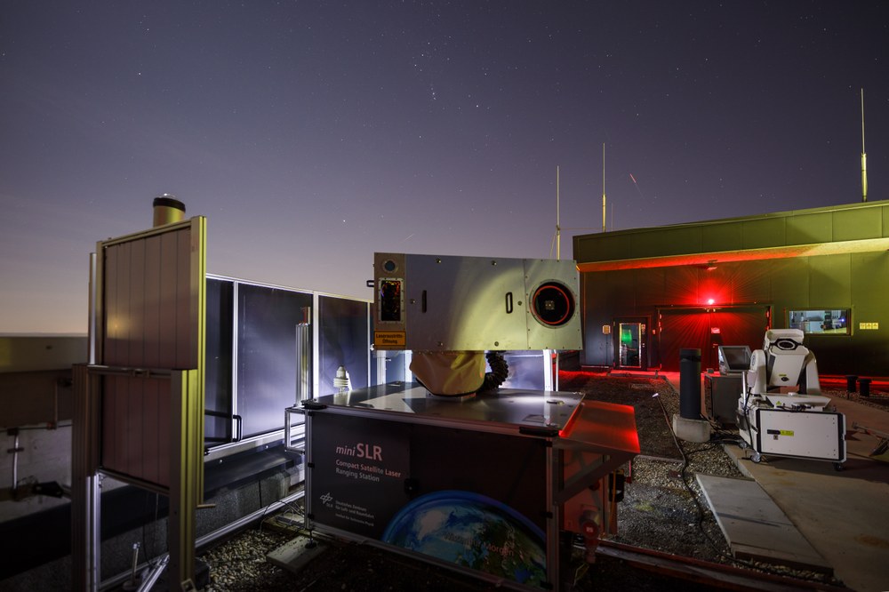
MiniSLR

The miniSLR® system makes it possible to obtain position data from satellites with millimetre precision. This data can be used for numerous applications in geodesy, earth observation, satellite operation or the monitoring of failed satellites. All that is needed on the satellite is a lightweight, passive reflector.
Brief Description
The miniSLR® is a compact and cost-effective laser ranging ground station for determining distances to satellites with millimetre accuracy. The measurement data can be used for numerous applications in geodesy, earth observation, satellite operation or the monitoring of (even failed) satellites.
Applications
Support for scientific and commercial satellite missions
Calibration of satellite navigation systems
Satellite geodetic measurements, even at remote locations
Collision avoidance (Space Situational Awareness, SSA)
Facts and Figures
High-precision distance measurement (sub-cm accuracy) to co-operative satellites orbiting the earth
Range 400 km - 25,000 km
Compact and transportable system (2.3 m x 1.6 m x 2 m)
Mass: 600 kg
Cost-effective design and easy maintenance
Weatherproof
Compared to conventional satellite laser ranging (SLR) systems, it is characterised by its low acquisition costs, compact design and simple maintenance. Fully automatic operation significantly reduces running costs. As the system can be manufactured and tested centrally before it is implemented at its place of use, no experts or specialised companies are required on site, and the significantly reduced effort and low costs make satellite laser ranging economically interesting for new applications and customers, or even accessible in the first place, for example operators of navigation satellite systems or university institutions and geodetic institutes in the global South. It also opens up new areas of application, such as the monitoring of satellite constellations for high-precision orbit prediction and the avoidance of collisions between failed and active satellites (Space Traffic Management, STM)
