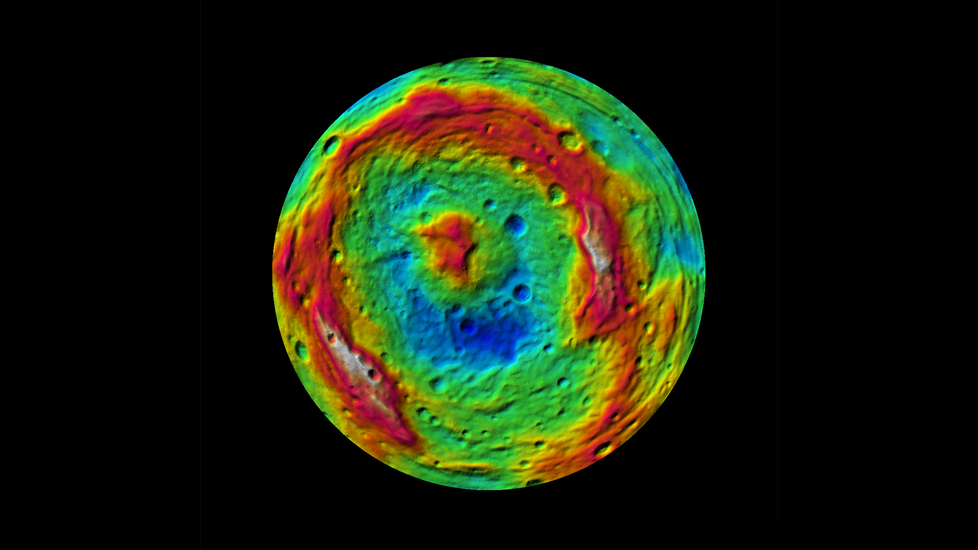
Vesta, Topographic Map of the Southern Hemisphere with Colour-Coded Elevation
This false-color map of the giant asteroid Vesta was created from stereo images obtained by the framing camera aboard NASA's Dawn spacecraft. The image shows the elevation of surface structures with a horizontal resolution of about 750 meters per pixel.
Global shape, topography, gravity field, rotation, and orbital motion are fundamental properties of planets, moons, asteroids, and comets. PGD studies these properties in detail, as these provide information about the origin of these bodies, and about the geophysical and surface processes that have shaped them.
Particular goals are the 3D modelling of observations from orbital and landed platforms, including rovers, efficient techniques for creation of 3D surface models, analysis of surface processes and structure, determination of rotational and tidal parameters, observations and modelling of physical and dynamical processes of minor bodies, the definition of geodetic reference systems, generation of planetary reference datasets, and innovative solutions for generation of geocoded image data, maps, web-based geographical information systems, and visualisations. Data-science methods and automated approaches based on machine learning are applied for analysis of surface features, change detection, and combined analysis of laser and imaging data.
We analyse data from numerous planetary missions, including (a) currently ongoing missions: Mars Express, ExoMars TGO, Mars 2020 Perseverance, (b) missions in cruise: JUICE, BepiColombo, Lucy (c) recently terminated missions: DART and (d) upcoming missions: Psyche, MMX, ExoMars, Comet Interceptor, Hera and Europa Clipper. For JUICE and BepiColombo PGD is responsible for operations and analysis of data from the laser al- timeters GALA (PI) and BELA (Co-PI), respectively. In addition to modelling and analysing of planets, moons and small bodies using mainly imaging and laser altimetry data PGD is working on orbital dynamics for mission scenarios and solar system objects.
Key Competences of the Department
Internationally highly recognized group for 3-D data products of planetary surfaces.One of the leading groups in planetary laser altimetry (PI-ships on BepiColombo and JUICE).
Simultaneous analysis of imaging and altimetry data for precise 3D models.
Shape models of small bodies from ground-based observations, orbiters, and landed elements.
Internationally highly recognized group in the field of small bodies (PI and Co-I-ships on Rosetta, Hayabusa2, DART, Hera, CometInterceptor, Lucy, and Psyche).


