
Team: Smart Cities and Spatial Development
The team “Smart Cities and Spatial Development” uses Earth Observation (EO) to provide targeted data, information products, and technical solutions to support sustainable human settlement development and assess related environmental and site conditions.

The focus of the research is on the development of operational tools to provide novel data and assessment criteria for “Global Urbanisation”, “Smart Cities”, and “Sustainable Spatial Development”. The related technical system solutions aim at an automated information extraction from large-volume and heterogeneous data sets (Big Earth Data). For this, Artificial Intelligence (Machine Learning) and Distributed Computing (High Performance Processing and Data Analytics) are jointly employed. These approaches are supplemented by modern information and communication technologies, which allow the most autonomous control of data access, management and processing (automation).

The geoinformation products and technical solutions are used in research, planning, business and politics. There, they serve as a basis for a dialogue in the global change context and for the implementation of indicator-based environmental observation systems and evidence-based decision support. For example, both, the “Global Urban Footprint (GUF)” layer and the enabling technology of the “Urban Thematic Exploitation Platform (U-TEP)” have already attracted active user communities of more than 400 institutions. Moreover, technologies and information products have successfully been licensed to commercial partners, including the “Global Urban Footprint” layer (Airbus DS Geo GmbH), the “TimeScan” method (CloudEO AG), or the “Green Roof Analytics” software (EFTAS Fernerkundung Technologietransfer GmbH).
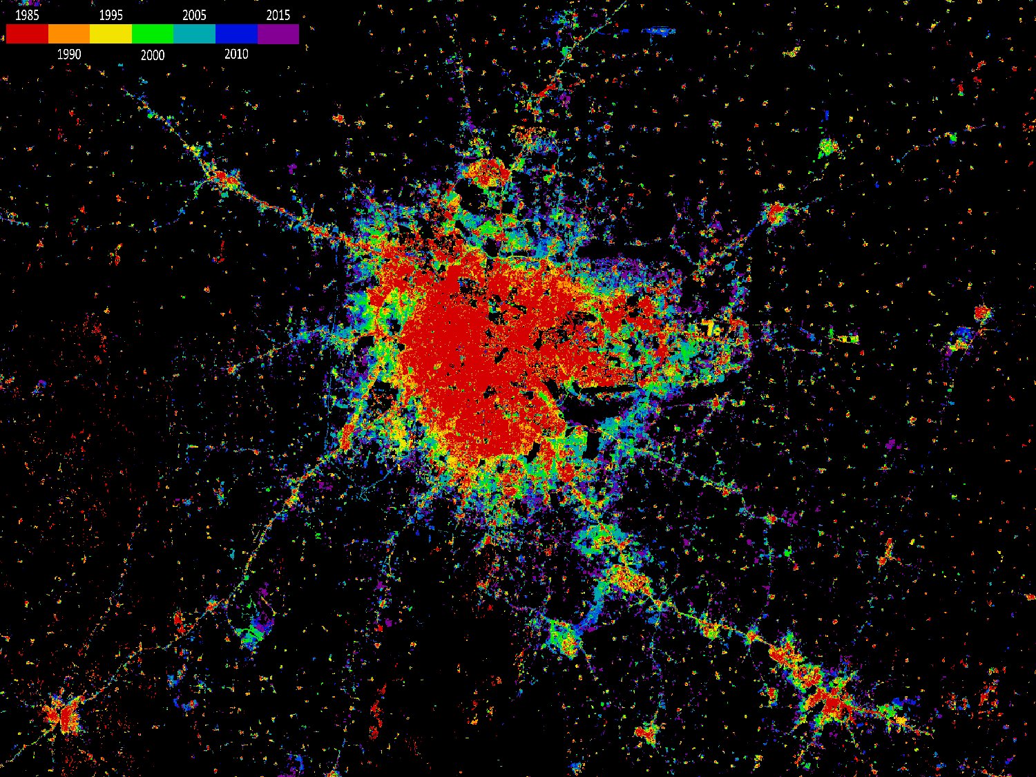
Managing urban development requires new data and knowledge – about how dynamic urban systems interact with the natural and man-made landscape surrounding them. To what extent do cities damage the environment by consuming land and resources, polluting the air and the water, or by reducing biodiversity? To what extent are cities threatened by natural hazards and climate change? How have urban regions developed in the past, and how should they do in future?
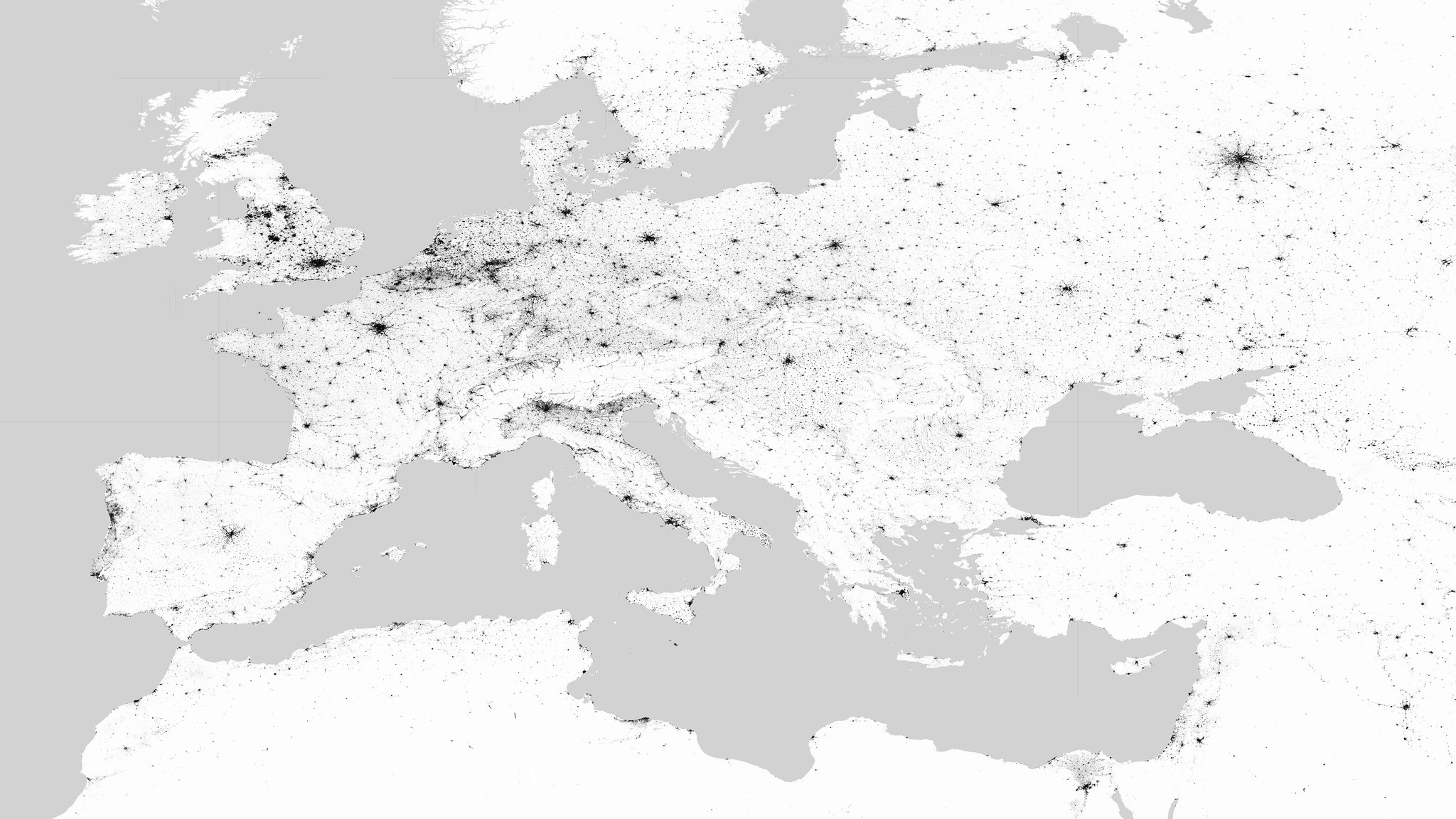
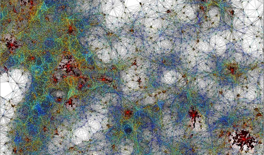
In particular, cities in Asia and Africa are expanding at a staggering pace. Within the next decade the number of megacities is expected to rise from around 30 to more than 40 and urban sprawls are emerging, spreading across extensive swathes of landscapes that, until recently, had been untouched by development. But how can the opportunities that urbanisation presents be put to good use? How can the negative effects of such rapid city growth be mitigated or avoided? This is one of the central challenges that society will face over the coming decades, because the future is urban: a large-scale transformation has occurred on Earth, largely ignored in headline stories on the topic of global change – for some years now, the number of people living in urban areas has exceeded that of those living in rural regions and the trend towards urbanisation shows no sign of abating. Today, approximately 7.2 billion people inhabit our planet and by 2050 this number will have risen to nine billion, of which 70 percent will be living in cities. In future, urban areas will account for 90 percent of population growth, 80 percent of increased prosperity and around 60 percent of energy consumption. Furthermore, urban conurbations will occupy a key role as centres of political, economic and cultural life: they will exemplify the future, defining how the coming generations will live and work.

The skills and techniques of the team “Smart Cities and Spatial Development” have been and are still being used and enhanced in many application-oriented projects related to sustainable urban and spatial development. In terms of data technology, the system solutions and information products are based on the analysis of remote sensing data - in particular collected by the Sentinel and Landsat satellite missions, but also by airborne sensors or drones. This data is usually complemented by an integration of additional information from official surveying, statistics or volunteered geographic information. To effectively address operational monitoring requirements and related geoinformation services, practice- and user-oriented aspects such as reproducibility, cost-efficiency and quality assurance always play a central role in the methodological developments, in addition to the underlying geo-scientific and engineering-related factors.
So far the team has participated in over 40 national and international projects, published more than 60 papers in scientific journals and books, and presented its research findings at about 180 national and international congresses and workshops. The team activities are implemented in the sense of a strongly application-oriented research in close cooperation with actors and decision-makers from science and practice. The users and partners include, amongst others the United Nations, World Bank, Organisation for Economic Co-operation and Development (OECD), Federal Foreign Office (Germany), Group on Earth Observation (GEO), Human Rights Watch, WWF, NASA, USGS, NOAA, Bill and Melinda Gates Foundation, Google, Facebook, or academic partners such as UC Berkeley, MIT, Stanford University, UCLA, or the Chinese Academy of Sciences.
