
Global Urban Footprint (GUF)
Landscape fragmentation as a societal challenge
Currently, more than half of the world’s population are urban dwellers and this number is still rapidly increasing. Since settlements - and urban areas in particular - represent the centers of human activity, the environmental, economic, political, societal and cultural impacts of urbanization are far-reaching. They include negative aspects like the loss of natural habitats, biodiversity and fertile soils, climate impacts, waste, pollution, crime, social conflicts or transportation and traffic problems, making urbanization to one of the most pressing global challenges. Accordingly, a profound understanding of the global spatial distribution and evolution of human settlements constitutes a key element in envisaging strategies to assure sustainable development of urban and rural settlements.
Settlement patterns from space
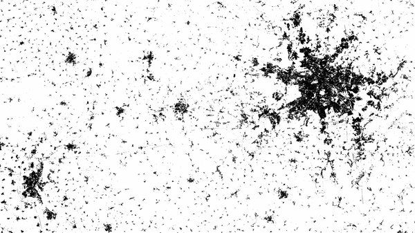
In this framework, the objective of the “Global Urban Footprint” (GUF) project is the worldwide mapping of settlements with unprecedented spatial resolution of 0.4 arcsec (~12 m). A total of 180 000 TerraSAR-X and TanDEM-X scenes have been processed to create the GUF. The resulting map shows the Earth in three colors only: black for “urban areas”, white for “land surface” and grey for “water”. This reduction emphasizes the settlement patterns and allows for the analysis of urban structures, and hence the proportion of settled areas, the regional population distribution and the arrangement of rural and urban areas.
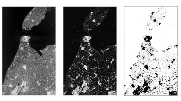
Figure: Global Urban Footprint of Tokio, Cairo and Dehli with optical satellite data for comparison
When looking at the entire GUF at once, mainly the metropolitan regions in Europe, USA East Coast and Asia stand out. When focusing on the full resolution of the GUF, one can even recognize small villages stretched along roads, single farm houses or non-built-up corridors in megacities. For a comprehensive and objective analysis of the settlement patterns, the DLR additionally developed an approach to display the spatial networks between the mapped settlements. This enables the computation of various form and centrality measures, which are used for qualitative and quantitative characterization of settlement patterns at different spatial units ranging from global to local scale.
Improved data for research
The GUF exhibits a high potential to enhance climate modelling, risk analyses in earthquake or tsunami regions and the monitoring of human impact on ecosystems. Moreover, the it also can be employer as basis for monitoring both the historical growth of different settlements, as well as their ongoing and future development.. This will allow effective comparative analyses of urban dynamics among different regions of the world.

Links
Downloads
- DLR-GUF Produktspezifikationen (13.6 KB)
- DLR-GUF Lizenzbedingungen mit Nutzerformular (277.2 KB)
- Referenzen (176.5 KB)