
Geomatics


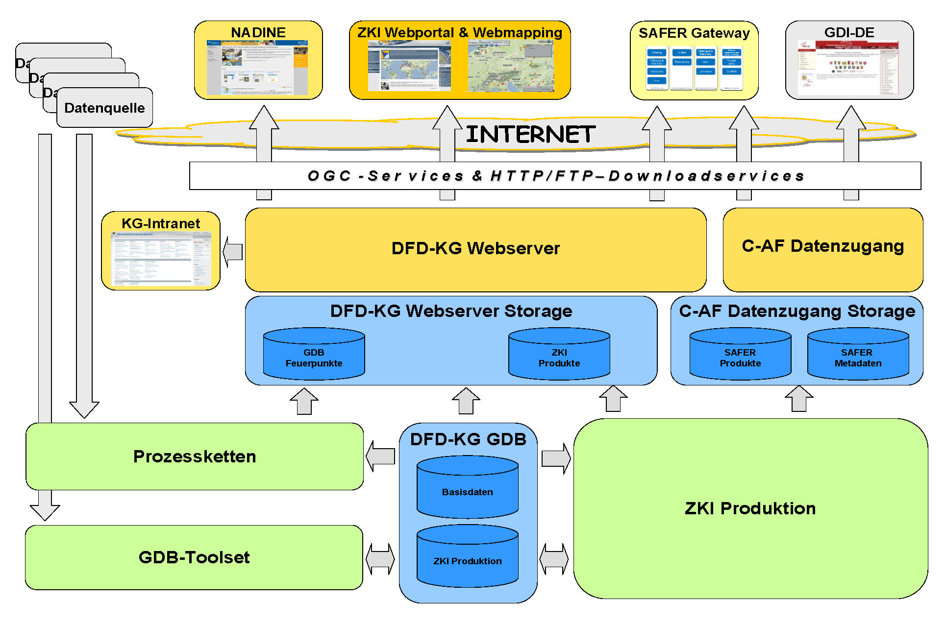
Processing geodata and using geographical information systems have for many years been main items of interest in the DFD departments concerned with applications for remote sensing data. Dealing with geodata has become almost a matter of course worldwide and a permanent part of many Internet applications, and is now incorporated in traditional IT infrastructures.
In day-to-day project work, these new circumstances have led to an increased need for expertise and tools and to calls for even more rapid and reliable availability of data and information as well as timely distribution of results and data products.
The Geomatics project team in the Civil Crisis Information and Geo-Risks department develops concepts and approaches for homogenizing and coordinating work processes and supports the department in developing data and information products, methodologies, services and prototypes.
Because of the multidisciplinary nature of this topic, there is close cooperation in design and implementation efforts between the Geomatics project team and colleagues in the Information Technology Department as well as in other DFD departments concerned with applications for remote sensing data.