
Misson Goal


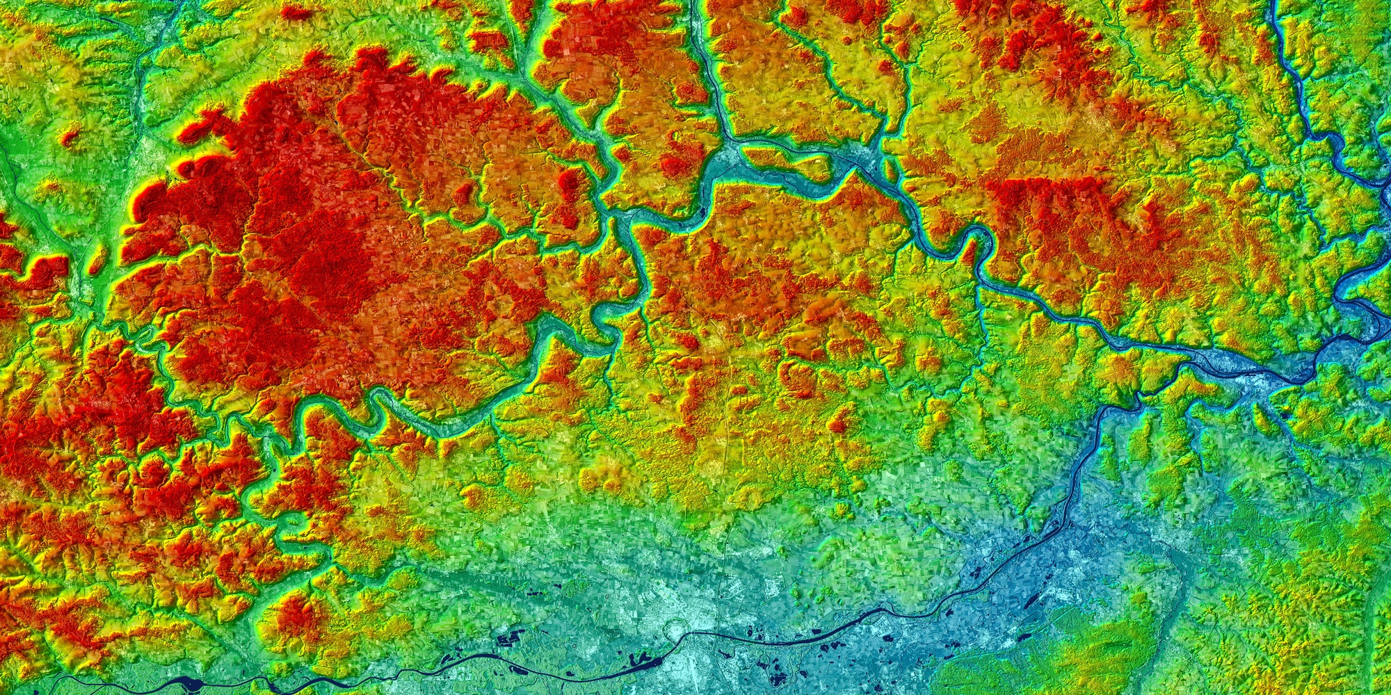
The main goal of the TanDEM-X mission is the generation of world-wide, consistent, timely, high-precision Digital Elevation Models (DEM, <12 m posting and <2 m height accuracy) as the basis for a wide range of scientific research, as well as for operational DEM production. The TanDEM-X mission is a novel way to realize an operational single pass SAR interferometer utilizing TerraSAR-X technology in a new system context.
Further important mission goals are:
- new applications based on velocity measurements (ocean currents, glacier movements, road traffic etc.) with along-track interferometry (ATI)
- stimulation of innovative SAR techniques in bi-static measurement configuration (digital beamforming, super resolution, polarimetric SAR interferometry)
- development of close formation flying technology being a basis for many future missions
- development of precise orbit and baseline determination techniques using dual-frequency GPS (provided with the TOR instrument)
- achievement of a long term availability of X-band data for scientific and commercial users, ensuring a sustainable product development and data delivery
In addition, TanDEM-X will provide the same capabilities as TerraSAR-X, i.e. Stripmap mode with 30 km swath and 3 m resolution, ScanSAR mode with 100 km swath and 16 m resolution and Spotlight mode with 10 km swath and up to 1 meter resolution.
In order to achieve the primary goal of the TanDEM-X mission, a global mapping in DTED-2 quality in ScanSAR mode is being considered. This will be performed in the first year of the mission. Following this phase, DTED-3 topographic mapping will be carried out in stripmap mode. The possibility to achieve DTED-4 topographic mapping on a local and/or regional scale is also under investigation.
For along-track interferometry a dedicated mission phase with adequate along-track baseline is under investigation.