Close-up view of the Valley of the Kings


Close-up view of the Valley of the Kings
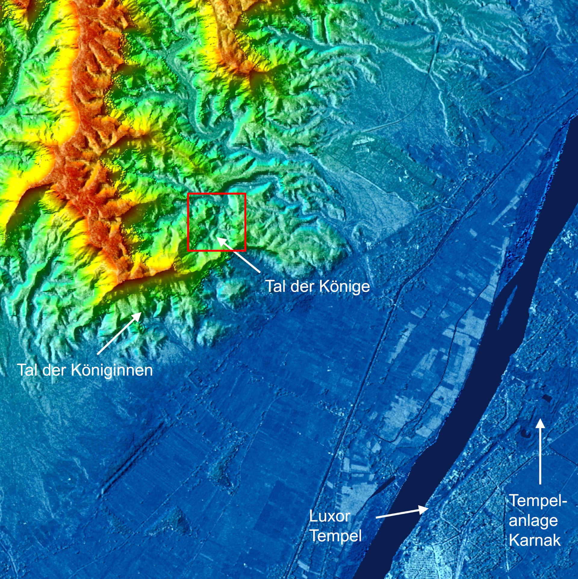
This digital elevation model covers an area of 10 kilometres in both north-south and east-west directions.The Valley of the Kings lies at the southern end of the foothills of the Theban Mountains (reddish). On their southernmost, almost horizontal, ridge is El-Qurn, at 420 metres the highest elevation of the Theban Mountains. The Valley of the Kings itself is to the east, just above the centre of the image on the left. The city of Luxor (in light blue) with the temple complex of Karnak and the Luxor Temple lies on the east bank of the Nile.