The Live-Lage research project is developing new technologies for rapid visual detection of major emergencies. Various optical technologies are being combined with the possibilities of new unmanned aerial systems. The aim is to operationally test these prototype solutions together with end users from public authorities and organisations with security tasks (BOS). To this end, a special version of the Modular Aerial Camera System (MACS) is being developed in close cooperation with the Duisburg fire department, with which overflown areas can be mapped and visualised in real time.
The Live Situation project emerged in 2018 from the need to develop a small system for rapid, precise visual reconnaissance of major incidents and disasters. The live situation exercise in Duisburg's inland harbour in May 2022 marks a highlight.
Live situation project video using the example of an exercise in Duisburg inland port in May 2022
Your consent to the storage of data ('cookies') is required for the playback of this video on Youtube.com. You can view and change your current data storage settings at any time under privacy.
Live situation project video using the example of an exercise in Duisburg inland port in May 2022
The Live Situation project emerged in 2018 from the need to develop a small system for rapid, precise visual reconnaissance of major incidents and disasters. The live situation exercise in Duisburg's inland harbour in May 2022 marks a highlight.
The vision of the project is to utilise fast-flying drones for large-scale reconnaissance of operational situations. To this end, the drone should automatically fly over mission-relevant areas and the resulting situation picture should be able to be used directly in the existing mission command systems. Instead of a video image, the MACS-nano camera system generates high-resolution aerial images, processes them and transfers them to the incident command system, where they are automatically merged into a large-scale situation picture. This allows the current situation at the scene to be assessed in real time. The comprehensive overview also makes it possible to quickly assess the overall situation and access routes. In the future, the planned concept should make it possible to obtain up-to-date situational pictures even before the emergency services arrive at the scene.
Current work
In 2021, the first MACS-nano prototype was integrated into the Vector unmanned aerial vehicle from Quantum Systems GmbH. This VTOL (Vertical Take-Off and Landing) drone has been trialled by the Duisburg fire department since the beginning of 2022. In May 2022, the situation picture was used operationally for the first time in the fire service's incident command system. The CX5 software from EuroCommand GmbH is being used here. The results were presented at Interschutz in June 2022. The provision of the situation picture as a dynamic web map service (WMS) was successfully trialled with various official end users in 2022. The project's first successful technology transfer was completed in June 2023. The MACS-nano camera system was handed over to the Duisburg fire department to contribute to situational awareness in emergency situations with live image data and a georeferenced display of the map material. At the request of the fire department, MACS-nano is currently being expanded to include a thermal infrared sensor.
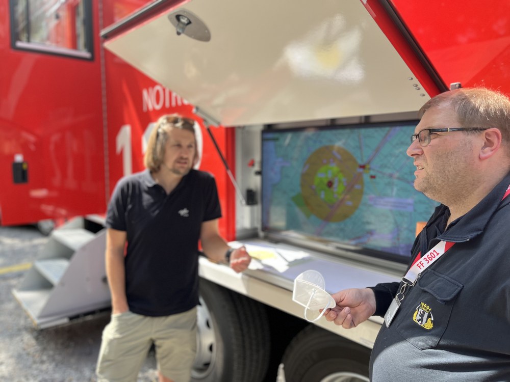
Discussion of the mapped area
The MACS-nano camera system on board a drone flew over the 141-hectare incident area twice during the fire in Berlin's Grunewald forest on 9 August 2022, capturing 2,600 individual images. The high-quality and, above all, large-scale mapping of the damaged area in real time helped the Berlin fire brigade to assess the fire and other endangered areas.
Together with the Duisburg fire department, Eurocommand GmbH and Quantum Systems, an exercise scenario was carried out on the Rheinorange in 2022. The response to a shipwreck with a person overboard was practised.
Image: 2/3, Credit:
DLR, Eurocommand, Feuerwehr Duisburg, Quantum Systems
Team photo with the OPTSAL DroneOps team, Duisburg fire department, ELW-2 and the DLR UAV during a live situation exercise 2020 to record hazardous situations.


