
Sonar drone systems MPS² and S2D2

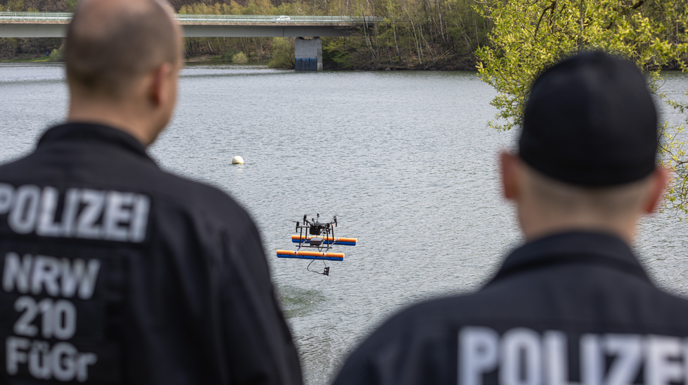
Markus Erwig / Polizei NRW
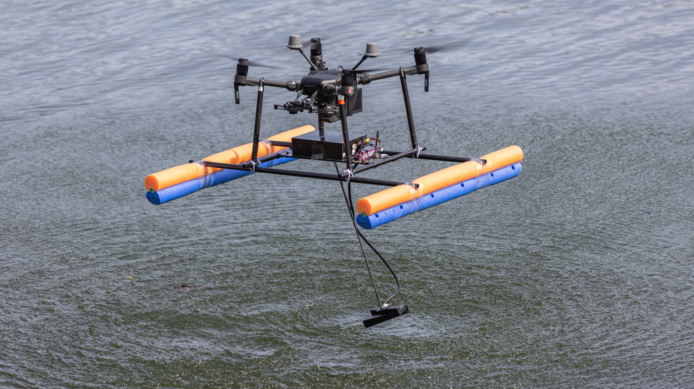
The drone-mounted sonar systems are compact, lightweight, and maneuverable. They can navigate even in confined areas that are virtually inaccessible with conventional technology and are suitable for use in hazardous areas such as flood zones.
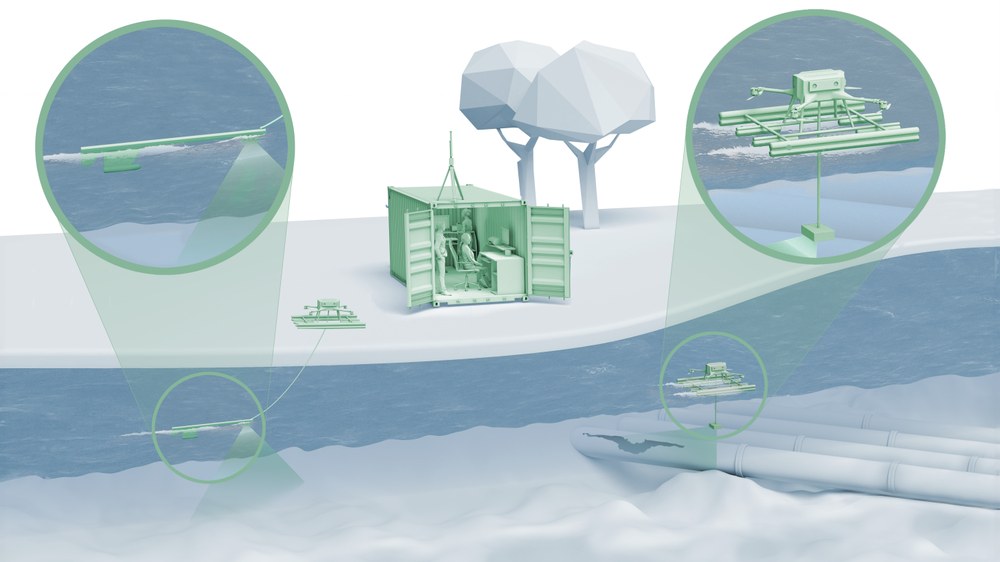
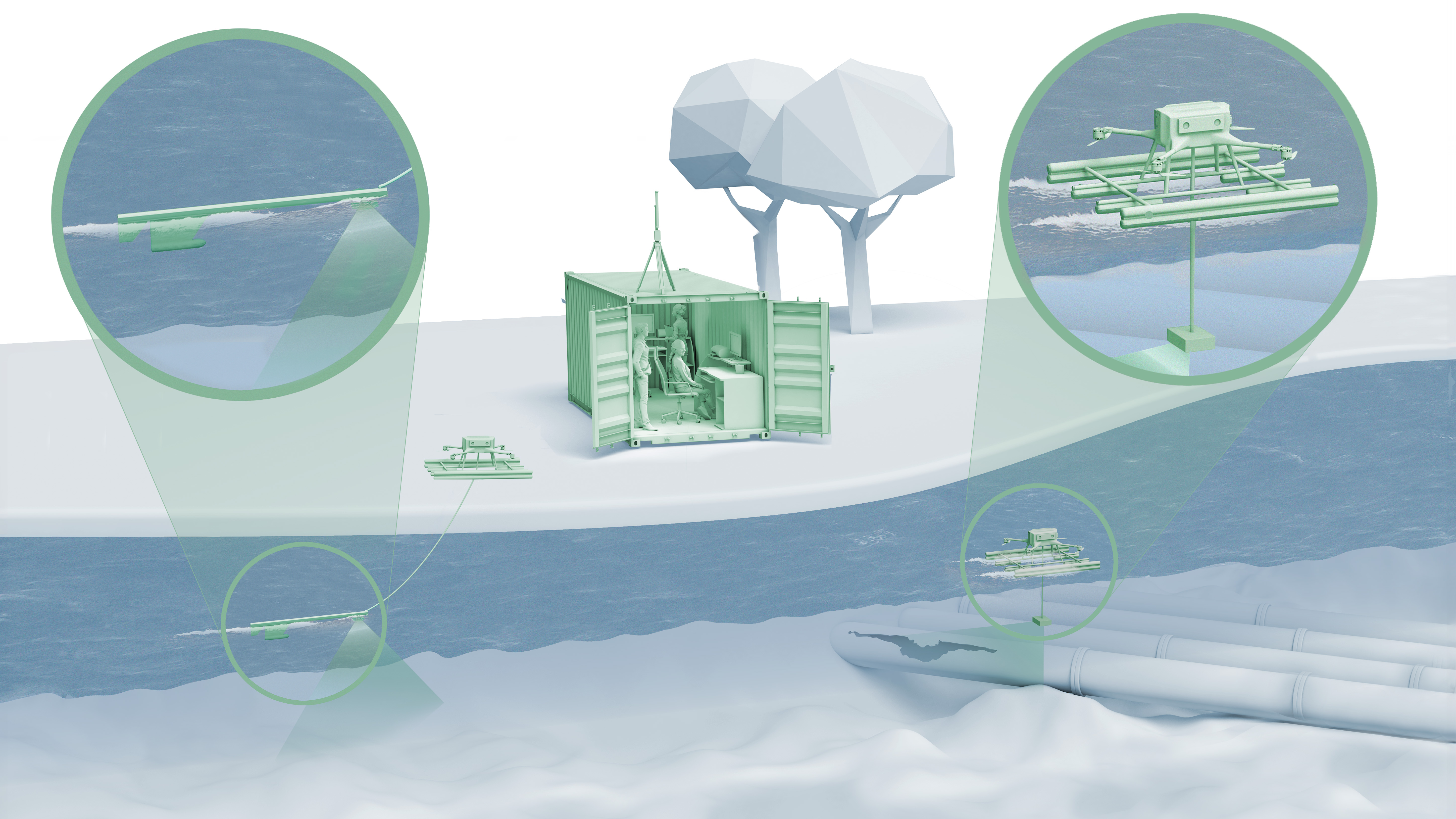
Sonar systems are usually transported to the deployment site by boat. This is usually costly, time-consuming and ties up important operational personnel. The sonar drone systems developed by the DLR Institute for the Protection of Terrestrial Infrastructures, on the other hand, are quickly ready for use and can simply fly to the deployment site. The systems can be set up and operated by just two people using a commercially available drone.
Due to its compact, lightweight design and high maneuverability, the sonar drone is also able to reach narrow areas that are difficult to access with conventional technology such as helicopters or boats – for example, densely overgrown banks or groups of driftwood. The drone can navigate through these without any problems. The systems are also suitable for operations in dangerous areas, such as flood plains or bodies of water with strong currents, where the lives of emergency services may possibly be at risk.
Compatible with various drones
The DLR Institute for the Protection of Terrestrial Infrastructures has developed two versions of the drone-carried sonar system: Both are modular and add a sonar detector and a floating frame to a commercially available drone. The control of the drone is deliberately decoupled from the sonar system. This enables dual-operator operation and the system remains compatible with drones from different manufacturers, as no modifications to the drone software are necessary.
Using secure real-time radio transmission, the sonar data is sent from the drone over distances of up to 800 meters to a ground station, where it can be analyzed on site. Alternatively, the data can be forwarded via a VPN tunnel to a control center, a live situation picture or, if required, to offsite sonar experts to obtain additional expert knowledge. While the floating frame and the operating concept are identical in both variants, different sonar detectors are used depending on the application, each of which has specific advantages.
MPS² – Multi Point Sonar System – Detailed multi-perspective analysis
The MPS² system uses a live-scope sonar that is stationary and primarily used in still waters such as reservoirs or lakes. It enables a 160° wide underwater image to be recorded from a single point. A 360° panoramic view can be captured by rotating the drone accordingly. A major advantage of live-scope technology is the ability to view objects from different perspectives. The so-called Hop2Scan method developed by DLR can be used for this purpose: A defined underwater area can be analyzed from several submersion points. To do this, the drone flies to a defined position and without landing, dips the sonar head into the water, scans the area, takes-off and repeats this process at all remaining points in the measurement grid. Due to the individual scanning maneuvers, the system is particularly good for the detailed assessment of smaller areas and less suitable for large-scale scanning.
Side scan data acquisition using a drone (S2D2) - scanning large areas, even in flowing water
The S2D2 system uses a side-scan sonar that only works in motion. The sonar is pulled through the water and records the respective data with a temporal and spatial offset to each other. The individual scans are then combined to form an overall picture of the water. The side scan sonar is particularly suitable for flowing waters and works reliably even at high stream velocities. With a towing speed of up to 2.8 km/h above ground, it provides a quick overview of large-scale scenarios. The system can be used safely in water bodies with flow velocities of up to 25 km/h.
The combination of a multicopter and a sonar system is easy to transport, quicker to deploy and reaches the site faster than conventional systems. It also provides precise geodata of the location, is easy to maintain, cost-efficient and significantly reduces risks to human life.
Technical highlights
• Modular system for simple sonar expansion of commercial drones
• No modification of the drone control or software necessary
• Floating frame optional for model S2D2
• Multi Point Sonar System for improved spatial sonar resolution through different perspectives
• Reaches areas inaccessible to boats (e.g. overgrown banks)
• Rapidly deployable and designed for two-person operation
• Real-time data transmission to offsite experts or control centers possible
• Lightweight and compact CFRP system (1.3 kg)
• Typical flight time (for example DJI M300): 35 minutes
• Capable of side-scan operation at speeds up to 6 km/h
• Real-time radio transmission up to 800 m
• S2D2 system is designed for safe use in strong currents
Contact
Dr. Christof Hammer