
Aerial surveying with QFly
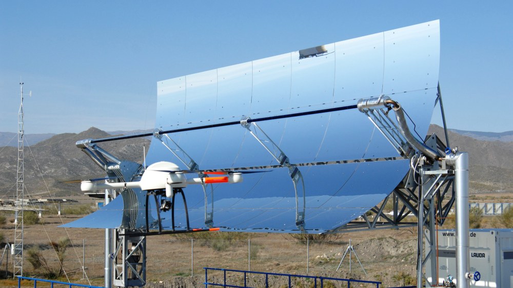

QFly uses a drone equipped with specialised software to provide detailed information about a solar field by taking aerial photographs.
The optical and thermal efficiency of parabolic trough solar fields depends on the function and condition of their components such as the concentrator, absorber and tracking system. The Institute of Solar Research is developing measurement methods to assess the condition of the components in existing power plants.
In order to optimise the field and localise problematic areas, it is essential to create a complete overview of the optical properties of the solar field. QFly uses airborne imaging techniques and an associated software package to provide information on the geometric, optical and thermal properties of the solar field.
QFly consists of three complementary measurement methods:
- QFly HighResolution: This method, based on the TARMES principle, can be used to determine the mirror shape and receiver position with high spatial resolution.
- QFly-Survey: QFly-Survey obtains similar results from a greater height (120 metres) with lower resolution and also information about the relative alignment of individual modules.
- QFly-Thermo: This procedure is used to screen for heat loss and is particularly useful for detecting receivers with defective vacuum insulation.
The collectors identified using QFly-Survey can be subjected to a targeted and efficient high-resolution analysis using QFly-HighResolution. This high-precision measurement provides the mirror shape (RMS < 0.1 mrad) of the concentrator and, relative to this, the position of the receiver tubes and their positional deviation from the focal line (RMS < 1 mm).

The QFly-Survey application is used for the general characterisation of large solar fields. A series of images is taken from an altitude of around 120 metres, making it possible to examine each individual collector for defects such as mirror shape, module alignment, torsion or tracking deviations. Within a few hours, it is possible to measure and characterise an entire commercial power plant. Individual collectors with particularly conspicuous characteristics are identified and examined in more detail at a later stage.
QFly-Thermo is used for automated and GPS-referenced thermal screening of the receivers. Defective or damaged receivers and pipe sections with excessive heat losses are localised in the solar field.
QFly has been licensed as a software product and is widely used in industry. For example, the companies CSP Services and Volateq offer characterisations and services for commercial concentrated solar power plants and photovoltaic parks based on the QFly code.
The functionality of the original QFly code has now been refactored within DLR as part of the Optical Measurement Toolbox (OMTool). In addition to the characterisation of parabolic trough solar fields, further evaluation routines can be developed on the basis of OMTool, for example in order to investigate and characterise heliostat fields in solar tower power plants. Among other things, current projects investigate how misaligned heliostats can be identified as efficiently as possible with the help of airborne measurements and artificial intelligence. In addition, the functionality of OMTool can be used to characterise the geometries of photovoltaic parks and thus serve as a basis for further analyses such as to characterise the soiling of photovoltaic modules.