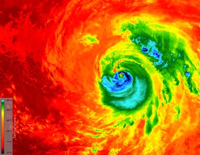
Temperature distribution during Hurricane Matthew
Temperature distribution during Hurricane Matthew
The image taken on 7 October 2016 by Copernicus satellite Sentinel-3A shows Hurricane Matthew approaching the US state of Florida. The temperatures of the clouds on its surface range from -80 degrees Celsius in the eye of the storm (dark blue colouring) to 25 degrees Celsius at the edges (dark red colouring). The image was taken with the SLSTR instrument (Sea and Land Surface Temperature Radiometer).

