
Methods & Processing Group
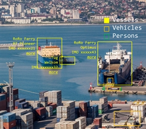

The Methods and Processing Group deals with the processing and analysis of sensor and instrument data. These instruments are used for the exploration of maritime regions to detect and assess the situation of critical infrastructures above and below the waterline. For the most part, the data processing takes place on board the exploration system, and must be carried out in real time. Only in this way can data be transferred efficiently to higher instances, such as a situation centre, thus effectively contributing to the creation of a situation overview. On the one hand, the group is developing fundamental algorithms for converting raw sensor data into user data (e.g. calibration, compression) as well as more in-depth algorithms such as those employed for the merging of data from different survey systems and for automatic object recognition. In order to increase the quantity and quality of the detection methods and sensor systems involved in creating a situation overview, the group is also involved in the (co-) development of airborne, ground-based and waterborne close range and remote sensing systems in the fields of optical, sonar and radar systems.
The involved working areas are as follows:
- On-board algorithms for signal and image processing
- Object detection, classification, identification and tracking
- Hybrid systems and local data fusion for optical and sonar instruments, or optical and radar instruments
- Development of experimental systems
Ongoing projects:
- MARLIN: Maritime Awareness Realtime Instrumentation Network
- DLR’s "Big Data Platform" cross-sectoral project
- DLR’s "Digital Atlas" cross-sectoral project