
AmplitudeX

Motivation
In dialogue with various stakeholders in the field of critical maritime infrastructure, the topics of smuggling, counterterrorism, sedimentation monitoring, and condition monitoring are repeatedly mentioned. In each of these areas, the desire for automated three-dimensional acquisition of structures, especially underwater, was expressed specifically. In particular, the inaccessibility of maritime structures and large moving objects make the use of classic surveying and monitoring technology difficult.
Goals and Methodology
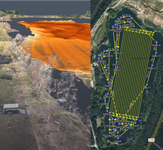
Within this project, an automated system network is to be developed that is capable of recording and monitoring critical areas of maritime infrastructures in real time, efficiently and in parts autonomously in three dimensions. The developed algorithms and processes shall be applicable for different sensor systems, especially in the underwater area. Central components of the system network are the interaction of heterogeneous sensors and a mission planning tool that first calculates the mission data of sensor platforms in three-dimensional space on the basis of two-dimensional overview maps and then on the basis of point clouds.
Innovations and Perspectives
The combination of large-scale aerial surveillance and mission-based underwater reconnaissance offers great potential for application in coastal areas. The three-dimensional mission planning of underwater vehicles can not only be used in harbors, but also in deeper and more complex sea areas.
Duration of the Project: 01.01.2023 - 31.12.2025