
Loading
WATERSIDE
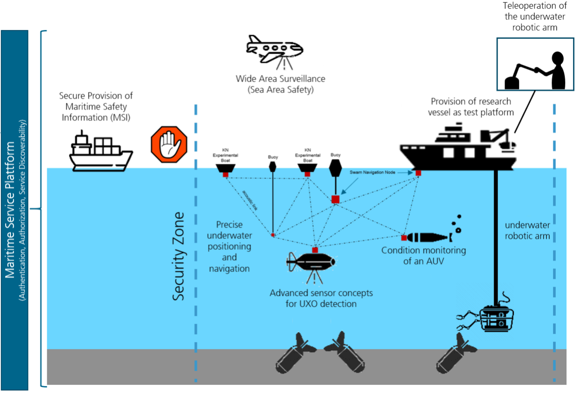

Overview of different topics covered in WATERSIDE.
Credit:
The project Watersite is about the identification and salvage of ammunition remnants in the North Sea and the Baltic Sea. Different institutes of DLR cover the entire process starting from the detection of the remnants using different sensors onboard autonomous underwater vehicles, to providing data of identified dump sites in a maritime situation report, to the recovery using remote-controlled vehicles. The Institute for Satellite Geodesy and Inertial Sensing is investigating the possibility to identify potential contaminated sites by measuring the gravity field, a process known as gravimetry.

Credit:
The advantage of gravimetry is that it can detect explosive remnants based on density variations in relation to the surrounding seabed, regardless of underwater visibility conditions and possible coverage by sediment. In addition, it is possible to determine the total mass and extent of a localized site in order to ascertain how much ammunition is located beneath the top visible layer. Therefore, typical dump sites are recreated in simulations to investigate the usage of gravimeter on autonomous underwater vehicles. The focus is on automated mapping of the gravity field at the seabed and the resulting requirements for the sensor in a dynamic environment and the sensor carrier, e.g., in determining position, speed, and orientation. Based on the expected signal strength and environmental influences, the use of conventional gravimeters and the development of quantum-based gravimeters for this application are evaluated.
Waterside is a joint project of the Institute of Systems Engineering for Future Mobility, the Institute of Communications and Navigation, the Institute of Robotics and Mechatronics, the Institute of Maintenance, Repair and Overhaul, the Institute for the Protection of Maritime Infrastructure, the Institute for Satellite Geodesy and Inertial Sensing, the Institute of Quantum Technologies, the Institute of Maritime Technologies and Propulsion Systems, and the Institute of Space Research.
Departments
Kontakt
Prof. Dr. Matthias Weigelt
Head Satellite Geodesy and Geodetic Modelling
German Aerospace Center (DLR)
Institute for Satellite Geodesy and Inertial Sensing
Satellite Geodesy and Geodetic Modelling
Callinstrasse 30b, 30167 Hannover
Germany