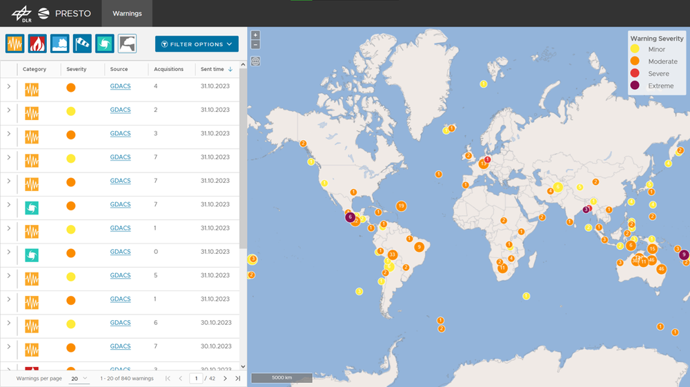
This monitoring system intersects public disaster alerts with satellite acquisition data to detect when and which satellite imagery will be available for a crisis event. It continuously retrives (potential) disaster areas of interest (AOIs) and event times from public disaster alerts provided by the Global Disaster Alert and Coordination System GDACS, MeteoAlarm, HND Bayern, DLR / BIRA and others.
Based on fully automatic retrieval of satellite position and acquisition data provided by DLR Neustrelitz, the system generates decision proposals with information on when and which remote sensing data will be available for regions potentially affected by a natural crisis event.
This information facilitates the anticipatory action of decision-makers for the use of earth observation to support local emergency authorities. Please be aware, that this monitoring service is still under development and only available internally.
The system is built on the UKIS technology developed at the German Remote Sensing Data Center.
Monitoring of public warnings for natural disasters