Skip to main contentSkip to navigationSkip to footer
  • DLR Portal
  • Press
  • Accessibility
deen
DLR Logo
Center for Satellite Based Crisis Information (ZKI)
  • About us

    • ▾ZKI
      • ▾FAQs
        • ▾Contact
        • Crisis Information

          • ▾Mapping and Exercises
            • ▾Monitoring Services
            • Services and Projects

              • ▾International Charter
                • ▾ZKI Fire- and Flood-Service
                  • ▾IF-Bund
                    • ▾Further Services for Crisis Information
                      • ▾Projekt Spotlights
                      • Latest

                        • ▾News
                          • ▾2025
                          • ▾2024
                          • ▾2023
                          • ▾2022
                          • ▾2021
                          • ▾2020
                          • ▾2019
                          • ▾2018
                          • ▾2017
                          • ▾2016
                      >
                      Services and Projects
                      >
                      ZKI Fire- and Flood-Service
                      Home
                      >
                      Services and Projects
                      >
                      ZKI Fire- and Flood-Service

                      ZKI Fire- and Flood-Service

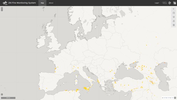
                      Fire Monitoring System

                      The application shows the current fire areas in Europe, analyzed in near-real time. The fully automatic analysis is based on data from the Sentinel-3 OLCI and MODIS sensors. The color gradations of the fire area represent the respective severity of the burn.

                      Flood Service

                      A system has been established at the German Remote Sensing Data Center of DLR that allows the near-real time mapping and monitoring of flood situations. It consists of fully automatic processing chains for the derivation of the inundation extent based on Sentinel-1 and TerraSAR-X Synthetic Aperture Radar (SAR) satellite data.

                      DLR logo
                      Center for Satellite Based Crisis Information (ZKI)
                      DLR Logo
                      Center for Satellite Based Crisis Information (ZKI)

                      Münchener Str. 20 82234 Wessling

                      Contact

                      • Contact form

                      About the website

                      • Accessibility
                      • Privacy Policy
                      • Privacy Settings (Cookies)
                      • Imprint & terms of use