
Water Monitoring System

The German Remote Sensing Data Center of the DLR operates a system for detecting and monitoring water surfaces in near real-time. It consists of fully automated process chains for deriving the extent of water bodies based on data from Synthetic Aperture Radar (SAR) and optical satellite missions, as well as from UAV and aerial imagery.
The automatic segmentation of water surfaces in Earth Observation data is mainly based on deep learning models trained by extensive reference datasets.
The derived water extent products are primarily used for rapid flood mapping activities. While systematically acquired Sentinel-1 and Sentinel-2 data allow a continuous flood monitoring according to the predefined acquisition plan of the European Space Agency (ESA), the flood processing chains of higher-resolution satellite missions are triggered as soon as relevant data is recorded over flood-affected areas (e.g. as part of various disaster management mechanisms such as the International Charter "Space and Major Disasters").
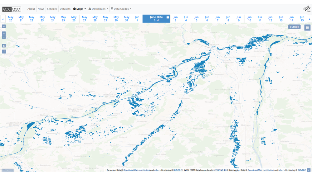
Freely available are the results of DLR’s Surface Water Inventory and Monitoring (SWIM) product. This includes automatically derived water masks of Sentinel-1 and Sentinel-2 data over Europe. The water masks are provided on the EOC Geoservice of DLR (https://geoservice.dlr.de/web/datasets/swim). SWIM is continuously expanded to a global service.
Related Articles
Bereczky, M., Wieland, M., Krullikowski, C., Martinis, S., Plank, S., 2022. Sentinel-1-based water and flood mapping: Benchmarking Convolutional Neural Networks against an operational rule-based processing chain. IEEE J. Sel. Top. Appl. Earth Obs. Remote Sens., 15, 2023–2036.
Groth, S., Wieland, M., Martinis, S., 2025. Surface Water Inventory and Monitoring (SWIM): Hands-on examples for improved flood mapping and water resource monitoring. ESA Living Planet Symposium, 2025, 23-27 June 2025, Vienna, Austria.
Martinis, S., Twele, A., Voigt, S., 2009. Towards operational near real-time flood detection using a split-based automatic thresholding procedure on high resolution TerraSAR-X data. Nat. Hazards Earth Syst. Sci. 9, 303-314.
Martinis, S., Kersten, J., Twele, A., 2015. A fully automated TerraSAR-X based flood service. ISPRS J. Photo. Remote Sens. 104, 203-212.
Martinis, S., Groth, S., Wieland, M., Knopp, L., Rättich, M., 2022. Towards a global seasonal and permanent reference water product from sentinel-1/2 data for improved flood mapping. Remote Sens. Environ. 278, 113077.
Wieland, M., Martinis, S., 2019. A modular processing chain for automated flood monitoring from multi-spectral satellite data. Remote Sens., 11 (19), 2330.
Wieland, M., Fichtner, F., Martinis, S., Groth, S., Krullikowski, C., Plank, S., Motagh, M., 2023. S1S2-Water: A global dataset for semantic segmentation of water bodies from Sentinel-1 and Sentinel-2 satellite images. IEEE J. Sel. Top. Appl. Earth Obs. Remote Sens., 17, 1084-1099.