Web Applications
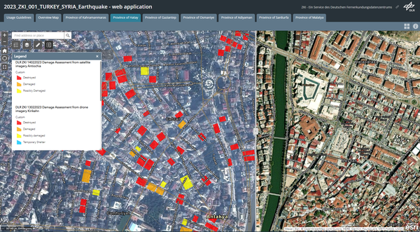
Depending on the requirements and needs of the users, web applications are created for crisis information or projects, which provide one or more interactive situation images in 2D or 3D view. The web GIS applications are based on ESRI ArcGIS Online or in-house developments by DLR-DFD.
Here you will find impressions of various web applications. Due to data protection guidelines, these are usually password-protected and only accessible to certain authorized users. If you have any questions or feedback, please use the contact form at the bottom of the website.