On November 9 and November 14 it was possible to monitor the fires in New South Wales, Australia using DLR’s BIROS satellite data. The FireBIRD BIROS sensor has with 320 m a much higher spatial resolution than the standard thermal sensors from MODIS or the Sentinel-3 SLSTR (1 km). Additionally the two different bands in the mid wave infrared (3.4-4.2 µm) and the long wave infrared (8.5-9.3 µm) allow not only the detection of hotspots but also the derivation of the fire radiative power (FRP) which is a quantitative measure for fire intensity.
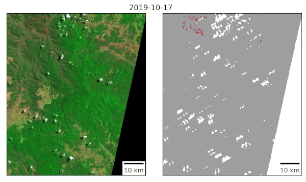
The fires have also been monitored by Sentinel-2 and Landsat-8 satellites, which carry multi-spectral sensors that acquire images in the visible spectrum, near and short wave infrared at spatial resolutions of 10 to 30 m. The high temporal revisit period of Sentinel-2 and the combination with Landsat-8 allowed monitoring the evolution of the fires at short time intervals and across large geographical areas. Burnt areas have been mapped automatically from the images using a pre-trained convolutional neural network.
Active fires detected by BIROS on November 9 and November 14


