A framework agreement has been concluded between the German Aerospace Center and the Federal Ministry of the Interior and Community (BMI), “IF-BUND - Innovative Remote Sensing for the Federal Administration”, for the period 2021-2024. Its goal is the methodical transfer of remote sensing science expertise to public authorities. Implementing user-oriented developments in the field of remote sensing, such as innovation and pilot projects, is one of the key components of IF-BUND.
The first innovation projects have now been successfully launched after many ideas were discussed by DLR and various federal authorities. The first three developments are described below and were also introduced at the National Forum for Remote Sensing and Copernicus.
Remote sensing data and artificial intelligence for the register census (SAT4GWR_IF-Bund)
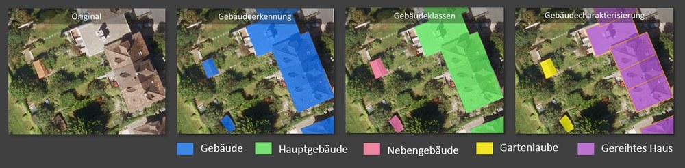
Deriving various building types using AI methodology. Left to right; original image, blue: all buildings, pink: annexes, yellow: garden sheds, lilac: terraced houses (from the Sat4GWR project)
Im Zuge der Konzeption des Registerzensus prüft das Statistische Bundesamt (StBA), inwieweit neue digitale Daten künftig die Ermittlung der Zensusergebnisse ergänzen können. In dem IF-BUND Innovationsprojekt „Sat4GWR_IF-Bund – Fernerkundung & KI für den Registerzensus“ sollen Algorithmen entwickelt werden, die in der Lage sind, Gebäude und Unterkünfte auf Satelliten- bzw. Luftbildern zu erkennen sowie bestimmte Merkmale abzuleiten. Die Fernerkundungsergebnisse sollen die Plausibilisierung der Gebäudedaten aus dem Gebäude- und Wohnungsregister (GWR) unterstützen. Der zu erwartende Mehrwert für den Registerzensus besteht darin, die bislang avisierten Prozesse bei Aufbau und Pflege des GWR zu ergänzen und damit die Qualität der Gebäudedaten im GWR bzw. im Registerzensus entscheidend zu verbessern. Das gemeinsame Projekt mit StBA und dem BKG wurde im Oktober 2021 gestartet und ist bis Dezember 2024 geplant.
Datenmanagementsystem für große Datenmengen und KI-Anwendungen für das BKG (DatKI4BKG)
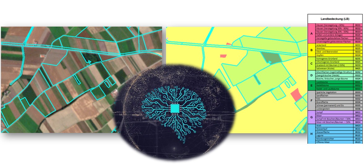
Support for drawing up a land cover model for Germany (LBM-DE) using AI methodology
In the project “DatKI4BKG – Design of a Data Management System (DMS) and Development of an AI-based Remote Sensing Methodology for BKG applications”, BKG and DLR are designing for BKG remote sensing data systems for mass data and adapting AI research applications for use in administrative practice. This project was launched in October 2021 and will run to April 2024.
DLR will be primarily involved in two aspects: (1) designing and setting up a data management system (DMS) for remote sensing data in the form of data cubes, and (2) developing and implementing AI-based methodologies with a focus on conributing to the generation of a land cover model (LBM-DE).
New approach for distinguishing urban and rural areas (Fe4ErsiGG)
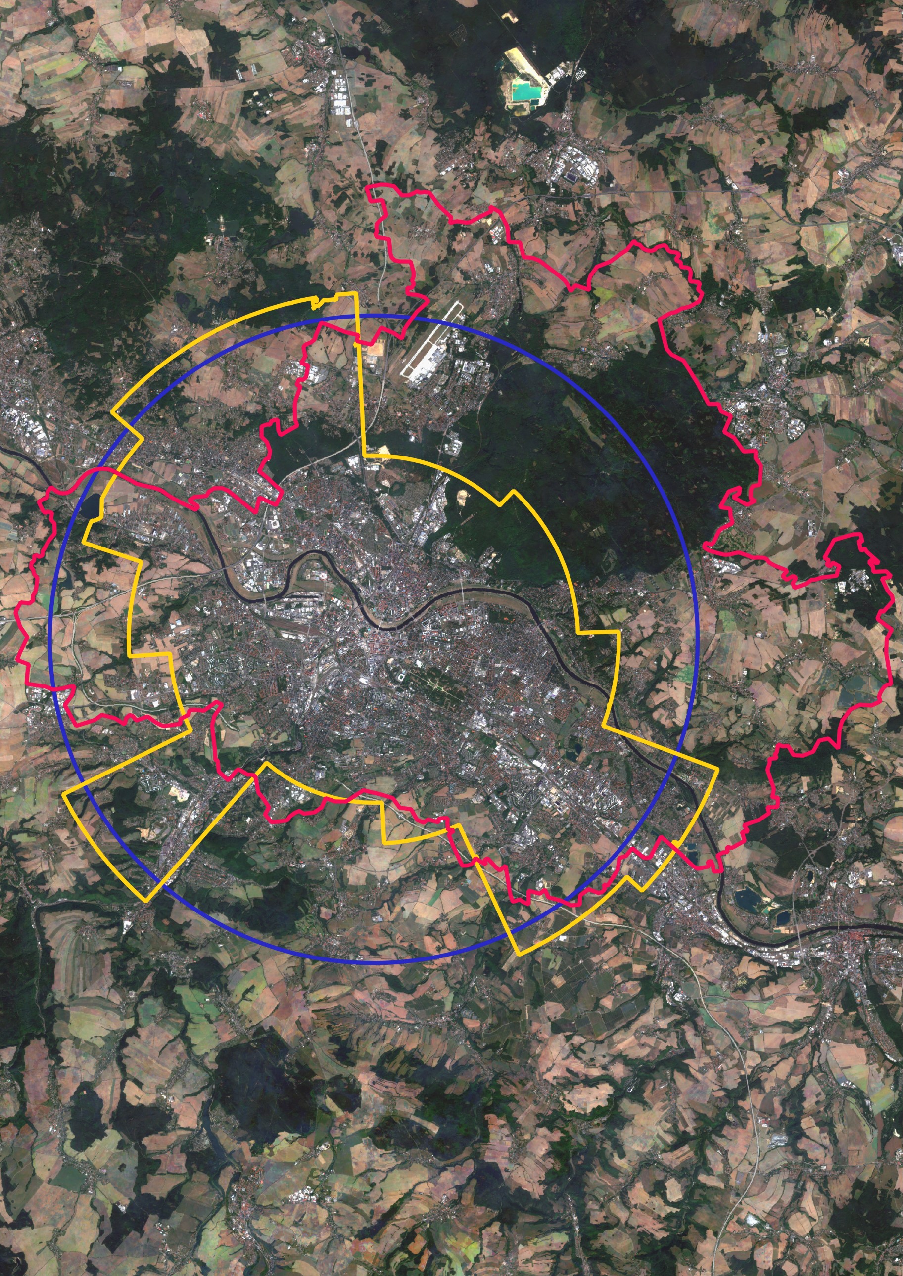
Satellite image derived from Sentinel-2 sensor data showing Dresden and its immediat surroundings with various demarcations
(red: administrative border, blue: buffer around the city centre, yellow: urban morphology; from the FE4ErSiGG project)
Realistic demarcation of settlement structures like urban areas, conurbations, suburbs, and rural areas based on space utilization patterns such as building and settlement densities determined with remote sensing methodologies – that is the goal of the IF-BUND innovation project “Remote Sensing for Determining the Borders of Settlement Structures and Administrative Units” (FE4ErSiGG). This project of the German Aerospace Center (DLR) will run for one year starting in December 2021 in collaboration with the Federal Institute for Research on Building, Urban Affairs and Spatial Development (BBSR). Other partners are the Federal Institute for Population Research (BiB) and BKG as advisor.
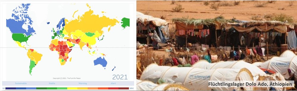
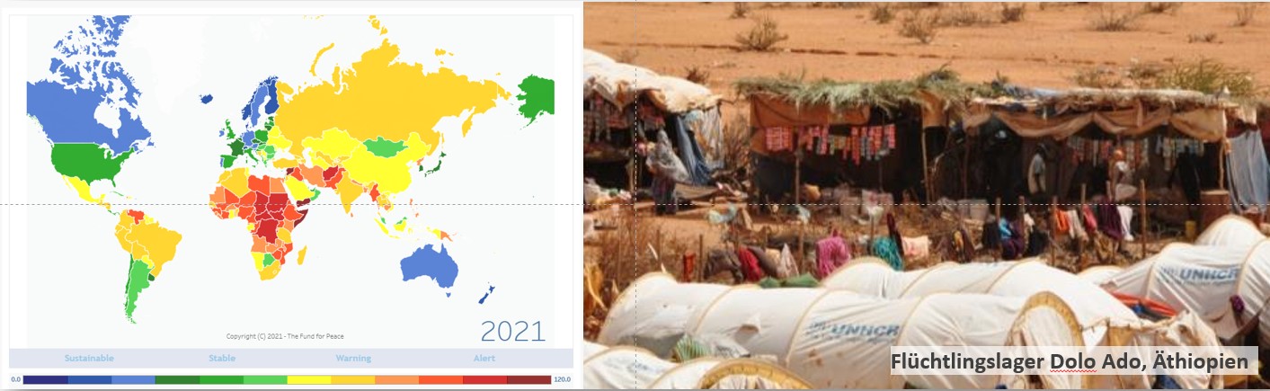
Anticipation of conflicts using information from satellites (ACIS)
Considering possible satellite and geodata for integration in existing conflict models
Credit:
left: https://fragilestatesindex.org/, as of 2021, right: Dolo Ado refugee camp, Ethiopia, Foto@UNHCR, 2016
The main goal of the “Anticipation of Conflicts using Information from Satellites (ACIS)” project is to support with spatially and temporally optimized (geo )information the existing and future conflict models developed by the crisis early-detection competence centre (KompZ KFE) at the Universität der Bundeswehr München on behalf of the Federal Foreign Office. In this collaboration DLR is to investigate the extent to which satellite data and other geodata can be integrated in existing models so that they can be improved with respect to such criteria as model performance, plausibility and usefulness.


