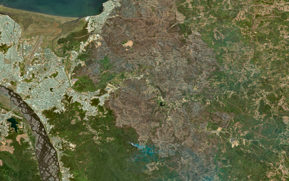
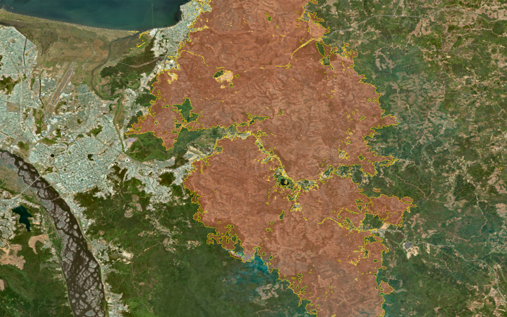
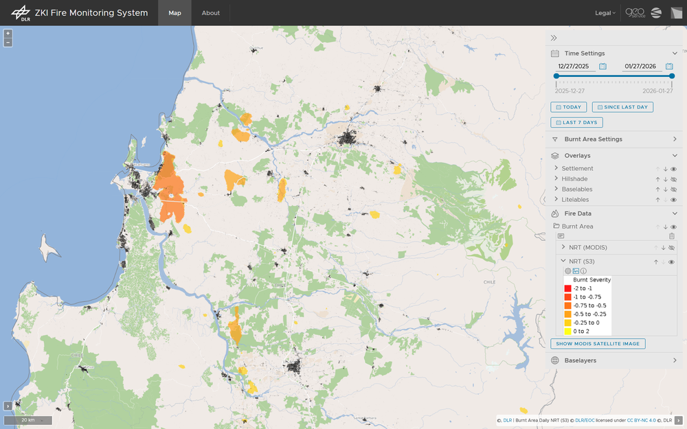
Chile is once more facing devastating wildfires. Thousands of people in the Biobío and Ñuble regions had to be evacuated. The Chilean government has declared a state of emergency.
As part of the the International Charter Space And Major Disasters, the DLR acquired and analyzed data from the German hyperspectral satellite mission EnMAP over the disaster areas. The extent of the burned areas was derived using a method developed by the DLR. All data and results were promptly forwarded to Chilean emergency response forces to support relief efforts as effectively as possible.