FE4KB
The aim of the FE4KB project (project duration 01/2023-12/2023) was to investigate population development in Germany independently of administrative territorial units at a small-scale level and to identify the resulting trends in urbanization and suburbanization. The project was carried out by the DLR, the Federal Institute for Population Research (BIB) and the Federal Institute for Research on Building, Urban Affairs and Spatial Development (BBSR). Models already developed in the joint IF-Bund predecessor project FE4ErSiGG were incorporated.
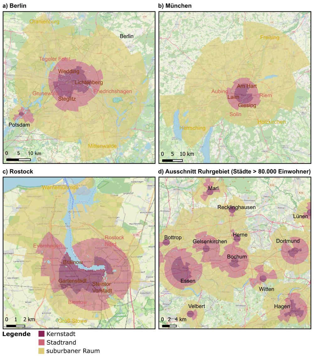
To achieve this goal, remote sensing and geodata sets were combined and automated, analyzed with regard to their morphological characteristics of the building structure and then divided into different settlement landscape classes. In addition, these results were coupled with demographic data, which made it possible for the first time to examine population development at a new, previously unavailable level of spatial and semantic detail. This provided a spatially differentiated insight into population development and structure in urban and rural regions.
With the new subdivision of the settlement landscape, it was also possible for the first time to quantify the population in regions that cannot be clearly identified as either rural or urban and are therefore only recorded imprecisely in conventional urban-rural demarcations. This includes many suburban regions that have experienced population growth in recent years, primarily due to increased migration from the major cities to the surrounding areas. Despite the success of the project, the limits of the applicability of a method of settlement typification based purely on building morphology also became apparent during the project. For example, the very different delineations of suburban or dispersed areas using the ring model are striking. An IF-Bund follow-up project has therefore been initiated to develop and test a grid-based approach using multimodal information.


