
TanDEM-X sees the rice growing


Can the height of a rice plant be measured from space? TanDEM-X, a DLR mission designed to generate high accuracy global elevation models, has been shown to be capable of doing just that. The growth of a rice plant can be observed starting from its vegetative phase, through its maturation phase until harvest. The measured height is very accurate, with an absolute error ranging from a few up to 20 centimeters, depending on the phenological phase. This result is astonishing considering that the plant grows to only about 1.5 meters and the TanDEM-X system’s relative and absolute elevation accuracy requirements are on the order of meters.
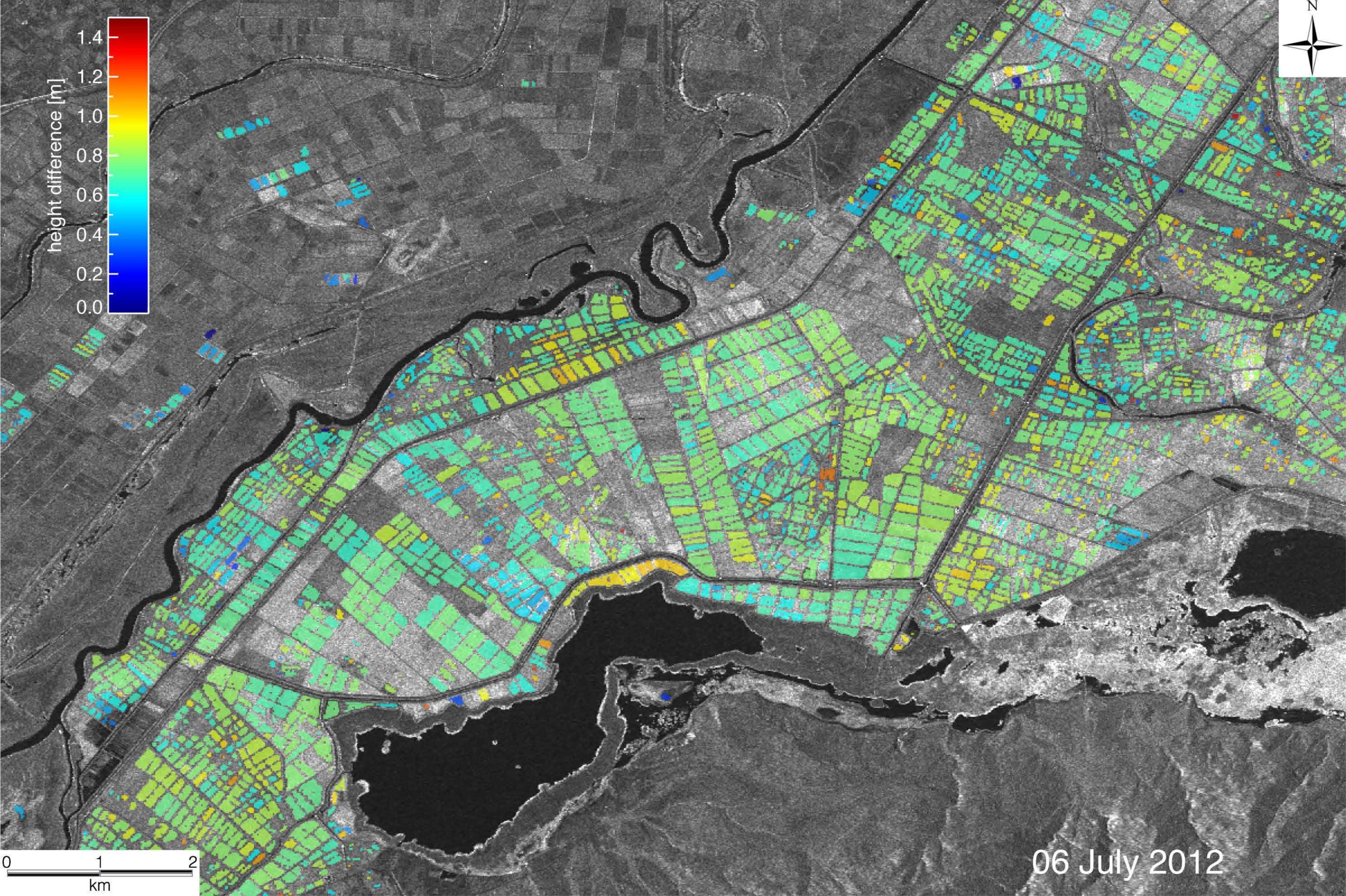
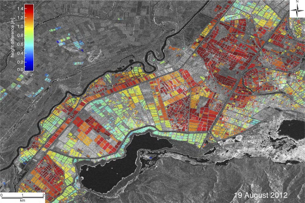
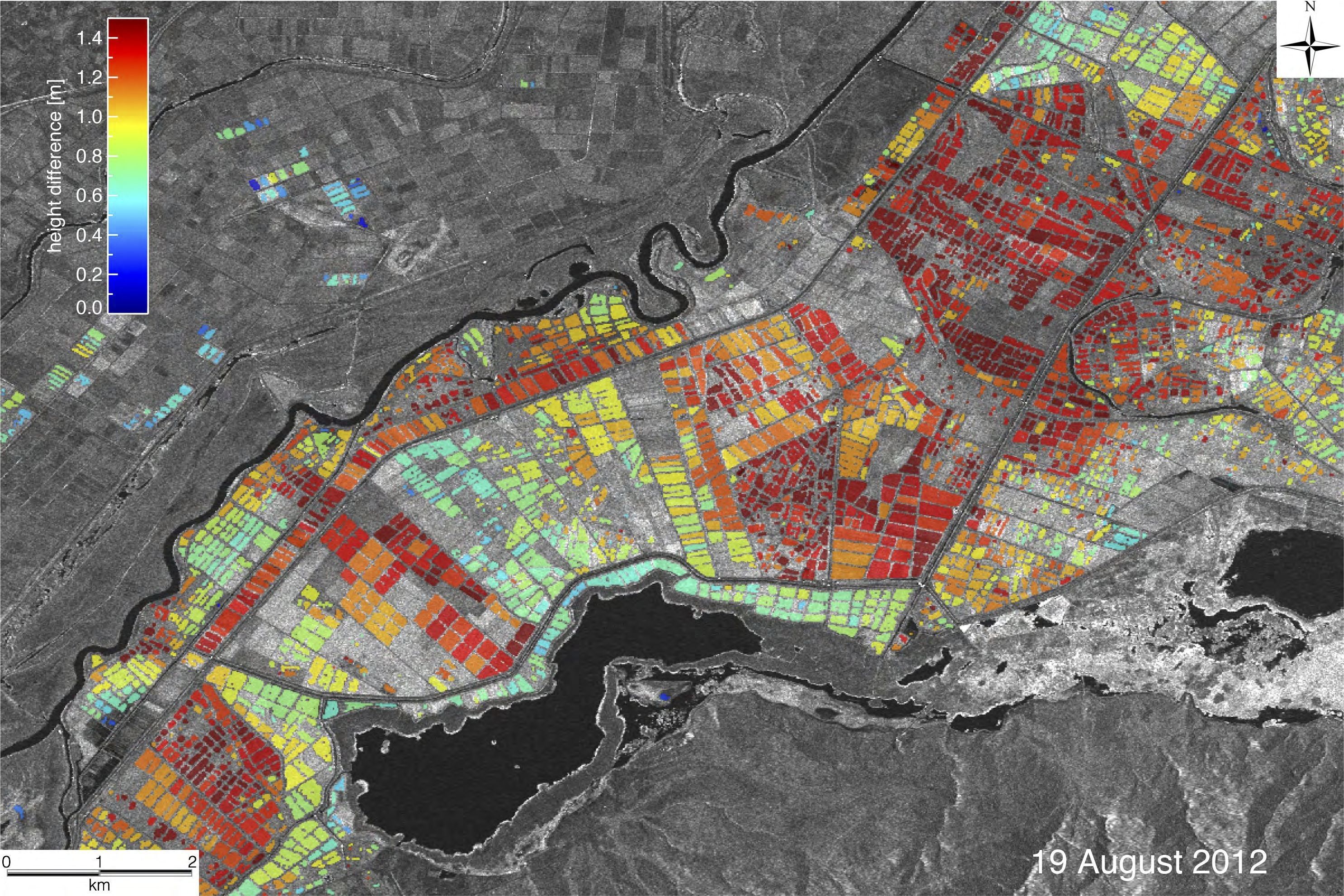
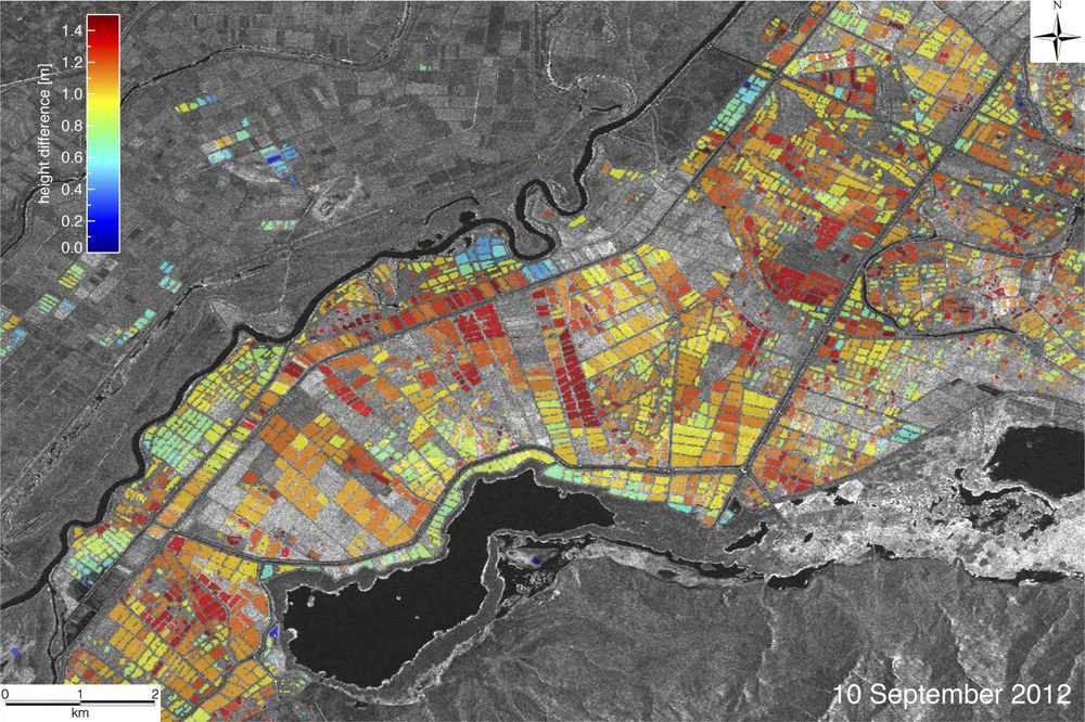
For the demonstration, a stack of TanDEM-X data in two polarisations spanning the plant life cycle was acquired over the Gala Lake region, at the border between Greece and Turkey. In the meantime, a dedicated GPS campaign has been carried out for reference fields. Maps showing the plant height on July 6, August 19 and September 10, 2012 [on the right]. Inspecting these maps, one could check the growth trend on a field-by-field basis. For instance, the July map shows a homogeneous result with plant heights of around 70 cm. The August map reveals the growth of most of the plants, with doubled heights compared to early July. For some of the fields, the higher maturation level is reached about a month later. In general, these maps can be used for agricultural planning in terms of production volume.
These outcomes can be significant to organizations for planning strategies. Rice is a crucial plant for planet Earth. In response to the increasing demand of rice, monitoring of farming activities is particularly urgent. TanDEM-X is an instrument which can perform this task.
Demonstration has been performed by Cristian Rossi (DLR-EOC/MF-SAR) in cooperation with the Geomatics Department of the Istanbul Technical University (Assoc. Prof. E. Erten). More info and detailed validation can be found in: Rossi, C., and Erten, E., 2015. Paddy rice monitoring using TanDEM-X, IEEE Transaction on Geoscience and Remote Sensing.