From Floods to Droughts: Exploring Surface Water with Satellite Data
September 18, 2026
From Floods to Droughts: Exploring Surface Water with Satellite Data
Rivers shift their course, reservoirs fill and empty, wetlands expand and contract, and floods can transform landscapes within hours. Monitoring these changes at regional and global scales is essential for disaster response, water resource management, environmental protection, and climate research. To support such applications, researchers at EOC develop a comprehensive archive of surface water masks that integrates observations from Sentinel-1 radar and Sentinel-2 optical satellite imagery: SWIM – Surface Water Inventory and Monitoring.
Surface Water Inventory and Monitoring
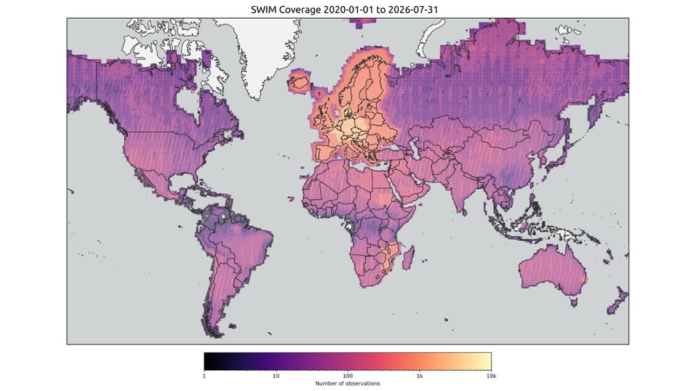
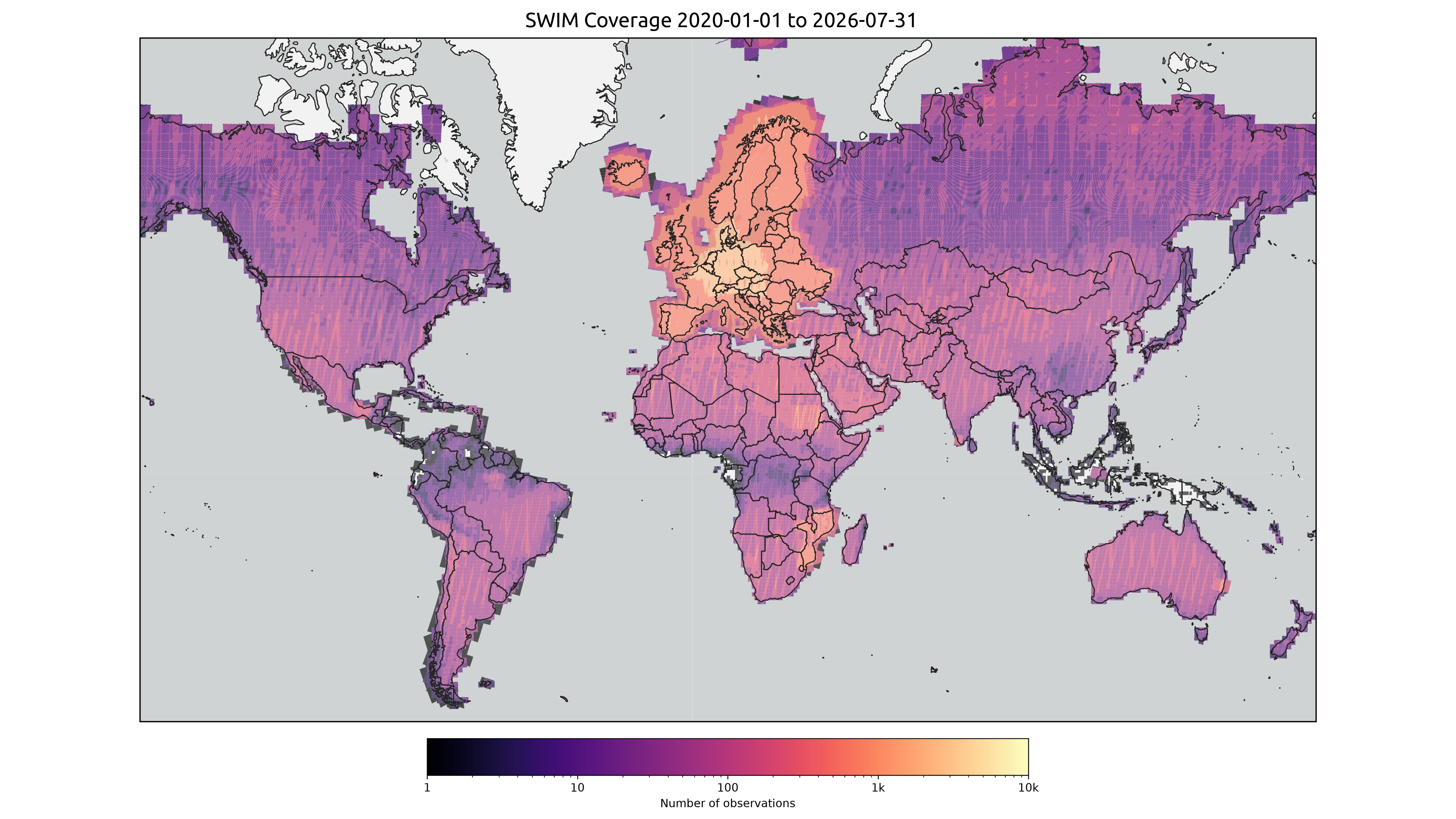
SWIM currently provides nearly three years (2024-2026) of global coverage, comprising more than one million high-resolution water masks at a 10 m grid spacing. New observations are continuously added to extend the archive and ensure that the collection remains up to date. For priority regions such as Europe, the archive already covers more than six years (2020-2026) of observations. In these regions, a continuous monitoring processes every newly available satellite scene as soon as it is released.
Terrabyte and EOC Geoservice as digital enabler
Large-scale processing of satellite images is done on the High Performance Data Analytics platform terrabyte with a dedicated processing pipeline that uses pretrained convolutional neural networks for Sentinel-1 and Sentinel-2. The analysis-ready water products are accessible through EOC Geoservice, where a range of data interfaces enables users to easily search and access the data by location, time, and other metadata. This facilitates their use by both researchers and operational users.
From research to application
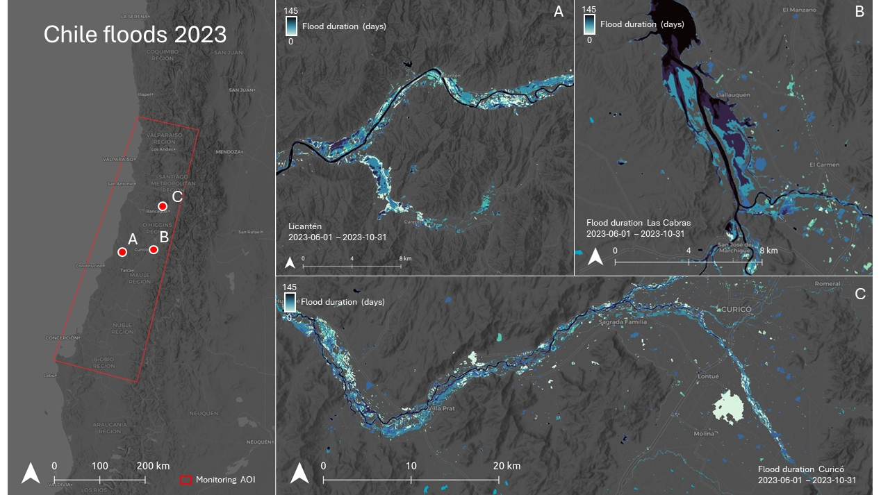
By combining observations collected over many years, the archive highlights seasonal flooding, recurring wetland dynamics, reservoir fluctuations, and long-term changes in lakes and rivers.
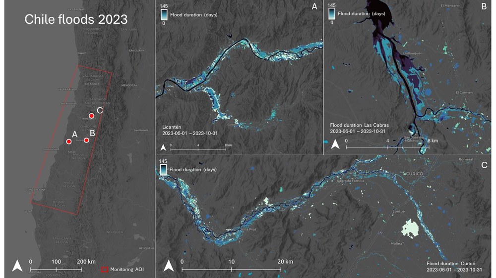
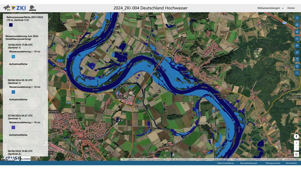
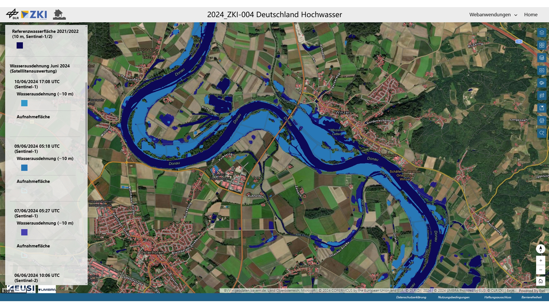
SWIM supports the rapid emergency mapping activities of the Center for Satellite Based Crisis Information (ZKI) with flood data. During flood events, newly acquired satellite images are compared with historical observations to map flooded areas, estimate impacts, and support disaster response. Furthermore, the same data enable drought monitoring, water resource assessment, ecosystem management, and climate research.
global coverage
SWIM water extent global coverage heatmap as of Juli 2026.
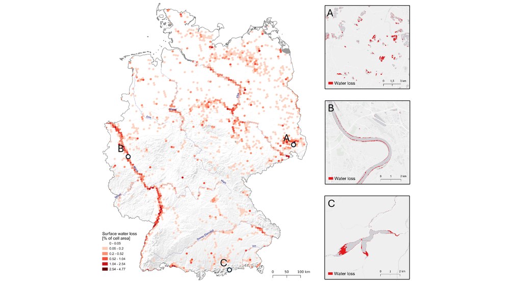
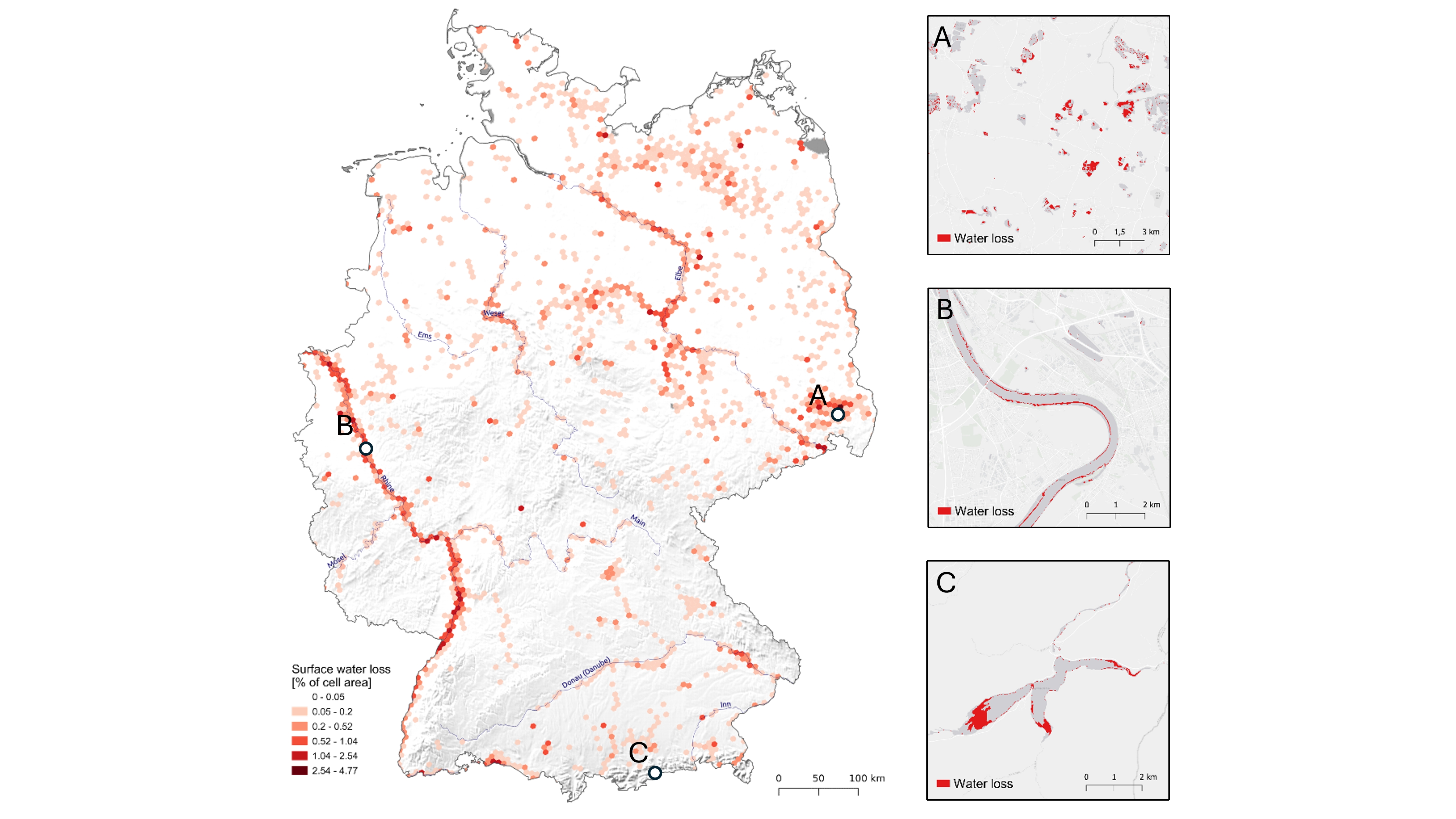
Hydrologic drought in Germany as seen by comparison of SWIM water extents during a drought period (July/August 2022) with a reference time period (July/August 2020-2021).