
HydroSHEDS v2: When Digital Elevation Models Become River Networks
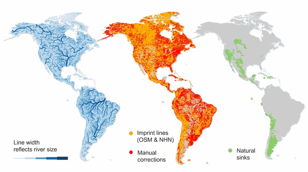
Rivers act as the arteries of our planet. The data required to map these lifelines comes from TanDEM-X, a radar satellite mission by the German Aerospace Center (DLR). Using this high-resolution terrain data, an international team has now created a new hydrological dataset: HydroSHEDS v2. Currently, the coverage for North, Central, and South America is available via the EOC data portal. The rest of the world will be rolled out progressively as the processing continues.
Rivers transport sediments and nutrients, fertilizing valleys and deltas as they connect habitats, create transport routes, and provide essential freshwater. This water forms the foundation of aquatic and terrestrial ecosystems and underpins our economy and way of life. With the help of the global surface model derived from TanDEM-X data, a hydrographic dataset has now been established that allows for the analysis of global river systems, their catchment areas, and how they are hydrologically interconnected.
HydroSHEDS v2 replaces its highly utilized predecessor HydroSHEDS v1, which was based on data from the older SRTM mission. HydroSHEDS v2 is significantly more accurate because the underlying TanDEM-X data offers vastly superior resolution and accuracy.
Developed and published by DLR in collaboration with international partners, HydroSHEDS v2 involves key contributors such as the World Wildlife Fund (WWF) USA, McGill University and Confluvio Consulting in Canada, and the German Earth Observation Center (EOC). The datasets are accessible via the Geoservice, the HydroSHEDS website, and the ArcGIS Living Atlas. The introduction of further continents follows a staged roadmap.
HydroSHEDS v2 provides more accurate drainage networks, basin boundaries, and data on hydrological connectivity.
Key products provided include:
- Flow directions (Raster/Grid)
- Stream network (River network as lines)
- Sub-basins (Catchment areas as polygons)
The dataset is based on TanDEM-X surface data (derived from 12 m resolution data). To model water flow more accurately, the algorithm filters out urban and forest areas. Water surfaces are generated using TanDEM-X intensity data and interferometric coherence information, combined with TanDEM-X water masks and external sources. Additionally, other datasets, such as the 3D World Settlement Footprint and a DLR vegetation layer, are integrated to refine the product, using customized algorithms to pinpoint lake and river centerlines.
“HydroSHEDS v2 provides an important new foundation for hydrologic science, conservation planning, and water resource management,” said Bernhard Lehner, Associate Professor at McGill University and co-founder of Confluvio. “By making these datasets openly available, we accelerate innovation and support better decision-making for freshwater systems worldwide.”


Links:
Contact
Maximilian Schwinger