
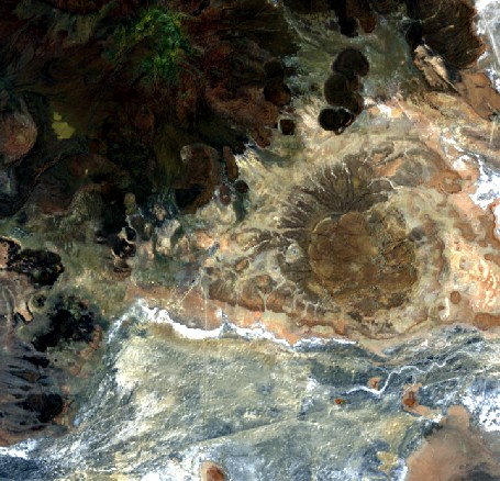
Example L2A data
South of the Salar de Uyuni, Bolivia -20.9031 S, -67.7451 W

Credit:
This DESIS tile shows a desert area South of the Salar de Uyuni in Bolivia. The L2A product was produced in "land mode", meaning land and water areas were processed using the atmospheric processing software for land (surface reflectance values for all pixels).
Processing details:
UTM projection, bilinear interpolation, land mode, no cirrus or haze removal, with terrain correction, summer season, ozone column 330 DU, 4 times spectral binning, GeoTIFF
Download
DESIS_CEOS_ARD_Example_Product.zip (164 MB)