EO4AlpineRisks uses satellite and airborne remote sensing to map, monitor and predict natural hazards across the Alpine region. By coupling high resolution multispectral imagery with AI driven analysis and atmospheric data, the project quantifies snow cover in real time, forecasts spring runoff for the Rhine, detects crevasses and potential landslides, and tracks changes in glaciers and Antarctic ice that influence sea level. The resulting tools are turned into actionable guidance for rescue services, mountain guides, tourism operators and the public through demonstrations, an interactive homepage and active outreach. In short, EO4AlpineRisks delivers science based, early warning solutions that improve safety and resilience in the Alps.
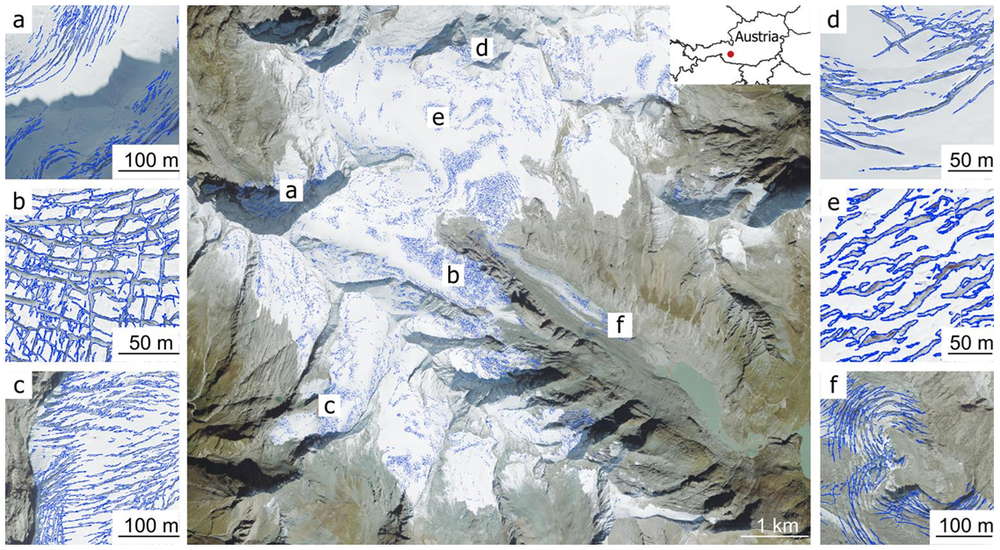
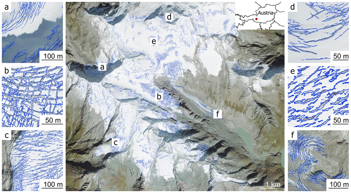
Glacier crevasses on the Großglockner.
The crevasses were mapped automatically using a deep learning approach. Figures a through f demonstrate the robust detection of crevasses with a wide variety of shapes. Initial results of this kind have already been integrated into the DAV maps.
Our team consists of colleagues from the German Remote Sensing Data Center (DFD), the Microwaves and Radar Institute (HR), The Remote Sensing Technology Institute (IMF), and Institute of Space Research (WR).